Property Record
301 S Laurel St, Walhalla, SC 29691
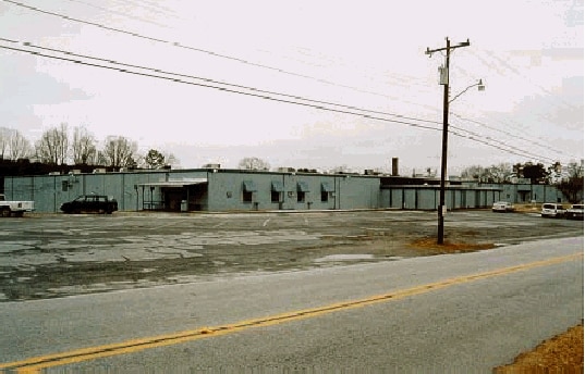

Property Detail
301 S Laurel St
500-18-02-001
(7.50 AC)
Mill
Oconee
B and X Area of moderate flood hazard, usually the area between the limits of the 100-year and 500-year floods.
South Carolina
2025
7.50 AC
2025
South Carolina Rural Areas
030403
Other Market Areas
134,836 SF
Seneca, SC
NEARBY LISTINGS FOR SALE OR LEASE
-
-
View all Walhalla listings for sale on LoopNet.com
DEMOGRAPHICS near 301 S Laurel St
1 mile
3 mile
5 mile
2025 Total Population
2,842
9,233
14,483
2030 Population
2,927
9,537
14,990
Pop Growth 2025-2030
+ 2.99%
+ 3.29%
+ 3.50%
Average Age
40
41
42
2025 Total Households
1,098
3,621
5,733
HH Growth 2025-2030
+ 2.82%
+ 3.26%
+ 3.47%
Median Household Inc
$52,823
$62,816
$66,303
Avg Household Size
2.50
2.50
2.50
2025 Avg HH Vehicles
2.00
2.00
2.00
Median Home Value
$130,188
$187,397
$211,884
Median Year Built
1981
1984
1986
Nearby Places
Map Layers
Map Styles
 Street
 Aerial
Layers
 Traffic
 Biking
Places
Listings with unknown addresses are not visible on the map
- Restaurants
- Banks
- Shops
- Fitness
- Groceries
Nearby Properties
Address
Land Use
TOTAL SIZE
Lot Size
Zoning
Address
Land Use
TOTAL SIZE
Lot Size
Zoning
79,533 SF
9.20 AC
Address
Land Use
TOTAL SIZE
Lot Size
Zoning
50,724 SF
1.59 AC
Address
Land Use
TOTAL SIZE
Lot Size
Zoning
111,834 SF
26.40 AC
Address
Land Use
TOTAL SIZE
Lot Size
Zoning
47,704 SF
13.45 AC
Address
Land Use
TOTAL SIZE
Lot Size
Zoning
10,182 SF
1.14 AC
Address
Land Use
TOTAL SIZE
Lot Size
Zoning
14,300 SF
6.06 AC
Address
Land Use
TOTAL SIZE
Lot Size
Zoning
18,634 SF
6.50 AC
Address
Land Use
TOTAL SIZE
Lot Size
Zoning
7,932 SF
1.67 AC
Address
Land Use
TOTAL SIZE
Lot Size
Zoning
6,061 SF
1.10 AC
Address
Land Use
TOTAL SIZE
Lot Size
Zoning
23,844 SF
1 AC
Address
Land Use
TOTAL SIZE
Lot Size
Zoning
10,645 SF
1.66 AC
Address
Land Use
TOTAL SIZE
Lot Size
Zoning
5,324 SF
0.66 AC
Address
Land Use
TOTAL SIZE
Lot Size
Zoning
14,136 SF
8.12 AC
Address
Land Use
TOTAL SIZE
Lot Size
Zoning
5,502 SF
1.18 AC
Address
Land Use
TOTAL SIZE
Lot Size
Zoning
25,628 SF
2.83 AC
Address
Land Use
TOTAL SIZE
Lot Size
Zoning
7,792 SF
3.44 AC
Address
Land Use
TOTAL SIZE
Lot Size
Zoning
6,954 SF
6.72 AC
Address
Land Use
TOTAL SIZE
Lot Size
Zoning
4,400 SF
6.13 AC
Address
Land Use
TOTAL SIZE
Lot Size
Zoning
38,600 SF
10.47 AC
Address
Land Use
TOTAL SIZE
Lot Size
Zoning
20,403 SF
6.50 AC
Address
Land Use
TOTAL SIZE
Lot Size
Zoning
38,112 SF
7.28 AC
Address
Land Use
TOTAL SIZE
Lot Size
Zoning
2,783 SF
2.06 AC
Address
Land Use
TOTAL SIZE
Lot Size
Zoning
10,720 SF
2.50 AC
Address
Land Use
TOTAL SIZE
Lot Size
Zoning
17,280 SF
51 AC
Address
Land Use
TOTAL SIZE
Lot Size
Zoning
15,292 SF
3.10 AC
Address
Land Use
TOTAL SIZE
Lot Size
Zoning
9,100 SF
3.13 AC
Address
Land Use
TOTAL SIZE
Lot Size
Zoning
39,900 SF
4.97 AC
Address
Land Use
TOTAL SIZE
Lot Size
Zoning
17,876 SF
1.66 AC
The World's #1 Commercial Real Estate Marketplace
Connect with us
© 2026 CoStar Group
The information above has been obtained from sources believed reliable. While we do not doubt its accuracy we have not verified it and make no guarantee, warranty or representation about it. It is your responsibility to independently confirm its accuracy and completeness. Any projections, opinions, assumptions, or estimates used are for example only and do not represent the current or future performance of the property. The value of this transaction to you depends on tax and other factors which should be evaluated by your tax, financial, and legal advisors. You and your advisors should conduct a careful, independent investigation of the property to determine to your satisfaction the suitability of the property for your needs.