Property Record
301 S Us Hwy, Jacksonville, FL 32234


NEARBY LISTINGS FOR SALE OR LEASE
Property Detail
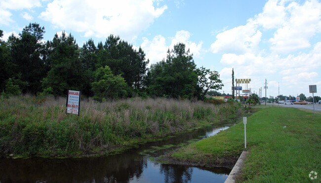
301 S Us Hwy
Jacksonville, FL
Section Land
000955-0040
34-2S-23E PT NE1/4 LYING W OF ST RD 200 RECD O/R BK 6750-1677
Commercialacreage
Duval
X
Florida
12031C0315H
2.53 AC
2024
Riverside
2025
Jacksonville (Florida)
017300
DEMOGRAPHICS near 301 S Us Hwy
1 Mile
3 Mile
5 Mile
2024 Total Population
171
2,323
3,323
2029 Population
182
2,476
3,569
Pop Growth 2024-2029
+ 6.43%
+ 6.59%
+ 7.40%
Average Age
40
41
40
2024 Total Households
69
942
1,285
HH Growth 2024-2029
+ 7.25%
+ 6.79%
+ 7.55%
Median Household Inc
$44,999
$45,900
$55,437
Avg Household Size
2.50
2.50
2.60
2024 Avg HH Vehicles
2.00
2.00
2.00
Median Home Value
$128,947
$141,260
$167,360
Median Year Built
1976
1979
1983
Nearby Places
Map Layers
Map Styles
 Street
 Aerial
- Restaurants
- Banks
- Shops
- Fitness
- Groceries
PUBLIC TRANSPORTATION
AIRPORT
Jacksonville International
DRIVE
WALK
Distance
Jacksonville International
42 min
30.5 mi
Freight Ports
Jacksonville Port
DRIVE
WALK
Distance
Jacksonville Port
34 min
24.3 mi
SALE & LEASE HISTORY
LISTING DATE
SALE/LEASE

Sep 25, 2016
For Lease
Sep 24, 2016
For Sale
Nearby Properties
Address
Land Use
TOTAL SIZE
Lot Size
Zoning
Address
Land Use
TOTAL SIZE
Lot Size
Zoning
1,285,084 SF
200.84 AC
IL
Address
Land Use
TOTAL SIZE
Lot Size
Zoning
177.67 AC
PUD
Address
Land Use
TOTAL SIZE
Lot Size
Zoning
3,189.13 AC
AGR
Address
Land Use
TOTAL SIZE
Lot Size
Zoning
438,134 SF
121.01 AC
IH
Address
Land Use
TOTAL SIZE
Lot Size
Zoning
1,851.54 AC
AGR
Address
Land Use
TOTAL SIZE
Lot Size
Zoning
40,786 SF
17.10 AC
PUD
Address
Land Use
TOTAL SIZE
Lot Size
Zoning
60,080 SF
8.57 AC
BI
Address
Land Use
TOTAL SIZE
Lot Size
Zoning
28,529 SF
16.76 AC
CCG-2
Address
Land Use
TOTAL SIZE
Lot Size
Zoning
653.35 AC
AGR
Address
Land Use
TOTAL SIZE
Lot Size
Zoning
55,070 SF
12.01 AC
BGI
Address
Land Use
TOTAL SIZE
Lot Size
Zoning
3,379 SF
1.39 AC
IH
Address
Land Use
TOTAL SIZE
Lot Size
Zoning
94,005 SF
21.45 AC
BGI
Address
Land Use
TOTAL SIZE
Lot Size
Zoning
4,094 SF
5.49 AC
CCG-1
Address
Land Use
TOTAL SIZE
Lot Size
Zoning
6,025.21 AC
PUD
Address
Land Use
TOTAL SIZE
Lot Size
Zoning
15,703 SF
4.55 AC
CCG-2
Address
Land Use
TOTAL SIZE
Lot Size
Zoning
21,192 SF
2.15 AC
CCG-1
Address
Land Use
TOTAL SIZE
Lot Size
Zoning
23,547 SF
2.49 AC
BRLD
Address
Land Use
TOTAL SIZE
Lot Size
Zoning
71.43 AC
PUD
Address
Land Use
TOTAL SIZE
Lot Size
Zoning
644.15 AC
AGR
Address
Land Use
TOTAL SIZE
Lot Size
Zoning
43,848 SF
7 AC
BRMD
Address
Land Use
TOTAL SIZE
Lot Size
Zoning
24,010 SF
4.22 AC
BLI
Address
Land Use
TOTAL SIZE
Lot Size
Zoning
10,658 SF
1.76 AC
BC
Address
Land Use
TOTAL SIZE
Lot Size
Zoning
6,180 SF
0.67 AC
BC
Address
Land Use
TOTAL SIZE
Lot Size
Zoning
441 SF
5.05 AC
BI
Address
Land Use
TOTAL SIZE
Lot Size
Zoning
7,008 SF
0.78 AC
BC
Address
Land Use
TOTAL SIZE
Lot Size
Zoning
5,132 SF
53.33 AC
IH
Address
Land Use
TOTAL SIZE
Lot Size
Zoning
61.76 AC
AGR
Address
Land Use
TOTAL SIZE
Lot Size
Zoning
8,144 SF
1.35 AC
BCIT
Address
Land Use
TOTAL SIZE
Lot Size
Zoning
14,192 SF
4.58 AC
CCG-2
Address
Land Use
TOTAL SIZE
Lot Size
Zoning
4,399 SF
0.60 AC
IH
The World's #1 Commercial Real Estate Marketplace
Connect with us
© 2026 CoStar Group
The information above has been obtained from sources believed reliable. While we do not doubt its accuracy we have not verified it and make no guarantee, warranty or representation about it. It is your responsibility to independently confirm its accuracy and completeness. Any projections, opinions, assumptions, or estimates used are for example only and do not represent the current or future performance of the property. The value of this transaction to you depends on tax and other factors which should be evaluated by your tax, financial, and legal advisors. You and your advisors should conduct a careful, independent investigation of the property to determine to your satisfaction the suitability of the property for your needs.