Property Record
301 Suggs Rd S, Dunn, NC 28334

NEARBY LISTINGS FOR SALE OR LEASE
Property Detail
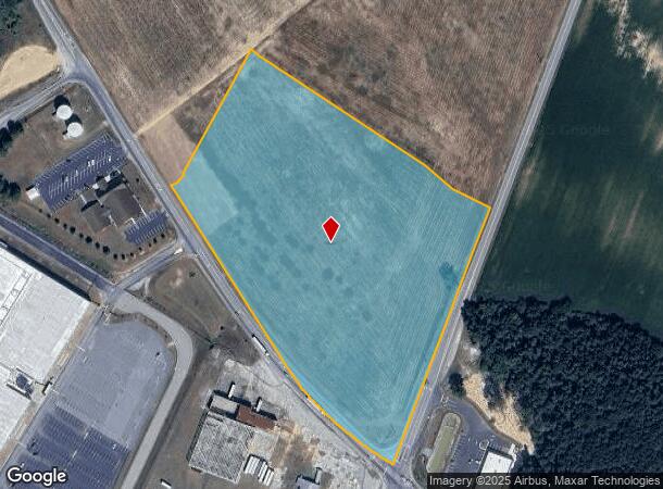
301 Suggs Rd S
Dunn, NC
R L Warren Property
021505 0123
LOT#1 DUNN INDUSTRIAL PARK MAP#2024-399
Industrialacreage
Harnett
X
North Carolina
3720150400K
1
2025
13.47 AC
2025
North Carolina Southeast Area
070401
Other Market Areas
DEMOGRAPHICS near 301 Suggs Rd S
1 Mile
3 Mile
5 Mile
2024 Total Population
269
8,847
20,612
2029 Population
297
9,790
22,490
Pop Growth 2024-2029
+ 10.41%
+ 10.66%
+ 9.11%
Average Age
46
42
43
2024 Total Households
115
3,712
8,564
HH Growth 2024-2029
+ 10.43%
+ 10.96%
+ 9.43%
Median Household Inc
$59,285
$39,160
$44,589
Avg Household Size
2.30
2.30
2.40
2024 Avg HH Vehicles
2.00
2.00
2.00
Median Home Value
$146,250
$147,750
$150,380
Median Year Built
1980
1974
1976
Nearby Places
Map Layers
Map Styles
 Street
 Aerial
- Restaurants
- Banks
- Shops
- Fitness
- Groceries
PUBLIC TRANSPORTATION
AIRPORT
Fayetteville Regional/Grannis Field
DRIVE
WALK
Distance
Fayetteville Regional/Grannis Field
36 min
27.5 mi
Freight Ports
Port of Wilmington
DRIVE
WALK
Distance
Port of Wilmington
126 min
106.0 mi
SALE & LEASE HISTORY
LISTING DATE
SALE/LEASE

Feb 16, 2022
For Sale
Nearby Properties
Address
Land Use
TOTAL SIZE
Lot Size
Zoning
Address
Land Use
TOTAL SIZE
Lot Size
Zoning
1,444,066 SF
116.27 AC
I100
Address
Land Use
TOTAL SIZE
Lot Size
Zoning
1,336,065 SF
115.65 AC
IND
Address
Land Use
TOTAL SIZE
Lot Size
Zoning
50,165 SF
3.65 AC
C3
Address
Land Use
TOTAL SIZE
Lot Size
Zoning
67,844 SF
2.64 AC
C3
Address
Land Use
TOTAL SIZE
Lot Size
Zoning
90,000 SF
61.34 AC
I100
Address
Land Use
TOTAL SIZE
Lot Size
Zoning
94,411 SF
14.50 AC
R10
Address
Land Use
TOTAL SIZE
Lot Size
Zoning
14,466 SF
1.64 AC
Address
Land Use
TOTAL SIZE
Lot Size
Zoning
52,334 SF
8.72 AC
R10
Address
Land Use
TOTAL SIZE
Lot Size
Zoning
44,726 SF
34.92 AC
I10
Address
Land Use
TOTAL SIZE
Lot Size
Zoning
26,334 SF
3.45 AC
C3
Address
Land Use
TOTAL SIZE
Lot Size
Zoning
43,834 SF
3.07 AC
R10
Address
Land Use
TOTAL SIZE
Lot Size
Zoning
50,991 SF
12 AC
I10
Address
Land Use
TOTAL SIZE
Lot Size
Zoning
8,133 SF
9.44 AC
C3
Address
Land Use
TOTAL SIZE
Lot Size
Zoning
30,959 SF
2.14 AC
C3
Address
Land Use
TOTAL SIZE
Lot Size
Zoning
60,864 SF
6.33 AC
C2
Address
Land Use
TOTAL SIZE
Lot Size
Zoning
9,095 SF
3.12 AC
OI
Address
Land Use
TOTAL SIZE
Lot Size
Zoning
37,716 SF
3.70 AC
C3
Address
Land Use
TOTAL SIZE
Lot Size
Zoning
43,785 SF
2.94 AC
Address
Land Use
TOTAL SIZE
Lot Size
Zoning
44,556 SF
2.76 AC
C2
Address
Land Use
TOTAL SIZE
Lot Size
Zoning
5,832 SF
0.63 AC
C3
Address
Land Use
TOTAL SIZE
Lot Size
Zoning
5,362 SF
1.24 AC
C2
Address
Land Use
TOTAL SIZE
Lot Size
Zoning
17,555 SF
12.85 AC
R10
Address
Land Use
TOTAL SIZE
Lot Size
Zoning
40,806 SF
5.50 AC
RM
Address
Land Use
TOTAL SIZE
Lot Size
Zoning
34,307 SF
1.59 AC
OI
Address
Land Use
TOTAL SIZE
Lot Size
Zoning
143,622 SF
8 AC
I10
Address
Land Use
TOTAL SIZE
Lot Size
Zoning
3,711 SF
1.50 AC
C3
Address
Land Use
TOTAL SIZE
Lot Size
Zoning
19,158 SF
5 AC
OI
Address
Land Use
TOTAL SIZE
Lot Size
Zoning
21,200 SF
4.86 AC
Address
Land Use
TOTAL SIZE
Lot Size
Zoning
17,132 SF
1.98 AC
Address
Land Use
TOTAL SIZE
Lot Size
Zoning
43,434 SF
1.87 AC
C2
The World's #1 Commercial Real Estate Marketplace
Connect with us
© 2025 CoStar Group
The information above has been obtained from sources believed reliable. While we do not doubt its accuracy we have not verified it and make no guarantee, warranty or representation about it. It is your responsibility to independently confirm its accuracy and completeness. Any projections, opinions, assumptions, or estimates used are for example only and do not represent the current or future performance of the property. The value of this transaction to you depends on tax and other factors which should be evaluated by your tax, financial, and legal advisors. You and your advisors should conduct a careful, independent investigation of the property to determine to your satisfaction the suitability of the property for your needs.