Property Record
301 Superior St, Sandusky, OH 44870
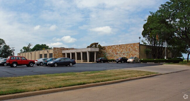


Property Detail
301 Superior St
Sandusky, OH
PT LOTS 70 71 72 OF MILLS 479 AC TR W SIDE SUPERIOR ST 8.6114A
59-00889-000
Erie
Commercialnec
Ohio
AE The base floodplain where base flood elevations are provided. AE Zones are now used on new format FIRMs instead of A1-A30 Zones.
70,71,7
2024
8.61 AC
2025
Erie County
040900
Cleveland
27,430 SF
NEARBY LISTINGS FOR SALE OR LEASE
DEMOGRAPHICS near 301 Superior St
1 mile
3 mile
5 mile
2025 Total Population
1,703
21,802
38,328
2030 Population
1,653
21,480
37,914
Pop Growth 2025-2030
(2.94%)
(1.48%)
(1.08%)
Average Age
43
41
43
2025 Total Households
753
9,511
16,419
HH Growth 2025-2030
(3.45%)
(1.58%)
(1.18%)
Median Household Inc
$47,711
$48,951
$54,274
Avg Household Size
2.10
2.20
2.20
2025 Avg HH Vehicles
2.00
2.00
2.00
Median Home Value
$133,409
$138,240
$164,467
Median Year Built
1954
1951
1960
Nearby Places
Map Layers
Map Styles
 Street
 Aerial
Layers
 Traffic
 Biking
Places
Listings with unknown addresses are not visible on the map
- Restaurants
- Banks
- Shops
- Fitness
- Groceries
PUBLIC TRANSPORTATION
COMMUTER RAIL
Drive
Walk
Distance
6 min
1.9 mi
Freight Ports
Drive
Walk
Distance
78 min
51.2 mi
SALE & LEASE HISTORY
LISTING DATE
SALE/LEASE

Sep 25, 2016
For Lease
Sep 23, 2016
For Sale
Nearby Properties
Address
Land Use
TOTAL SIZE
Lot Size
Zoning
Address
Land Use
TOTAL SIZE
Lot Size
Zoning
66,569 SF
10.32 AC
Address
Land Use
TOTAL SIZE
Lot Size
Zoning
9,764 SF
14.82 AC
Address
Land Use
TOTAL SIZE
Lot Size
Zoning
163,634 SF
30.71 AC
Address
Land Use
TOTAL SIZE
Lot Size
Zoning
600 SF
128.66 AC
Address
Land Use
TOTAL SIZE
Lot Size
Zoning
56,460 SF
4.53 AC
Address
Land Use
TOTAL SIZE
Lot Size
Zoning
101,567 SF
10.64 AC
Address
Land Use
TOTAL SIZE
Lot Size
Zoning
109,181 SF
8.89 AC
Address
Land Use
TOTAL SIZE
Lot Size
Zoning
46,295 SF
4.31 AC
Address
Land Use
TOTAL SIZE
Lot Size
Zoning
26,644 SF
0.16 AC
Address
Land Use
TOTAL SIZE
Lot Size
Zoning
68,204 SF
5.36 AC
Address
Land Use
TOTAL SIZE
Lot Size
Zoning
31,713 SF
9.18 AC
Address
Land Use
TOTAL SIZE
Lot Size
Zoning
36,400 SF
3.87 AC
Address
Land Use
TOTAL SIZE
Lot Size
Zoning
3,379 SF
0.15 AC
Address
Land Use
TOTAL SIZE
Lot Size
Zoning
41,105 SF
2.65 AC
Address
Land Use
TOTAL SIZE
Lot Size
Zoning
48,108 SF
14.41 AC
Address
Land Use
TOTAL SIZE
Lot Size
Zoning
71,321 SF
3.60 AC
Address
Land Use
TOTAL SIZE
Lot Size
Zoning
18,848 SF
3.37 AC
Address
Land Use
TOTAL SIZE
Lot Size
Zoning
95,556 SF
1.05 AC
Address
Land Use
TOTAL SIZE
Lot Size
Zoning
46,620 SF
4.37 AC
Address
Land Use
TOTAL SIZE
Lot Size
Zoning
84,320 SF
101.67 AC
Address
Land Use
TOTAL SIZE
Lot Size
Zoning
49,477 SF
0.25 AC
Address
Land Use
TOTAL SIZE
Lot Size
Zoning
6,000 SF
24.21 AC
Address
Land Use
TOTAL SIZE
Lot Size
Zoning
2,340 SF
12.26 AC
Address
Land Use
TOTAL SIZE
Lot Size
Zoning
43,764 SF
2.60 AC
Address
Land Use
TOTAL SIZE
Lot Size
Zoning
39,547 SF
7.37 AC
Address
Land Use
TOTAL SIZE
Lot Size
Zoning
42,358 SF
4.20 AC
Address
Land Use
TOTAL SIZE
Lot Size
Zoning
5,160 SF
15.08 AC
Address
Land Use
TOTAL SIZE
Lot Size
Zoning
11,645 SF
1.99 AC
Address
Land Use
TOTAL SIZE
Lot Size
Zoning
235,856 SF
19.90 AC
Address
Land Use
TOTAL SIZE
Lot Size
Zoning
132,873 SF
9.19 AC
The World's #1 Commercial Real Estate Marketplace
Connect with us
© 2026 CoStar Group
The information above has been obtained from sources believed reliable. While we do not doubt its accuracy we have not verified it and make no guarantee, warranty or representation about it. It is your responsibility to independently confirm its accuracy and completeness. Any projections, opinions, assumptions, or estimates used are for example only and do not represent the current or future performance of the property. The value of this transaction to you depends on tax and other factors which should be evaluated by your tax, financial, and legal advisors. You and your advisors should conduct a careful, independent investigation of the property to determine to your satisfaction the suitability of the property for your needs.