Property Record
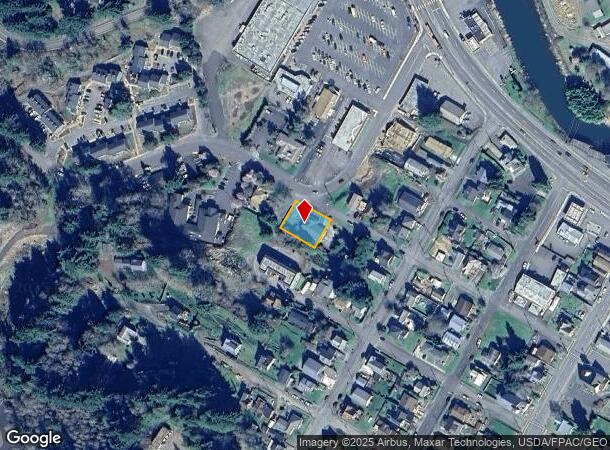
301 Sw Belair Dr, Clatskanie, OR 97016
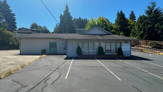
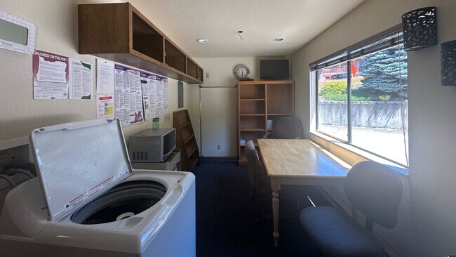
This Property Is For Sale
NEARBY LISTINGS FOR SALE OR LEASE
-
-
View all Clatskanie listings for sale on LoopNet.com
Property Detail
301 Sw Belair Dr
25840
Bryants Add 01
Medicalbuilding
Columbia
X
Oregon
41009C0127D
0.21 AC
2025
Columbia County
2025
Portland
970201
Portland-Vancouver-Hillsboro, OR-WA
1,656 SF
DEMOGRAPHICS near 301 Sw Belair Dr
1 Mile
3 Mile
5 Mile
2024 Total Population
1,942
3,080
4,054
2029 Population
2,095
3,324
4,383
Pop Growth 2024-2029
+ 7.88%
+ 7.92%
+ 8.12%
Average Age
43
43
43
2024 Total Households
788
1,221
1,603
HH Growth 2024-2029
+ 7.87%
+ 7.86%
+ 8.11%
Median Household Inc
$77,018
$78,595
$79,700
Avg Household Size
2.30
2.30
2.40
2024 Avg HH Vehicles
2.00
2.00
2.00
Median Home Value
$397,221
$400,372
$400,599
Median Year Built
1975
1976
1977
Nearby Places
Map Layers
Map Styles
 Street
 Aerial
- Restaurants
- Banks
- Shops
- Fitness
- Groceries
Nearby Properties
Address
Land Use
TOTAL SIZE
Lot Size
Zoning
Address
Land Use
TOTAL SIZE
Lot Size
Zoning
23,292 SF
1.87 AC
CL:C-1
Address
Land Use
TOTAL SIZE
Lot Size
Zoning
35,524 SF
4.65 AC
CL:C-1
Address
Land Use
TOTAL SIZE
Lot Size
Zoning
17.79 AC
CO:M-1
Address
Land Use
TOTAL SIZE
Lot Size
Zoning
7,104 SF
1 AC
CL:C-1
Address
Land Use
TOTAL SIZE
Lot Size
Zoning
12.38 AC
CL:MFR
Address
Land Use
TOTAL SIZE
Lot Size
Zoning
19,991 SF
1.02 AC
CL:C-1
Address
Land Use
TOTAL SIZE
Lot Size
Zoning
12,263 SF
2.47 AC
CL:C-1
Address
Land Use
TOTAL SIZE
Lot Size
Zoning
1.71 AC
CL:CS
Address
Land Use
TOTAL SIZE
Lot Size
Zoning
21,924 SF
3.82 AC
CL:MFR
Address
Land Use
TOTAL SIZE
Lot Size
Zoning
2,277 SF
0.53 AC
CL:C-1
Address
Land Use
TOTAL SIZE
Lot Size
Zoning
7,528 SF
1.08 AC
CL:C-1
Address
Land Use
TOTAL SIZE
Lot Size
Zoning
19.64 AC
CO:M-1
Address
Land Use
TOTAL SIZE
Lot Size
Zoning
8,342 SF
0.34 AC
CL:C-1
Address
Land Use
TOTAL SIZE
Lot Size
Zoning
11,114 SF
0.69 AC
CL:C-1
Address
Land Use
TOTAL SIZE
Lot Size
Zoning
5,150 SF
0.59 AC
CL:C-1
Address
Land Use
TOTAL SIZE
Lot Size
Zoning
3,969 SF
1.04 AC
CL:C-1
Address
Land Use
TOTAL SIZE
Lot Size
Zoning
6,117 SF
0.67 AC
CL:C-1
Address
Land Use
TOTAL SIZE
Lot Size
Zoning
2,831 SF
0.33 AC
CL:C-1
Address
Land Use
TOTAL SIZE
Lot Size
Zoning
12,320 SF
0.26 AC
CL:C-1
Address
Land Use
TOTAL SIZE
Lot Size
Zoning
6,636 SF
0.66 AC
CL:MF2.5
Address
Land Use
TOTAL SIZE
Lot Size
Zoning
3,370 SF
0.45 AC
CL:C-1
Address
Land Use
TOTAL SIZE
Lot Size
Zoning
3,226 SF
1.37 AC
CL:C-1
Address
Land Use
TOTAL SIZE
Lot Size
Zoning
1,975 SF
0.96 AC
CL:MFR
Address
Land Use
TOTAL SIZE
Lot Size
Zoning
4,340 SF
0.54 AC
CL:C-1
Address
Land Use
TOTAL SIZE
Lot Size
Zoning
10,325 SF
0.43 AC
CL:C-1
Address
Land Use
TOTAL SIZE
Lot Size
Zoning
2,464 SF
0.50 AC
CL:C-1
Address
Land Use
TOTAL SIZE
Lot Size
Zoning
2,835 SF
0.42 AC
CL:C-1
Address
Land Use
TOTAL SIZE
Lot Size
Zoning
2,736 SF
60.26 AC
CO:PA-80
Address
Land Use
TOTAL SIZE
Lot Size
Zoning
1.20 AC
CL:R-10
Address
Land Use
TOTAL SIZE
Lot Size
Zoning
4,678 SF
0.24 AC
CL:MF2.5
The World's #1 Commercial Real Estate Marketplace
Connect with us
© 2025 CoStar Group
The information above has been obtained from sources believed reliable. While we do not doubt its accuracy we have not verified it and make no guarantee, warranty or representation about it. It is your responsibility to independently confirm its accuracy and completeness. Any projections, opinions, assumptions, or estimates used are for example only and do not represent the current or future performance of the property. The value of this transaction to you depends on tax and other factors which should be evaluated by your tax, financial, and legal advisors. You and your advisors should conduct a careful, independent investigation of the property to determine to your satisfaction the suitability of the property for your needs.