Property Record
301 Us Route 1, Cumberland Foreside, ME 04110

NEARBY LISTINGS FOR SALE OR LEASE
-
-
View all Cumberland Foreside listings for sale on LoopNet.com
Property Detail
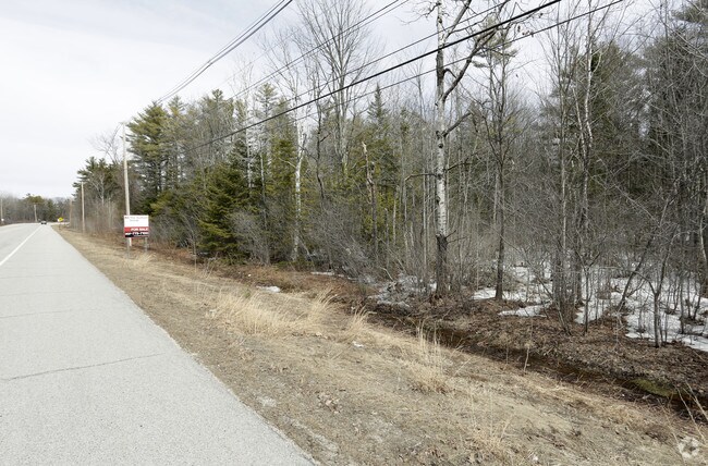
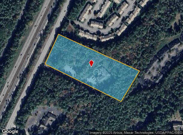
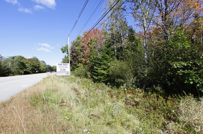
301 Us Route 1
CMBL-000002D-R000000-000001
Cumberland
Commercialbuilding
Maine
X
1
23005C0701F
6.10 AC
2025
NE Cumberland County
2025
Portland/South Portland
004202
Portland-South Portland, ME
9,035 SF
DEMOGRAPHICS near 301 Us Route 1
1 Mile
3 Mile
5 Mile
2024 Total Population
1,440
13,527
25,434
2029 Population
1,510
14,136
26,443
Pop Growth 2024-2029
+ 4.86%
+ 4.50%
+ 3.97%
Average Age
45
44
44
2024 Total Households
581
5,318
10,004
HH Growth 2024-2029
+ 4.99%
+ 4.59%
+ 4.02%
Median Household Inc
$117,377
$106,574
$114,268
Avg Household Size
2.40
2.50
2.50
2024 Avg HH Vehicles
2.00
2.00
2.00
Median Home Value
$614,583
$566,380
$576,538
Median Year Built
1972
1975
1977
Nearby Places
Map Layers
Map Styles
 Street
 Aerial
- Restaurants
- Banks
- Shops
- Fitness
- Groceries
PUBLIC TRANSPORTATION
COMMUTER RAIL
Freeport Amtrak Station (Downeaster - Amtrak)
DRIVE
WALK
Distance
Freeport Amtrak Station (Downeaster - Amtrak)
12 min
7.6 mi
AIRPORT
Portland International Jetport
DRIVE
WALK
Distance
Portland International Jetport
22 min
14.3 mi
Freight Ports
Portland, ME
DRIVE
WALK
Distance
Portland, ME
16 min
11.3 mi
Nearby Properties
Address
Land Use
TOTAL SIZE
Lot Size
Zoning
Address
Land Use
TOTAL SIZE
Lot Size
Zoning
152,724 SF
46.80 AC
13
Address
Land Use
TOTAL SIZE
Lot Size
Zoning
117.24 AC
31
Address
Land Use
TOTAL SIZE
Lot Size
Zoning
187,437 SF
62.85 AC
23
Address
Land Use
TOTAL SIZE
Lot Size
Zoning
Address
Land Use
TOTAL SIZE
Lot Size
Zoning
66.50 AC
RR2
Address
Land Use
TOTAL SIZE
Lot Size
Zoning
21.50 AC
13
Address
Land Use
TOTAL SIZE
Lot Size
Zoning
83,378 SF
42 AC
13
Address
Land Use
TOTAL SIZE
Lot Size
Zoning
68,068 SF
6.02 AC
BP
Address
Land Use
TOTAL SIZE
Lot Size
Zoning
93,752 SF
10.86 AC
21
Address
Land Use
TOTAL SIZE
Lot Size
Zoning
9.70 AC
CD4-C1
Address
Land Use
TOTAL SIZE
Lot Size
Zoning
7.42 AC
17
Address
Land Use
TOTAL SIZE
Lot Size
Zoning
60,698 SF
11.60 AC
CD4-C2
Address
Land Use
TOTAL SIZE
Lot Size
Zoning
1,896 SF
10.58 AC
LDR
Address
Land Use
TOTAL SIZE
Lot Size
Zoning
108.88 AC
RR1
Address
Land Use
TOTAL SIZE
Lot Size
Zoning
47,488 SF
15.14 AC
CIVIC
Address
Land Use
TOTAL SIZE
Lot Size
Zoning
49,513 SF
4.06 AC
21
Address
Land Use
TOTAL SIZE
Lot Size
Zoning
37,746 SF
3.16 AC
LDR
Address
Land Use
TOTAL SIZE
Lot Size
Zoning
18 AC
13
Address
Land Use
TOTAL SIZE
Lot Size
Zoning
31,293 SF
7.20 AC
OC
Address
Land Use
TOTAL SIZE
Lot Size
Zoning
28,536 SF
7.10 AC
CD4-C1
Address
Land Use
TOTAL SIZE
Lot Size
Zoning
3,000 SF
5.77 AC
BP
Address
Land Use
TOTAL SIZE
Lot Size
Zoning
5.10 AC
24
Address
Land Use
TOTAL SIZE
Lot Size
Zoning
40.37 AC
13
Address
Land Use
TOTAL SIZE
Lot Size
Zoning
23,376 SF
37.04 AC
LDR
Address
Land Use
TOTAL SIZE
Lot Size
Zoning
153.50 AC
MDR/
Address
Land Use
TOTAL SIZE
Lot Size
Zoning
36,374 SF
5.80 AC
SD1
Address
Land Use
TOTAL SIZE
Lot Size
Zoning
2.10 AC
21
Address
Land Use
TOTAL SIZE
Lot Size
Zoning
25,374 SF
Address
Land Use
TOTAL SIZE
Lot Size
Zoning
23,362 SF
3.01 AC
13
The World's #1 Commercial Real Estate Marketplace
Connect with us
© 2025 CoStar Group
The information above has been obtained from sources believed reliable. While we do not doubt its accuracy we have not verified it and make no guarantee, warranty or representation about it. It is your responsibility to independently confirm its accuracy and completeness. Any projections, opinions, assumptions, or estimates used are for example only and do not represent the current or future performance of the property. The value of this transaction to you depends on tax and other factors which should be evaluated by your tax, financial, and legal advisors. You and your advisors should conduct a careful, independent investigation of the property to determine to your satisfaction the suitability of the property for your needs.