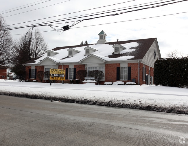
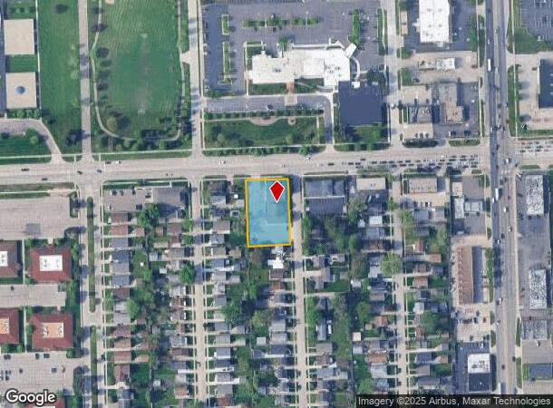
Property Record
301 W 13 Mile Rd, Madison Heights, MI 48071
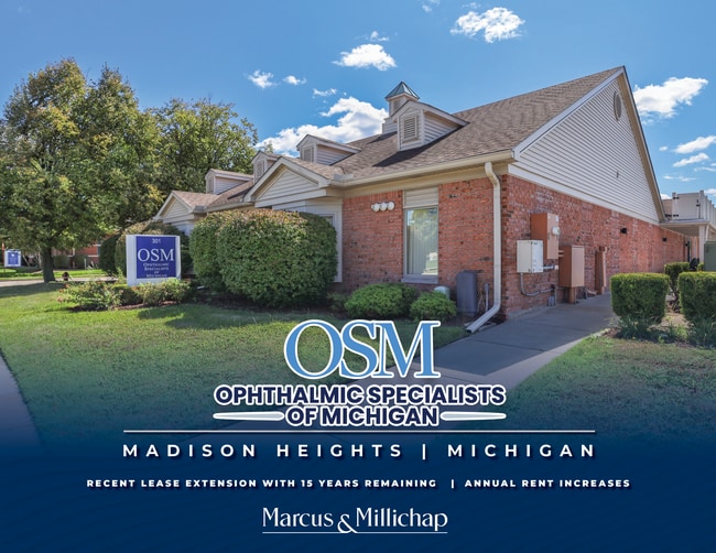
This Property Is For Sale
NEARBY LISTINGS FOR SALE OR LEASE
Property Detail
301 W 13 Mile Rd
25-11-227-040
Northview Sub
Officebuilding
T1N, R11E, SEC 11 NORTHVIEW SUB LOTS 160 TO 164 INCL 10/31/85 FR 031 & 032
X
Oakland
26125C0563F
Michigan
2023
160-164
2024
Royal Oak
181200
Detroit
7,090 SF
Detroit-Warren-Dearborn, MI
DEMOGRAPHICS near 301 W 13 Mile Rd
1 Mile
3 Mile
5 Mile
2024 Total Population
9,505
117,345
316,344
2029 Population
9,443
116,038
313,309
Pop Growth 2024-2029
(0.65%)
(1.11%)
(0.96%)
Average Age
41
41
41
2024 Total Households
4,749
53,243
137,951
HH Growth 2024-2029
(0.53%)
(1.11%)
(0.94%)
Median Household Inc
$56,327
$73,124
$76,542
Avg Household Size
2.00
2.20
2.20
2024 Avg HH Vehicles
2.00
2.00
2.00
Median Home Value
$195,328
$224,573
$229,270
Median Year Built
1970
1961
1962
Nearby Places
- Restaurants
- Banks
- Shops
- Fitness
- Groceries
PUBLIC TRANSPORTATION
COMMUTER RAIL
Royal Oak Amtrak (Wolverine - Amtrak)
DRIVE
WALK
Distance
Royal Oak Amtrak (Wolverine - Amtrak)
10 min
4.2 mi
Troy Amtrak Station (Wolverine - Amtrak)
DRIVE
WALK
Distance
Troy Amtrak Station (Wolverine - Amtrak)
13 min
5.8 mi
AIRPORT
Windsor International
DRIVE
WALK
Distance
Windsor International
42 min
24.3 mi
Detroit Metro Wayne County
DRIVE
WALK
Distance
Detroit Metro Wayne County
47 min
33.9 mi
Freight Ports
Port of Toledo
DRIVE
WALK
Distance
Port of Toledo
93 min
74.9 mi
Nearby Properties
Address
Land Use
TOTAL SIZE
Lot Size
Zoning
Address
Land Use
TOTAL SIZE
Lot Size
Zoning
4.20 AC
REG BUS
Address
Land Use
TOTAL SIZE
Lot Size
Zoning
136,137 SF
12.28 AC
RM2
Address
Land Use
TOTAL SIZE
Lot Size
Zoning
0.81 AC
CBD
Address
Land Use
TOTAL SIZE
Lot Size
Zoning
21.76 AC
Address
Land Use
TOTAL SIZE
Lot Size
Zoning
476,388 SF
23 AC
Address
Land Use
TOTAL SIZE
Lot Size
Zoning
40.32 AC
RM-2
Address
Land Use
TOTAL SIZE
Lot Size
Zoning
10,734 SF
3.52 AC
SPEC REDEV
Address
Land Use
TOTAL SIZE
Lot Size
Zoning
12.16 AC
PUD
Address
Land Use
TOTAL SIZE
Lot Size
Zoning
251,735 SF
10.57 AC
RM3
Address
Land Use
TOTAL SIZE
Lot Size
Zoning
362,816 SF
29 AC
Address
Land Use
TOTAL SIZE
Lot Size
Zoning
645 SF
23.16 AC
RM-2
Address
Land Use
TOTAL SIZE
Lot Size
Zoning
94,228 SF
17.66 AC
Address
Land Use
TOTAL SIZE
Lot Size
Zoning
228,421 SF
17.18 AC
RMMUL
Address
Land Use
TOTAL SIZE
Lot Size
Zoning
46.10 AC
MZ
Address
Land Use
TOTAL SIZE
Lot Size
Zoning
349,226 SF
21.62 AC
RMMUL
Address
Land Use
TOTAL SIZE
Lot Size
Zoning
276,235 SF
14.49 AC
OM
Address
Land Use
TOTAL SIZE
Lot Size
Zoning
236,900 SF
20.34 AC
RM1
Address
Land Use
TOTAL SIZE
Lot Size
Zoning
804 SF
1.50 AC
CBD
Address
Land Use
TOTAL SIZE
Lot Size
Zoning
1.46 AC
CBD
Address
Land Use
TOTAL SIZE
Lot Size
Zoning
378,412 SF
Address
Land Use
TOTAL SIZE
Lot Size
Zoning
204,086 SF
18.72 AC
RM1
Address
Land Use
TOTAL SIZE
Lot Size
Zoning
126,450 SF
17.25 AC
RM-2
Address
Land Use
TOTAL SIZE
Lot Size
Zoning
94,228 SF
17.66 AC
B2
Address
Land Use
TOTAL SIZE
Lot Size
Zoning
230,192 SF
B3GEN
Address
Land Use
TOTAL SIZE
Lot Size
Zoning
120,678 SF
13.31 AC
RM-2
Address
Land Use
TOTAL SIZE
Lot Size
Zoning
171,259 SF
1.26 AC
CBD
Address
Land Use
TOTAL SIZE
Lot Size
Zoning
62,528 SF
5.27 AC
M-1 LT
Address
Land Use
TOTAL SIZE
Lot Size
Zoning
59,019 SF
11.74 AC
Address
Land Use
TOTAL SIZE
Lot Size
Zoning
10,800 SF
9 AC
M1
Address
Land Use
TOTAL SIZE
Lot Size
Zoning
13.89 AC
PUD
The World's #1 Commercial Real Estate Marketplace
Connect with us
© 2025 CoStar Group
The information above has been obtained from sources believed reliable. While we do not doubt its accuracy we have not verified it and make no guarantee, warranty or representation about it. It is your responsibility to independently confirm its accuracy and completeness. Any projections, opinions, assumptions, or estimates used are for example only and do not represent the current or future performance of the property. The value of this transaction to you depends on tax and other factors which should be evaluated by your tax, financial, and legal advisors. You and your advisors should conduct a careful, independent investigation of the property to determine to your satisfaction the suitability of the property for your needs.