Property Record
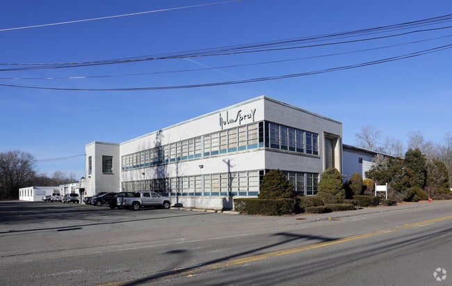
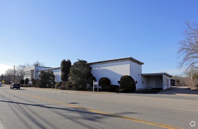
301 W Main St, Norton, MA 02766

Save to a Folder
{{folder.Name}}
{{folder.ListingIds.length}} Properties
{{folder.ListingIds.length}} Property
Create a New Folder
Property Detail
301 W Main St
NORT-000026-000000-000080
Bristol
Industrialgeneral
Massachusetts
AE The base floodplain where base flood elevations are provided. AE Zones are now used on new format FIRMs instead of A1-A30 Zones.
9.10 AC
2025
Attleboro/New Bedford
2025
Boston
611202
Providence-Warwick, RI-MA
NEARBY LISTINGS FOR SALE OR LEASE
DEMOGRAPHICS near 301 W Main St
1 mile
3 mile
5 mile
2025 Total Population
2,028
25,784
75,934
2030 Population
2,056
26,369
77,531
Pop Growth 2025-2030
+ 1.38%
+ 2.27%
+ 2.10%
Average Age
43
41
41
2025 Total Households
759
9,443
28,258
HH Growth 2025-2030
+ 1.45%
+ 2.45%
+ 2.18%
Median Household Inc
$145,172
$109,077
$111,020
Avg Household Size
2.60
2.50
2.60
2025 Avg HH Vehicles
2.00
2.00
2.00
Median Home Value
$614,532
$511,179
$515,373
Median Year Built
1981
1976
1976
Nearby Places
Map Layers
Map Styles
 Street
 Aerial
Layers
 Traffic
 Biking
Places
Listings with unknown addresses are not visible on the map
- Restaurants
- Banks
- Shops
- Fitness
- Groceries
PUBLIC TRANSPORTATION
COMMUTER RAIL
Attleboro (Foxboro Event Service - MBTA, Providence/Stoughton Line - MBTA)
Drive
Walk
Distance
Attleboro (Foxboro Event Service - MBTA, Providence/Stoughton Line - MBTA)
7 min
3.8 mi
Mansfield (Foxboro Line (Special Events Only) - Massachusetts Bay Transportation Authority Commuter Rail (Purple Line), Providence/Stoughton Line - Massachusetts Bay Transportation Authority Commuter Rail (Purple Line))
Drive
Walk
Distance
Mansfield (Foxboro Line (Special Events Only) - Massachusetts Bay Transportation Authority Commuter Rail (Purple Line), Providence/Stoughton Line - Massachusetts Bay Transportation Authority Commuter Rail (Purple Line))
16 min
8.5 mi
AIRPORT
Rhode Island Tf Green International
Drive
Walk
Distance
Rhode Island Tf Green International
41 min
24.8 mi
Freight Ports
Port of Davisville, RI
Drive
Walk
Distance
Port of Davisville, RI
57 min
37.2 mi
Nearby Properties
Address
Land Use
TOTAL SIZE
Lot Size
Zoning
Address
Land Use
TOTAL SIZE
Lot Size
Zoning
351,950 SF
31.45 AC
Address
Land Use
TOTAL SIZE
Lot Size
Zoning
Address
Land Use
TOTAL SIZE
Lot Size
Zoning
177,218 SF
50.82 AC
Address
Land Use
TOTAL SIZE
Lot Size
Zoning
10.40 AC
Address
Land Use
TOTAL SIZE
Lot Size
Zoning
228,377 SF
24.19 AC
IND
Address
Land Use
TOTAL SIZE
Lot Size
Zoning
228,377 SF
24.19 AC
IND
Address
Land Use
TOTAL SIZE
Lot Size
Zoning
26.34 AC
Address
Land Use
TOTAL SIZE
Lot Size
Zoning
11,110 SF
25.74 AC
Address
Land Use
TOTAL SIZE
Lot Size
Zoning
26.70 AC
Address
Land Use
TOTAL SIZE
Lot Size
Zoning
82,828 SF
15.45 AC
Address
Land Use
TOTAL SIZE
Lot Size
Zoning
70,663 SF
8.80 AC
Address
Land Use
TOTAL SIZE
Lot Size
Zoning
82,946 SF
25.50 AC
Address
Land Use
TOTAL SIZE
Lot Size
Zoning
358.70 AC
Address
Land Use
TOTAL SIZE
Lot Size
Zoning
6.30 AC
Address
Land Use
TOTAL SIZE
Lot Size
Zoning
106.27 AC
Address
Land Use
TOTAL SIZE
Lot Size
Zoning
3,153 SF
53 AC
Address
Land Use
TOTAL SIZE
Lot Size
Zoning
17,797 SF
79.97 AC
Address
Land Use
TOTAL SIZE
Lot Size
Zoning
64.80 AC
Address
Land Use
TOTAL SIZE
Lot Size
Zoning
113,173 SF
4.52 AC
R60
Address
Land Use
TOTAL SIZE
Lot Size
Zoning
5,760 SF
23.95 AC
Address
Land Use
TOTAL SIZE
Lot Size
Zoning
113,671 SF
13.13 AC
Address
Land Use
TOTAL SIZE
Lot Size
Zoning
76,295 SF
3.66 AC
I
Address
Land Use
TOTAL SIZE
Lot Size
Zoning
13,555 SF
14.70 AC
I
Address
Land Use
TOTAL SIZE
Lot Size
Zoning
44,486 SF
0.14 AC
Address
Land Use
TOTAL SIZE
Lot Size
Zoning
80,293 SF
7.58 AC
I
Address
Land Use
TOTAL SIZE
Lot Size
Zoning
99,960 SF
6.81 AC
Address
Land Use
TOTAL SIZE
Lot Size
Zoning
178,800 SF
13.74 AC
Address
Land Use
TOTAL SIZE
Lot Size
Zoning
87,546 SF
1.60 AC
Address
Land Use
TOTAL SIZE
Lot Size
Zoning
12,864 SF
9.25 AC
Address
Land Use
TOTAL SIZE
Lot Size
Zoning
10.94 AC
The World's #1 Commercial Real Estate Marketplace
Connect with us
© 2026 CoStar Group
The information above has been obtained from sources believed reliable. While we do not doubt its accuracy we have not verified it and make no guarantee, warranty or representation about it. It is your responsibility to independently confirm its accuracy and completeness. Any projections, opinions, assumptions, or estimates used are for example only and do not represent the current or future performance of the property. The value of this transaction to you depends on tax and other factors which should be evaluated by your tax, financial, and legal advisors. You and your advisors should conduct a careful, independent investigation of the property to determine to your satisfaction the suitability of the property for your needs.