Property Record
301 W Sam Ridley Pkwy, Smyrna, TN 37167


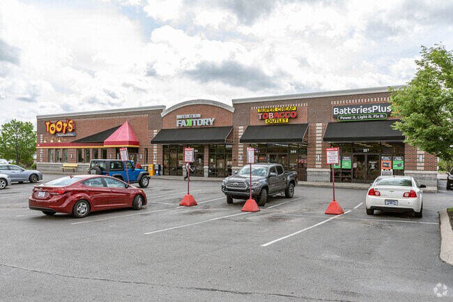
Property Detail
301 W Sam Ridley Pkwy
028-044.11-000
LOT 3 VILLAGE CREST COMMERCIAL PROPERTY PB 26 PG 5
Stripcommercialcenter
RUTHERFORD
C-2
Tennessee
B and X Area of moderate flood hazard, usually the area between the limits of the 100-year and 500-year floods.
3
2025
1.49 AC
2025
Rutherford County
040311
Nashville
8,107 SF
Nashville-Davidson--Murfreesboro--Franklin, TN
NEARBY LISTINGS FOR SALE OR LEASE
DEMOGRAPHICS near 301 W Sam Ridley Pkwy
1 mile
3 mile
5 mile
2025 Total Population
8,210
58,700
118,166
2030 Population
8,877
63,685
127,876
Pop Growth 2025-2030
+ 8.12%
+ 8.49%
+ 8.22%
Average Age
37
37
36
2025 Total Households
3,306
21,212
41,019
HH Growth 2025-2030
+ 8.14%
+ 8.58%
+ 8.34%
Median Household Inc
$63,526
$79,372
$83,742
Avg Household Size
2.50
2.70
2.80
2025 Avg HH Vehicles
2.00
2.00
2.00
Median Home Value
$345,945
$349,768
$363,223
Median Year Built
1997
1998
2000
Nearby Places
Map Layers
Map Styles
 Street
 Aerial
Transit
 Traffic
 Biking
Places
Listings with unknown addresses are not visible on the map
- Restaurants
- Banks
- Shops
- Fitness
- Groceries
PUBLIC TRANSPORTATION
AIRPORT
Nashville International
Drive
Walk
Distance
Nashville International
23 min
15.8 mi
Nearby Properties
Address
Land Use
TOTAL SIZE
Lot Size
Zoning
Address
Land Use
TOTAL SIZE
Lot Size
Zoning
404,723 SF
1,495 AC
Address
Land Use
TOTAL SIZE
Lot Size
Zoning
302,040 SF
60 AC
Address
Land Use
TOTAL SIZE
Lot Size
Zoning
618,332 SF
45.75 AC
Address
Land Use
TOTAL SIZE
Lot Size
Zoning
564,124 SF
37.66 AC
Address
Land Use
TOTAL SIZE
Lot Size
Zoning
377,869 SF
26.47 AC
Address
Land Use
TOTAL SIZE
Lot Size
Zoning
22,099 SF
18.58 AC
Address
Land Use
TOTAL SIZE
Lot Size
Zoning
323,961 SF
27.38 AC
I-2
Address
Land Use
TOTAL SIZE
Lot Size
Zoning
4,709 SF
25.76 AC
RM14
Address
Land Use
TOTAL SIZE
Lot Size
Zoning
17,953 SF
14.92 AC
Address
Land Use
TOTAL SIZE
Lot Size
Zoning
5,352 SF
30 AC
RMF
Address
Land Use
TOTAL SIZE
Lot Size
Zoning
4,974 SF
18.91 AC
C2
Address
Land Use
TOTAL SIZE
Lot Size
Zoning
301,272 SF
26.09 AC
Address
Land Use
TOTAL SIZE
Lot Size
Zoning
588,845 SF
72.56 AC
Address
Land Use
TOTAL SIZE
Lot Size
Zoning
163,177 SF
39.68 AC
Address
Land Use
TOTAL SIZE
Lot Size
Zoning
99,209 SF
44.41 AC
Address
Land Use
TOTAL SIZE
Lot Size
Zoning
202,737 SF
41 AC
Address
Land Use
TOTAL SIZE
Lot Size
Zoning
132,470 SF
42.16 AC
Address
Land Use
TOTAL SIZE
Lot Size
Zoning
223,445 SF
57.60 AC
Address
Land Use
TOTAL SIZE
Lot Size
Zoning
768,304 SF
40.03 AC
I-2
Address
Land Use
TOTAL SIZE
Lot Size
Zoning
212,268 SF
49 AC
Address
Land Use
TOTAL SIZE
Lot Size
Zoning
128,082 SF
19 AC
Address
Land Use
TOTAL SIZE
Lot Size
Zoning
304,456 SF
40.14 AC
Address
Land Use
TOTAL SIZE
Lot Size
Zoning
3,142 SF
11.40 AC
C2
Address
Land Use
TOTAL SIZE
Lot Size
Zoning
105,638 SF
17.63 AC
Address
Land Use
TOTAL SIZE
Lot Size
Zoning
3,296 SF
14.63 AC
Address
Land Use
TOTAL SIZE
Lot Size
Zoning
22,500 SF
23.38 AC
RM16
Address
Land Use
TOTAL SIZE
Lot Size
Zoning
121,104 SF
43.60 AC
Address
Land Use
TOTAL SIZE
Lot Size
Zoning
536,732 SF
30.91 AC
I2
Address
Land Use
TOTAL SIZE
Lot Size
Zoning
33,264 SF
27.97 AC
I2
Address
Land Use
TOTAL SIZE
Lot Size
Zoning
497,452 SF
26.75 AC
I-2
The World's #1 Commercial Real Estate Marketplace
Connect with us
© 2026 CoStar Group
The information above has been obtained from sources believed reliable. While we do not doubt its accuracy we have not verified it and make no guarantee, warranty or representation about it. It is your responsibility to independently confirm its accuracy and completeness. Any projections, opinions, assumptions, or estimates used are for example only and do not represent the current or future performance of the property. The value of this transaction to you depends on tax and other factors which should be evaluated by your tax, financial, and legal advisors. You and your advisors should conduct a careful, independent investigation of the property to determine to your satisfaction the suitability of the property for your needs.