Property Record
3010 Cobb Pky Nw, Kennesaw, GA 30152


NEARBY LISTINGS FOR SALE OR LEASE
-
-
View all Kennesaw listings for sale on LoopNet.com
Property Detail
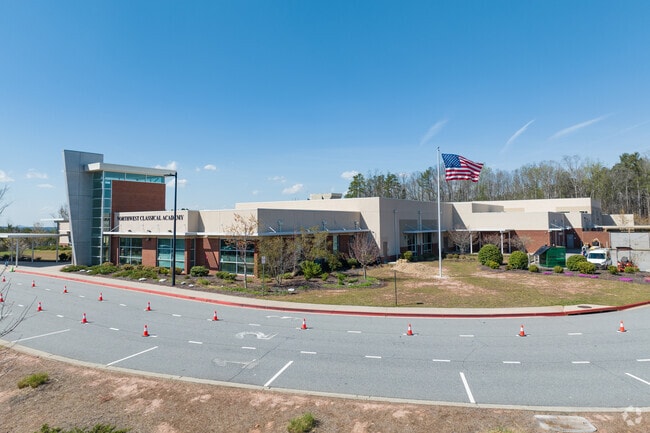
3010 Cobb Pky Nw
20-0126-011
Cobb
Publicschool
Georgia
X
126
13057C0325E
36.39 AC
0
Kennesaw/Town Center
2025
Atlanta
030260
Atlanta-Sandy Springs-Roswell, GA
111,673 SF
DEMOGRAPHICS near 3010 Cobb Pky Nw
1 Mile
3 Mile
5 Mile
2024 Total Population
10,296
71,045
162,873
2029 Population
10,421
72,032
167,244
Pop Growth 2024-2029
+ 1.21%
+ 1.39%
+ 2.68%
Average Age
38
39
38
2024 Total Households
3,736
26,032
59,272
HH Growth 2024-2029
+ 1.23%
+ 1.46%
+ 2.70%
Median Household Inc
$94,623
$88,602
$91,138
Avg Household Size
2.70
2.70
2.60
2024 Avg HH Vehicles
2.00
2.00
2.00
Median Home Value
$265,164
$285,645
$310,989
Median Year Built
1995
1995
1996
Nearby Places
Map Layers
Map Styles
 Street
 Aerial
- Restaurants
- Banks
- Shops
- Fitness
- Groceries
PUBLIC TRANSPORTATION
AIRPORT
Hartsfield - Jackson Atlanta International
DRIVE
WALK
Distance
Hartsfield - Jackson Atlanta International
53 min
37.2 mi
Nearby Properties
Address
Land Use
TOTAL SIZE
Lot Size
Zoning
Address
Land Use
TOTAL SIZE
Lot Size
Zoning
497,466 SF
40.63 AC
RM-12
Address
Land Use
TOTAL SIZE
Lot Size
Zoning
95,228 SF
12.97 AC
CBD
Address
Land Use
TOTAL SIZE
Lot Size
Zoning
342,443 SF
19.15 AC
NRC/RM12
Address
Land Use
TOTAL SIZE
Lot Size
Zoning
1,120 SF
42.20 AC
HI
Address
Land Use
TOTAL SIZE
Lot Size
Zoning
269,464 SF
2.61 AC
CBD
Address
Land Use
TOTAL SIZE
Lot Size
Zoning
69,476 SF
8.11 AC
PVC
Address
Land Use
TOTAL SIZE
Lot Size
Zoning
13.43 AC
OI
Address
Land Use
TOTAL SIZE
Lot Size
Zoning
7.53 AC
OI
Address
Land Use
TOTAL SIZE
Lot Size
Zoning
174,960 SF
3.99 AC
MU
Address
Land Use
TOTAL SIZE
Lot Size
Zoning
225,382 SF
18.67 AC
RM-8
Address
Land Use
TOTAL SIZE
Lot Size
Zoning
288,926 SF
75 AC
LI
Address
Land Use
TOTAL SIZE
Lot Size
Zoning
212,038 SF
24.96 AC
RM-8
Address
Land Use
TOTAL SIZE
Lot Size
Zoning
198,423 SF
15.31 AC
OI
Address
Land Use
TOTAL SIZE
Lot Size
Zoning
347,298 SF
30.41 AC
GC/HI/WS
Address
Land Use
TOTAL SIZE
Lot Size
Zoning
316,088 SF
18.27 AC
GC
Address
Land Use
TOTAL SIZE
Lot Size
Zoning
218,433 SF
26.38 AC
C2/R-8
Address
Land Use
TOTAL SIZE
Lot Size
Zoning
458,760 SF
37.30 AC
LI
Address
Land Use
TOTAL SIZE
Lot Size
Zoning
2,925 SF
1.25 AC
CBD
Address
Land Use
TOTAL SIZE
Lot Size
Zoning
227,675 SF
16.98 AC
PVC
Address
Land Use
TOTAL SIZE
Lot Size
Zoning
200,596 SF
16.04 AC
RM-8
Address
Land Use
TOTAL SIZE
Lot Size
Zoning
653,408 SF
20.16 AC
HI
Address
Land Use
TOTAL SIZE
Lot Size
Zoning
147,079 SF
16.90 AC
C2/R-7
Address
Land Use
TOTAL SIZE
Lot Size
Zoning
972 SF
4.21 AC
CBD
Address
Land Use
TOTAL SIZE
Lot Size
Zoning
204,948 SF
15 AC
RM-8
Address
Land Use
TOTAL SIZE
Lot Size
Zoning
5.50 AC
CBD
Address
Land Use
TOTAL SIZE
Lot Size
Zoning
405,105 SF
32.38 AC
HI
Address
Land Use
TOTAL SIZE
Lot Size
Zoning
115,210 SF
9.66 AC
RM-8
Address
Land Use
TOTAL SIZE
Lot Size
Zoning
295,518 SF
18.83 AC
LI
Address
Land Use
TOTAL SIZE
Lot Size
Zoning
156,945 SF
18.03 AC
RM-8
Address
Land Use
TOTAL SIZE
Lot Size
Zoning
120,715 SF
14.60 AC
SLC
The World's #1 Commercial Real Estate Marketplace
Connect with us
© 2026 CoStar Group
The information above has been obtained from sources believed reliable. While we do not doubt its accuracy we have not verified it and make no guarantee, warranty or representation about it. It is your responsibility to independently confirm its accuracy and completeness. Any projections, opinions, assumptions, or estimates used are for example only and do not represent the current or future performance of the property. The value of this transaction to you depends on tax and other factors which should be evaluated by your tax, financial, and legal advisors. You and your advisors should conduct a careful, independent investigation of the property to determine to your satisfaction the suitability of the property for your needs.