Property Record
3010 E Broad St, Mansfield, TX 76063
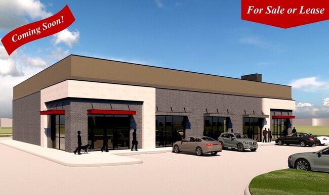

Property Detail
3010 E Broad St
Dallas-Fort Worth-Arlington, TX
NEW INTERMEDIATE SCH SOUTH ADD BLOCK 1 LOT 1R3
42678399
TARRANT
Residentialacreage
Texas
AE The base floodplain where base flood elevations are provided. AE Zones are now used on new format FIRMs instead of A1-A30 Zones.
1
2024
5.67 AC
2025
Arlington/Mansfield
111319
Dallas/Ft Worth
NEARBY LISTINGS FOR SALE OR LEASE
DEMOGRAPHICS near 3010 E Broad St
1 mile
3 mile
5 mile
2025 Total Population
8,697
76,417
157,508
2030 Population
9,395
82,109
168,094
Pop Growth 2025-2030
+ 8.03%
+ 7.45%
+ 6.72%
Average Age
37
37
37
2025 Total Households
3,005
24,598
50,063
HH Growth 2025-2030
+ 8.32%
+ 7.66%
+ 6.96%
Median Household Inc
$124,104
$120,037
$113,233
Avg Household Size
2.80
3.10
3.10
2025 Avg HH Vehicles
2.00
2.00
2.00
Median Home Value
$508,455
$422,806
$390,060
Median Year Built
2009
2006
2005
Nearby Places
Map Layers
Map Styles
 Street
 Aerial
Transit
 Traffic
 Biking
Places
Listings with unknown addresses are not visible on the map
- Restaurants
- Banks
- Shops
- Fitness
- Groceries
PUBLIC TRANSPORTATION
AIRPORT
Dallas-Fort Worth International
Drive
Walk
Distance
Dallas-Fort Worth International
36 min
25.2 mi
Dallas Love Field
Drive
Walk
Distance
Dallas Love Field
46 min
33.7 mi
SALE & LEASE HISTORY
LISTING DATE
SALE/LEASE

Jun 26, 2020
For Lease
Jun 26, 2020
For Sale
Dec 13, 2019
For Sale
Nearby Properties
Address
Land Use
TOTAL SIZE
Lot Size
Zoning
Address
Land Use
TOTAL SIZE
Lot Size
Zoning
565,115 SF
27.71 AC
Address
Land Use
TOTAL SIZE
Lot Size
Zoning
447,960 SF
29.42 AC
Address
Land Use
TOTAL SIZE
Lot Size
Zoning
512,471 SF
69.41 AC
Address
Land Use
TOTAL SIZE
Lot Size
Zoning
22.94 AC
Address
Land Use
TOTAL SIZE
Lot Size
Zoning
324,849 SF
13.52 AC
Address
Land Use
TOTAL SIZE
Lot Size
Zoning
426,667 SF
12.87 AC
Address
Land Use
TOTAL SIZE
Lot Size
Zoning
339,196 SF
12.48 AC
Address
Land Use
TOTAL SIZE
Lot Size
Zoning
326,267 SF
13.11 AC
Address
Land Use
TOTAL SIZE
Lot Size
Zoning
352,649 SF
17.16 AC
Address
Land Use
TOTAL SIZE
Lot Size
Zoning
312,848 SF
17.20 AC
Address
Land Use
TOTAL SIZE
Lot Size
Zoning
213,607 SF
40.03 AC
Address
Land Use
TOTAL SIZE
Lot Size
Zoning
383,484 SF
10.97 AC
Address
Land Use
TOTAL SIZE
Lot Size
Zoning
273,381 SF
8.32 AC
Address
Land Use
TOTAL SIZE
Lot Size
Zoning
246,204 SF
15.16 AC
Address
Land Use
TOTAL SIZE
Lot Size
Zoning
258,908 SF
22.41 AC
Address
Land Use
TOTAL SIZE
Lot Size
Zoning
79,330 SF
23.78 AC
Address
Land Use
TOTAL SIZE
Lot Size
Zoning
353,016 SF
8.08 AC
Address
Land Use
TOTAL SIZE
Lot Size
Zoning
209,307 SF
15.34 AC
Address
Land Use
TOTAL SIZE
Lot Size
Zoning
360,543 SF
10.34 AC
Address
Land Use
TOTAL SIZE
Lot Size
Zoning
330,444 SF
9.74 AC
Address
Land Use
TOTAL SIZE
Lot Size
Zoning
325,213 SF
8.20 AC
Address
Land Use
TOTAL SIZE
Lot Size
Zoning
98,664 SF
5.47 AC
Address
Land Use
TOTAL SIZE
Lot Size
Zoning
165,932 SF
10.70 AC
Address
Land Use
TOTAL SIZE
Lot Size
Zoning
200,443 SF
14.01 AC
Address
Land Use
TOTAL SIZE
Lot Size
Zoning
177,384 SF
28.68 AC
Address
Land Use
TOTAL SIZE
Lot Size
Zoning
148,148 SF
8.58 AC
Address
Land Use
TOTAL SIZE
Lot Size
Zoning
148,148 SF
8.60 AC
Address
Land Use
TOTAL SIZE
Lot Size
Zoning
318,000 SF
19.93 AC
Address
Land Use
TOTAL SIZE
Lot Size
Zoning
359,397 SF
17.31 AC
Address
Land Use
TOTAL SIZE
Lot Size
Zoning
125,000 SF
18.37 AC
The World's #1 Commercial Real Estate Marketplace
Connect with us
© 2026 CoStar Group
The information above has been obtained from sources believed reliable. While we do not doubt its accuracy we have not verified it and make no guarantee, warranty or representation about it. It is your responsibility to independently confirm its accuracy and completeness. Any projections, opinions, assumptions, or estimates used are for example only and do not represent the current or future performance of the property. The value of this transaction to you depends on tax and other factors which should be evaluated by your tax, financial, and legal advisors. You and your advisors should conduct a careful, independent investigation of the property to determine to your satisfaction the suitability of the property for your needs.