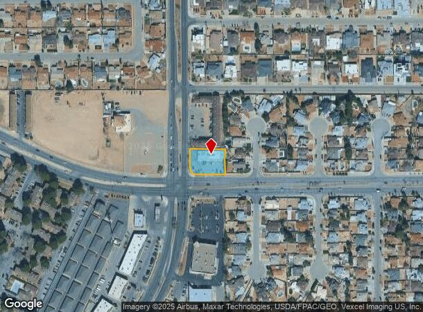
Property Record
3010 George Dieter Dr, El Paso, TX 79936
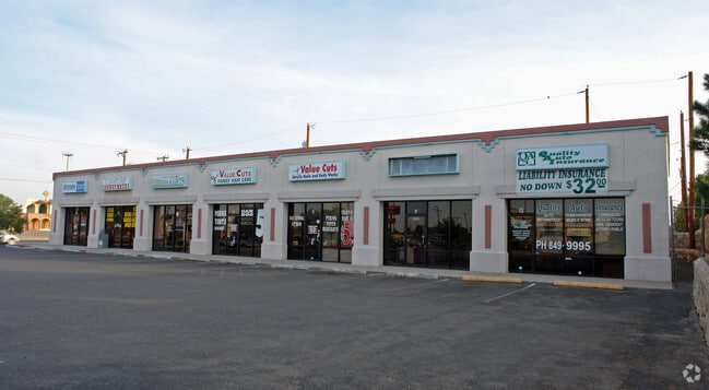
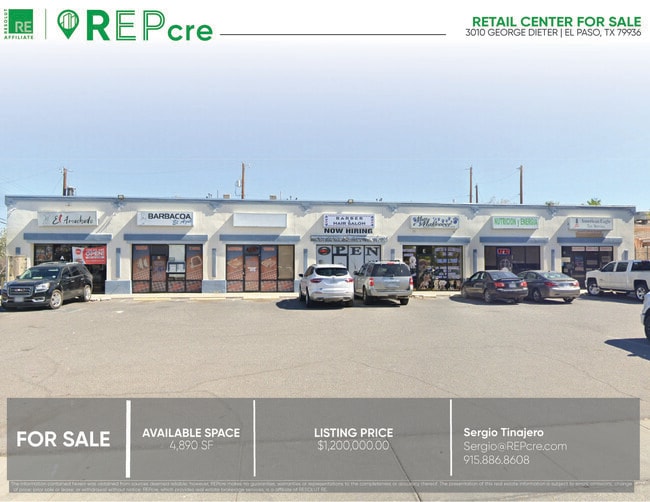
This Property Is For Sale
NEARBY LISTINGS FOR SALE OR LEASE
Property Detail
3010 George Dieter Dr
V893-999-5030-5620
Vista Del Sol
Commercialnec
503 VISTA DEL SOL #121 S PT OF 56 (172.33 ON N - 87.52 ON W - 141.26 ON S - 117.53 ON E) (20000.32 SQ FT)
X
El Paso
4802140043B
Texas
2024
0.46 AC
2025
East
010323
El Paso
4,829 SF
El Paso, TX
DEMOGRAPHICS near 3010 George Dieter Dr
1 Mile
3 Mile
5 Mile
2024 Total Population
21,536
131,095
259,793
2029 Population
21,679
131,841
261,574
Pop Growth 2024-2029
+ 0.66%
+ 0.57%
+ 0.69%
Average Age
39
38
36
2024 Total Households
7,593
45,724
88,493
HH Growth 2024-2029
+ 0.66%
+ 0.59%
+ 0.69%
Median Household Inc
$61,755
$57,717
$57,141
Avg Household Size
2.80
2.80
2.90
2024 Avg HH Vehicles
2.00
2.00
2.00
Median Home Value
$158,428
$157,065
$159,727
Median Year Built
1985
1987
1989
Nearby Places
Map Layers
Map Styles
 Street
 Aerial
- Restaurants
- Banks
- Shops
- Fitness
- Groceries
PUBLIC TRANSPORTATION
AIRPORT
El Paso International
DRIVE
WALK
Distance
El Paso International
16 min
6.7 mi
Freight Ports
Port of Corpus Christi
DRIVE
WALK
Distance
Port of Corpus Christi
673 min
686.9 mi
Nearby Properties
Address
Land Use
TOTAL SIZE
Lot Size
Zoning
Address
Land Use
TOTAL SIZE
Lot Size
Zoning
440,943 SF
41.37 AC
C4
Address
Land Use
TOTAL SIZE
Lot Size
Zoning
300,851 SF
31.50 AC
SP
Address
Land Use
TOTAL SIZE
Lot Size
Zoning
195,977 SF
9.77 AC
C4
Address
Land Use
TOTAL SIZE
Lot Size
Zoning
135,639 SF
211.63 AC
C4
Address
Land Use
TOTAL SIZE
Lot Size
Zoning
205,189 SF
22.92 AC
C4
Address
Land Use
TOTAL SIZE
Lot Size
Zoning
192,676 SF
20.58 AC
C4C
Address
Land Use
TOTAL SIZE
Lot Size
Zoning
214,837 SF
9.44 AC
AO
Address
Land Use
TOTAL SIZE
Lot Size
Zoning
235,670 SF
10 AC
A3C
Address
Land Use
TOTAL SIZE
Lot Size
Zoning
202,253 SF
10.70 AC
A2
Address
Land Use
TOTAL SIZE
Lot Size
Zoning
192,261 SF
8.07 AC
A3C
Address
Land Use
TOTAL SIZE
Lot Size
Zoning
106,261 SF
3 AC
R3
Address
Land Use
TOTAL SIZE
Lot Size
Zoning
193,556 SF
5.28 AC
C3
Address
Land Use
TOTAL SIZE
Lot Size
Zoning
154,016 SF
8.05 AC
A2
Address
Land Use
TOTAL SIZE
Lot Size
Zoning
140,126 SF
13.98 AC
C4
Address
Land Use
TOTAL SIZE
Lot Size
Zoning
174,863 SF
15.28 AC
C4
Address
Land Use
TOTAL SIZE
Lot Size
Zoning
259,968 SF
10.54 AC
AO
Address
Land Use
TOTAL SIZE
Lot Size
Zoning
173,471 SF
13.29 AC
C4
Address
Land Use
TOTAL SIZE
Lot Size
Zoning
170,528 SF
9.05 AC
C3S
Address
Land Use
TOTAL SIZE
Lot Size
Zoning
75,500 SF
5.31 AC
Address
Land Use
TOTAL SIZE
Lot Size
Zoning
186,950 SF
14.30 AC
C1
Address
Land Use
TOTAL SIZE
Lot Size
Zoning
144,211 SF
17.20 AC
C4
Address
Land Use
TOTAL SIZE
Lot Size
Zoning
189,234 SF
10.01 AC
AO
Address
Land Use
TOTAL SIZE
Lot Size
Zoning
119,175 SF
11.04 AC
C4S
Address
Land Use
TOTAL SIZE
Lot Size
Zoning
53,145 SF
3.75 AC
C4C
Address
Land Use
TOTAL SIZE
Lot Size
Zoning
163,540 SF
18.75 AC
C3
Address
Land Use
TOTAL SIZE
Lot Size
Zoning
45,364 SF
30 AC
R3
Address
Land Use
TOTAL SIZE
Lot Size
Zoning
107,215 SF
4.05 AC
GM
Address
Land Use
TOTAL SIZE
Lot Size
Zoning
226,736 SF
12 AC
A2
Address
Land Use
TOTAL SIZE
Lot Size
Zoning
64,090 SF
Address
Land Use
TOTAL SIZE
Lot Size
Zoning
195,920 SF
10 AC
A2
The World's #1 Commercial Real Estate Marketplace
Connect with us
© 2025 CoStar Group
The information above has been obtained from sources believed reliable. While we do not doubt its accuracy we have not verified it and make no guarantee, warranty or representation about it. It is your responsibility to independently confirm its accuracy and completeness. Any projections, opinions, assumptions, or estimates used are for example only and do not represent the current or future performance of the property. The value of this transaction to you depends on tax and other factors which should be evaluated by your tax, financial, and legal advisors. You and your advisors should conduct a careful, independent investigation of the property to determine to your satisfaction the suitability of the property for your needs.