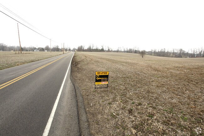
Property Record
3010 Gottbrath Pkwy, Jeffersonville, IN 47130
NEARBY LISTINGS FOR SALE OR LEASE
Property Detail
3010 Gottbrath Pkwy
Louisville-Jefferson County, KY-IN
BRIDGEPOINTE COMMONS SEC.3 LOT 304 2.04 AC
10-42-03-600-362.000-039
Clark
Commercialacreage
Indiana
AE
304
18019C0279E
4.01 AC
2024
Outlying Clark County
2024
Louisville
050706
DEMOGRAPHICS near 3010 Gottbrath Pkwy
1 Mile
3 Mile
5 Mile
2024 Total Population
3,526
31,341
91,628
2029 Population
3,957
35,064
101,390
Pop Growth 2024-2029
+ 12.22%
+ 11.88%
+ 10.65%
Average Age
40
40
41
2024 Total Households
1,398
12,858
37,358
HH Growth 2024-2029
+ 12.45%
+ 12.14%
+ 11.05%
Median Household Inc
$87,384
$70,813
$63,953
Avg Household Size
2.50
2.40
2.40
2024 Avg HH Vehicles
2.00
2.00
2.00
Median Home Value
$229,565
$187,069
$192,020
Median Year Built
2005
1995
1984
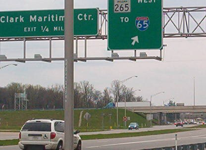
Nearby Places
Map Layers
Map Styles
 Street
 Aerial
- Restaurants
- Banks
- Shops
- Fitness
- Groceries
PUBLIC TRANSPORTATION
AIRPORT
Louisville Muhammad Ali International
DRIVE
WALK
Distance
Louisville Muhammad Ali International
26 min
15.4 mi
Freight Ports
Port of Toledo
DRIVE
WALK
Distance
Port of Toledo
348 min
302.0 mi
SALE & LEASE HISTORY
LISTING DATE
SALE/LEASE

Sep 25, 2016
For Lease
Sep 24, 2016
For Sale
Nearby Properties
Address
Land Use
TOTAL SIZE
Lot Size
Zoning
Address
Land Use
TOTAL SIZE
Lot Size
Zoning
1,102,160 SF
65.70 AC
Address
Land Use
TOTAL SIZE
Lot Size
Zoning
948,552 SF
70.58 AC
Address
Land Use
TOTAL SIZE
Lot Size
Zoning
13,240 SF
20.84 AC
Address
Land Use
TOTAL SIZE
Lot Size
Zoning
4,361 SF
18.18 AC
Address
Land Use
TOTAL SIZE
Lot Size
Zoning
620,000 SF
33.95 AC
Address
Land Use
TOTAL SIZE
Lot Size
Zoning
607,500 SF
34.89 AC
Address
Land Use
TOTAL SIZE
Lot Size
Zoning
52.78 AC
Address
Land Use
TOTAL SIZE
Lot Size
Zoning
4,402 SF
9.99 AC
Address
Land Use
TOTAL SIZE
Lot Size
Zoning
79,039 SF
26.39 AC
Address
Land Use
TOTAL SIZE
Lot Size
Zoning
507,456 SF
11.50 AC
Address
Land Use
TOTAL SIZE
Lot Size
Zoning
667,972 SF
37.48 AC
Address
Land Use
TOTAL SIZE
Lot Size
Zoning
500,000 SF
24.99 AC
Address
Land Use
TOTAL SIZE
Lot Size
Zoning
592,800 SF
33.72 AC
Address
Land Use
TOTAL SIZE
Lot Size
Zoning
470,244 SF
21.11 AC
Address
Land Use
TOTAL SIZE
Lot Size
Zoning
12.89 AC
Address
Land Use
TOTAL SIZE
Lot Size
Zoning
427,988 SF
21.89 AC
Address
Land Use
TOTAL SIZE
Lot Size
Zoning
4,178 SF
10.39 AC
Address
Land Use
TOTAL SIZE
Lot Size
Zoning
Address
Land Use
TOTAL SIZE
Lot Size
Zoning
448,950 SF
30.44 AC
Address
Land Use
TOTAL SIZE
Lot Size
Zoning
14,720 SF
13 AC
Address
Land Use
TOTAL SIZE
Lot Size
Zoning
8,752 SF
19.78 AC
Address
Land Use
TOTAL SIZE
Lot Size
Zoning
534,140 SF
33 AC
Address
Land Use
TOTAL SIZE
Lot Size
Zoning
499,500 SF
30.26 AC
Address
Land Use
TOTAL SIZE
Lot Size
Zoning
11,404 SF
19.68 AC
Address
Land Use
TOTAL SIZE
Lot Size
Zoning
Address
Land Use
TOTAL SIZE
Lot Size
Zoning
256,500 SF
12.87 AC
Address
Land Use
TOTAL SIZE
Lot Size
Zoning
357,419 SF
26.60 AC
Address
Land Use
TOTAL SIZE
Lot Size
Zoning
257,335 SF
18.71 AC
Address
Land Use
TOTAL SIZE
Lot Size
Zoning
128,269 SF
10.18 AC
Address
Land Use
TOTAL SIZE
Lot Size
Zoning
3,116 SF
16.22 AC
The World's #1 Commercial Real Estate Marketplace
Connect with us
© 2025 CoStar Group
The information above has been obtained from sources believed reliable. While we do not doubt its accuracy we have not verified it and make no guarantee, warranty or representation about it. It is your responsibility to independently confirm its accuracy and completeness. Any projections, opinions, assumptions, or estimates used are for example only and do not represent the current or future performance of the property. The value of this transaction to you depends on tax and other factors which should be evaluated by your tax, financial, and legal advisors. You and your advisors should conduct a careful, independent investigation of the property to determine to your satisfaction the suitability of the property for your needs.