Property Record
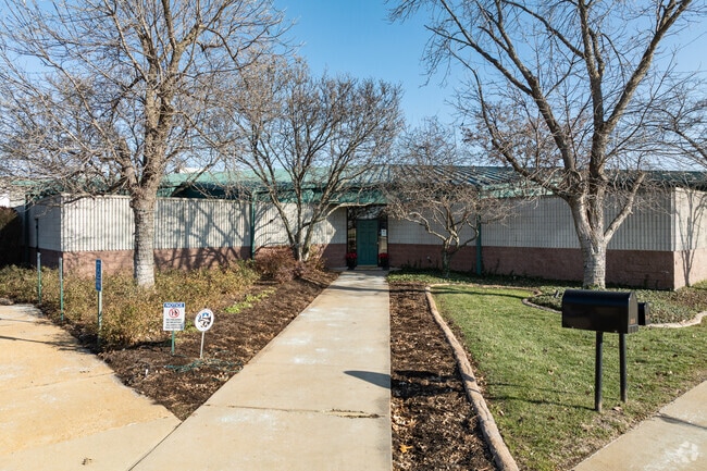
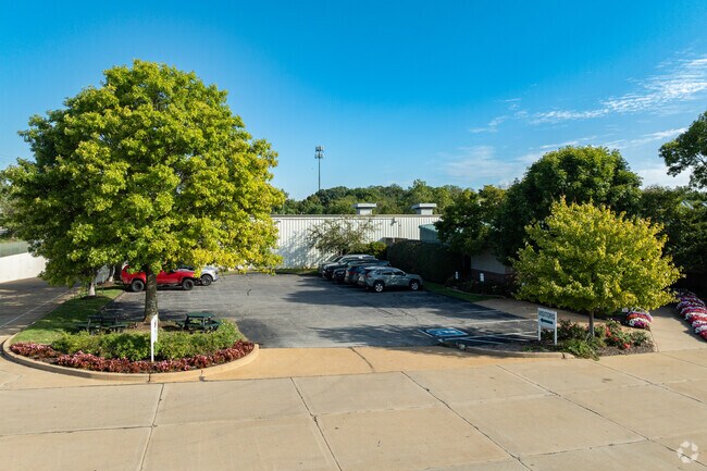
3010 High Ridge Blvd, High Ridge, MO 63049

NEARBY LISTINGS FOR SALE OR LEASE
Property Detail
3010 High Ridge Blvd
St. Louis, MO-IL
Brackmans
03-6.0-14.0-4-005-029
BRACKMANS; LOT 6 & PT LTS 5&7 MAXWELLS 10TH PT LOTS 1 2 & 3 (7/41)
Industrialgeneral
Jefferson
X
Missouri
29099C0083F
1-3,5
2024
2.74 AC
2025
Jefferson County
700306
St. Louis
75,099 SF
DEMOGRAPHICS near 3010 High Ridge Blvd
1 Mile
3 Mile
5 Mile
2024 Total Population
3,687
22,492
57,118
2029 Population
3,792
23,244
58,352
Pop Growth 2024-2029
+ 2.85%
+ 3.34%
+ 2.16%
Average Age
42
41
40
2024 Total Households
1,513
8,792
21,851
HH Growth 2024-2029
+ 2.91%
+ 3.41%
+ 2.30%
Median Household Inc
$75,774
$73,528
$76,745
Avg Household Size
2.40
2.50
2.60
2024 Avg HH Vehicles
2.00
2.00
2.00
Median Home Value
$183,160
$208,251
$224,720
Median Year Built
1976
1985
1985
Nearby Places
Map Layers
Map Styles
 Street
 Aerial
- Restaurants
- Banks
- Shops
- Fitness
- Groceries
PUBLIC TRANSPORTATION
AIRPORT
St Louis Lambert International
DRIVE
WALK
Distance
St Louis Lambert International
45 min
30.3 mi
Freight Ports
Tulsa Port of Inola
DRIVE
WALK
Distance
Tulsa Port of Inola
408 min
367.4 mi
Nearby Properties
Address
Land Use
TOTAL SIZE
Lot Size
Zoning
Address
Land Use
TOTAL SIZE
Lot Size
Zoning
28,790 SF
1,196.80 AC
NU
Address
Land Use
TOTAL SIZE
Lot Size
Zoning
155,242 SF
22.76 AC
R09
Address
Land Use
TOTAL SIZE
Lot Size
Zoning
108,535 SF
14.09 AC
PUD
Address
Land Use
TOTAL SIZE
Lot Size
Zoning
186,525 SF
20.80 AC
R20
Address
Land Use
TOTAL SIZE
Lot Size
Zoning
1,910 SF
5.19 AC
R40
Address
Land Use
TOTAL SIZE
Lot Size
Zoning
273,663 SF
18.81 AC
R09
Address
Land Use
TOTAL SIZE
Lot Size
Zoning
108,211 SF
15.18 AC
PI
Address
Land Use
TOTAL SIZE
Lot Size
Zoning
76,636 SF
8.41 AC
CC2
Address
Land Use
TOTAL SIZE
Lot Size
Zoning
57,518 SF
4.88 AC
R09
Address
Land Use
TOTAL SIZE
Lot Size
Zoning
14,328 SF
451.70 AC
PI
Address
Land Use
TOTAL SIZE
Lot Size
Zoning
22,768 SF
2.91 AC
Address
Land Use
TOTAL SIZE
Lot Size
Zoning
93,250 SF
2.63 AC
PUD
Address
Land Use
TOTAL SIZE
Lot Size
Zoning
15,064 SF
2.34 AC
CC2
Address
Land Use
TOTAL SIZE
Lot Size
Zoning
85,156 SF
9.27 AC
CC2
Address
Land Use
TOTAL SIZE
Lot Size
Zoning
39,276 SF
4.93 AC
CC2
Address
Land Use
TOTAL SIZE
Lot Size
Zoning
30,896 SF
6.01 AC
CC2
Address
Land Use
TOTAL SIZE
Lot Size
Zoning
51,166 SF
6.09 AC
CC2
Address
Land Use
TOTAL SIZE
Lot Size
Zoning
4,514 SF
1.76 AC
CC2
Address
Land Use
TOTAL SIZE
Lot Size
Zoning
6,488 SF
1.06 AC
PUD
Address
Land Use
TOTAL SIZE
Lot Size
Zoning
31,680 SF
1.45 AC
PI
Address
Land Use
TOTAL SIZE
Lot Size
Zoning
4,392 SF
1.71 AC
Address
Land Use
TOTAL SIZE
Lot Size
Zoning
3,426 SF
1.76 AC
Address
Land Use
TOTAL SIZE
Lot Size
Zoning
4,476 SF
1.37 AC
PUD
Address
Land Use
TOTAL SIZE
Lot Size
Zoning
54,575 SF
3.78 AC
CC2
Address
Land Use
TOTAL SIZE
Lot Size
Zoning
45,264 SF
7.21 AC
CC2
Address
Land Use
TOTAL SIZE
Lot Size
Zoning
4,310 SF
1.57 AC
CC2
Address
Land Use
TOTAL SIZE
Lot Size
Zoning
7,396 SF
1.69 AC
CC2
Address
Land Use
TOTAL SIZE
Lot Size
Zoning
36,296 SF
13.38 AC
CC2
Address
Land Use
TOTAL SIZE
Lot Size
Zoning
9,920 SF
1.37 AC
CC2
The World's #1 Commercial Real Estate Marketplace
Connect with us
© 2026 CoStar Group
The information above has been obtained from sources believed reliable. While we do not doubt its accuracy we have not verified it and make no guarantee, warranty or representation about it. It is your responsibility to independently confirm its accuracy and completeness. Any projections, opinions, assumptions, or estimates used are for example only and do not represent the current or future performance of the property. The value of this transaction to you depends on tax and other factors which should be evaluated by your tax, financial, and legal advisors. You and your advisors should conduct a careful, independent investigation of the property to determine to your satisfaction the suitability of the property for your needs.