Property Record
3010 Roeding Rd, Ceres, CA 95307


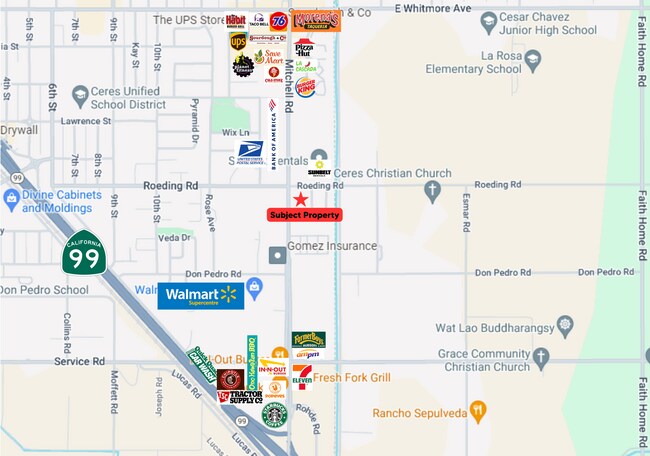

This Property Is For Sale
Property Detail
3010 Roeding Rd
Modesto, CA
STANISLAUS
069-28-04
California
Commercialacreage
32
B and X Area of moderate flood hazard, usually the area between the limits of the 100-year and 500-year floods.
2 AC
2025
Modesto
2025
Stockton/Modesto
002602
NEARBY LISTINGS FOR SALE OR LEASE
DEMOGRAPHICS near 3010 Roeding Rd
1 mile
3 mile
5 mile
2024 Total Population
12,269
63,212
147,910
2029 Population
12,344
63,602
148,496
Pop Growth 2024-2029
+ 0.61%
+ 0.62%
+ 0.40%
Average Age
35
35
36
2024 Total Households
3,557
17,582
43,115
HH Growth 2024-2029
+ 0.70%
+ 0.64%
+ 0.40%
Median Household Inc
$78,875
$80,568
$74,742
Avg Household Size
3.50
3.50
3.30
2024 Avg HH Vehicles
2.00
2.00
2.00
Median Home Value
$428,250
$440,329
$424,040
Median Year Built
1975
1983
1977
Nearby Places
Map Layers
Map Styles
 Street
 Aerial
Transit
 Traffic
 Biking
Places
Listings with unknown addresses are not visible on the map
- Restaurants
- Banks
- Shops
- Fitness
- Groceries
PUBLIC TRANSPORTATION
AIRPORT
Stockton Metro
Drive
Walk
Distance
Stockton Metro
40 min
30.3 mi
Freight Ports
Port of Stockton
Drive
Walk
Distance
Port of Stockton
49 min
38.8 mi
Nearby Properties
Address
Land Use
TOTAL SIZE
Lot Size
Zoning
Address
Land Use
TOTAL SIZE
Lot Size
Zoning
877,788 SF
103.22 AC
MI
Address
Land Use
TOTAL SIZE
Lot Size
Zoning
726,299 SF
38.86 AC
M2
Address
Land Use
TOTAL SIZE
Lot Size
Zoning
774,633 SF
39.18 AC
MODM2
Address
Land Use
TOTAL SIZE
Lot Size
Zoning
1,897,790 SF
92.04 AC
M2
Address
Land Use
TOTAL SIZE
Lot Size
Zoning
697,000 SF
37.82 AC
MODM2
Address
Land Use
TOTAL SIZE
Lot Size
Zoning
194,384 SF
17.34 AC
MODM2
Address
Land Use
TOTAL SIZE
Lot Size
Zoning
21,802 SF
10.96 AC
COUM
Address
Land Use
TOTAL SIZE
Lot Size
Zoning
775,280 SF
30.42 AC
COUM
Address
Land Use
TOTAL SIZE
Lot Size
Zoning
327,227 SF
13.52 AC
MODM1
Address
Land Use
TOTAL SIZE
Lot Size
Zoning
186,058 SF
14.35 AC
CERRC
Address
Land Use
TOTAL SIZE
Lot Size
Zoning
326,176 SF
14.92 AC
MODM2
Address
Land Use
TOTAL SIZE
Lot Size
Zoning
255,404 SF
17.49 AC
Address
Land Use
TOTAL SIZE
Lot Size
Zoning
165,196 SF
15.57 AC
Address
Land Use
TOTAL SIZE
Lot Size
Zoning
71,572 SF
5.35 AC
Address
Land Use
TOTAL SIZE
Lot Size
Zoning
362,384 SF
19.43 AC
Address
Land Use
TOTAL SIZE
Lot Size
Zoning
318,687 SF
36.39 AC
COUM
Address
Land Use
TOTAL SIZE
Lot Size
Zoning
61,640 SF
5.39 AC
Address
Land Use
TOTAL SIZE
Lot Size
Zoning
174,524 SF
11.61 AC
M
Address
Land Use
TOTAL SIZE
Lot Size
Zoning
392,796 SF
25.89 AC
COUM
Address
Land Use
TOTAL SIZE
Lot Size
Zoning
63,527 SF
5.18 AC
MI
Address
Land Use
TOTAL SIZE
Lot Size
Zoning
172,380 SF
11.92 AC
M2
Address
Land Use
TOTAL SIZE
Lot Size
Zoning
102,489 SF
10.27 AC
C2
Address
Land Use
TOTAL SIZE
Lot Size
Zoning
391,953 SF
22.92 AC
M2
Address
Land Use
TOTAL SIZE
Lot Size
Zoning
93,140 SF
13.08 AC
MI
Address
Land Use
TOTAL SIZE
Lot Size
Zoning
75,262 SF
2.31 AC
C1
Address
Land Use
TOTAL SIZE
Lot Size
Zoning
217,998 SF
15.02 AC
Address
Land Use
TOTAL SIZE
Lot Size
Zoning
325,000 SF
14.26 AC
Address
Land Use
TOTAL SIZE
Lot Size
Zoning
133,192 SF
9.11 AC
Address
Land Use
TOTAL SIZE
Lot Size
Zoning
57,395 SF
3.43 AC
CERIP
Address
Land Use
TOTAL SIZE
Lot Size
Zoning
88,283 SF
11.48 AC
The World's #1 Commercial Real Estate Marketplace
Connect with us
© 2026 CoStar Group
The information above has been obtained from sources believed reliable. While we do not doubt its accuracy we have not verified it and make no guarantee, warranty or representation about it. It is your responsibility to independently confirm its accuracy and completeness. Any projections, opinions, assumptions, or estimates used are for example only and do not represent the current or future performance of the property. The value of this transaction to you depends on tax and other factors which should be evaluated by your tax, financial, and legal advisors. You and your advisors should conduct a careful, independent investigation of the property to determine to your satisfaction the suitability of the property for your needs.