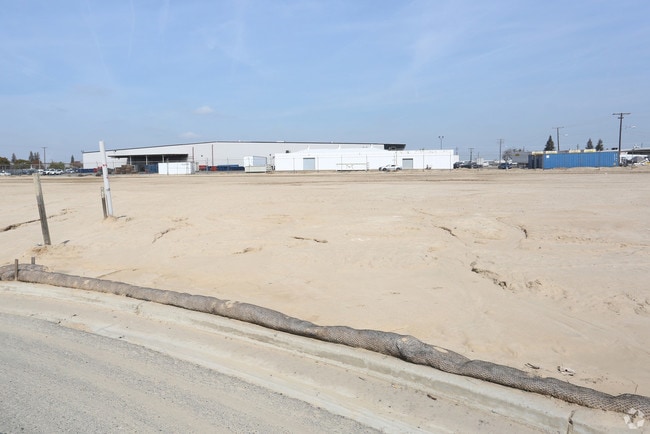
Property Record
30108 Road 76, Visalia, CA 93291

NEARBY LISTINGS FOR SALE OR LEASE
Property Detail
30108 Road 76
Visalia-Porterville, CA
Kelsey Tract
081-100-065-000
PARCEL 19 PARCEL MAP NO 4800 PM 49-5
Industrialgeneral
Tulare
X
California
06031C0250C
0.76 AC
2024
Northwest Visalia
2025
Visalia/Porterville
001008
DEMOGRAPHICS near 30108 Road 76
1 Mile
3 Mile
5 Mile
2024 Total Population
2,098
11,076
62,535
2029 Population
2,143
11,437
64,837
Pop Growth 2024-2029
+ 2.14%
+ 3.26%
+ 3.68%
Average Age
30
34
37
2024 Total Households
532
3,329
20,646
HH Growth 2024-2029
+ 2.07%
+ 3.36%
+ 3.72%
Median Household Inc
$59,647
$89,031
$83,152
Avg Household Size
3.90
3.30
2.90
2024 Avg HH Vehicles
3.00
2.00
2.00
Median Home Value
$237,305
$340,171
$334,631
Median Year Built
2001
2002
1994
Nearby Places
Map Layers
Map Styles
 Street
 Aerial
- Restaurants
- Banks
- Shops
- Fitness
- Groceries
SALE & LEASE HISTORY
LISTING DATE
SALE/LEASE

Oct 30, 2019
For Sale
Nearby Properties
Address
Land Use
TOTAL SIZE
Lot Size
Zoning
Address
Land Use
TOTAL SIZE
Lot Size
Zoning
1,080,308 SF
62.13 AC
Address
Land Use
TOTAL SIZE
Lot Size
Zoning
795,140 SF
64.73 AC
IH
Address
Land Use
TOTAL SIZE
Lot Size
Zoning
300,560 SF
38.07 AC
IL
Address
Land Use
TOTAL SIZE
Lot Size
Zoning
610,344 SF
83.28 AC
IH
Address
Land Use
TOTAL SIZE
Lot Size
Zoning
353,600 SF
18.49 AC
Address
Land Use
TOTAL SIZE
Lot Size
Zoning
500,388 SF
31.90 AC
IH
Address
Land Use
TOTAL SIZE
Lot Size
Zoning
326,700 SF
55.21 AC
IH
Address
Land Use
TOTAL SIZE
Lot Size
Zoning
384,146 SF
18.37 AC
IH
Address
Land Use
TOTAL SIZE
Lot Size
Zoning
Address
Land Use
TOTAL SIZE
Lot Size
Zoning
156 AC
Address
Land Use
TOTAL SIZE
Lot Size
Zoning
176,582 SF
17.09 AC
M-1
Address
Land Use
TOTAL SIZE
Lot Size
Zoning
19.34 AC
QP
Address
Land Use
TOTAL SIZE
Lot Size
Zoning
549,395 SF
29.81 AC
IL
Address
Land Use
TOTAL SIZE
Lot Size
Zoning
10.13 AC
Address
Land Use
TOTAL SIZE
Lot Size
Zoning
227,486 SF
9.42 AC
Address
Land Use
TOTAL SIZE
Lot Size
Zoning
Address
Land Use
TOTAL SIZE
Lot Size
Zoning
32,048 SF
2.81 AC
CSO
Address
Land Use
TOTAL SIZE
Lot Size
Zoning
216,438 SF
14.23 AC
IH
Address
Land Use
TOTAL SIZE
Lot Size
Zoning
252,364 SF
13.68 AC
IH
Address
Land Use
TOTAL SIZE
Lot Size
Zoning
236,442 SF
11.29 AC
IH
Address
Land Use
TOTAL SIZE
Lot Size
Zoning
73,500 SF
3.60 AC
IH
Address
Land Use
TOTAL SIZE
Lot Size
Zoning
59,808 SF
34.14 AC
IH
Address
Land Use
TOTAL SIZE
Lot Size
Zoning
105,630 SF
11.50 AC
IH
Address
Land Use
TOTAL SIZE
Lot Size
Zoning
38,400 SF
13.70 AC
IH
Address
Land Use
TOTAL SIZE
Lot Size
Zoning
227,136 SF
12.18 AC
IH
Address
Land Use
TOTAL SIZE
Lot Size
Zoning
50,318 SF
1.94 AC
Address
Land Use
TOTAL SIZE
Lot Size
Zoning
160,000 SF
9.70 AC
IH
Address
Land Use
TOTAL SIZE
Lot Size
Zoning
262,720 SF
12.81 AC
X
The World's #1 Commercial Real Estate Marketplace
Connect with us
© 2025 CoStar Group
The information above has been obtained from sources believed reliable. While we do not doubt its accuracy we have not verified it and make no guarantee, warranty or representation about it. It is your responsibility to independently confirm its accuracy and completeness. Any projections, opinions, assumptions, or estimates used are for example only and do not represent the current or future performance of the property. The value of this transaction to you depends on tax and other factors which should be evaluated by your tax, financial, and legal advisors. You and your advisors should conduct a careful, independent investigation of the property to determine to your satisfaction the suitability of the property for your needs.