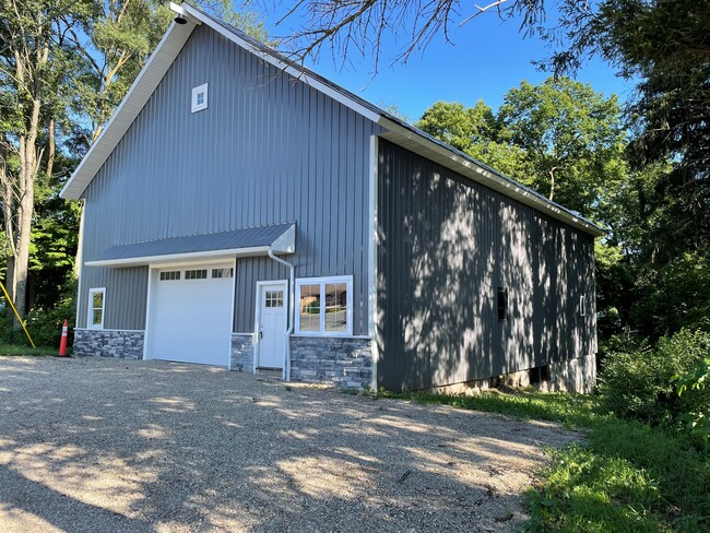
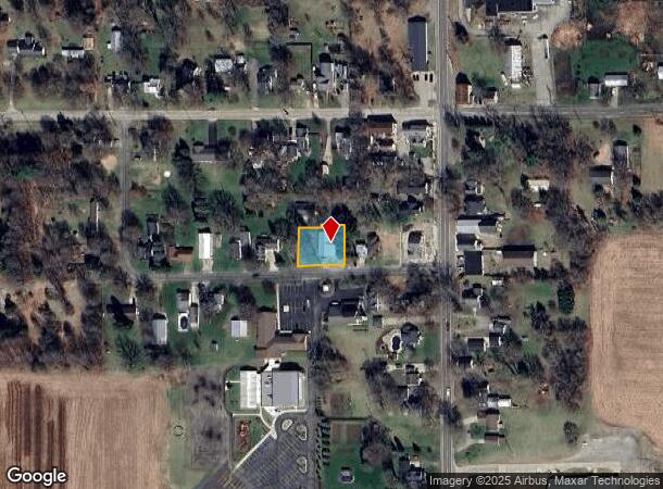
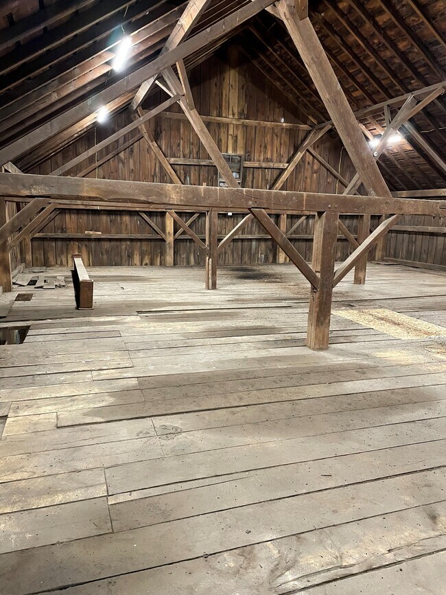
Property Record
3011 Newell St, Burnips, MI 49314
Current Lease Availabilities
NEARBY LISTINGS FOR SALE OR LEASE
-
-
View all Burnips listings for lease on LoopNet.com
Property Detail
3011 Newell St
West Michigan
Village Of Burnips
Holland, MI
Allegan
19-700-005-10
Michigan
Sfr
0.29 AC
X
Outlying Allegan County
26005C0250G
DEMOGRAPHICS near 3011 Newell St
1 Mile
3 Mile
5 Mile
2024 Total Population
478
3,498
10,520
2029 Population
474
3,475
10,704
Pop Growth 2024-2029
(0.84%)
(0.66%)
+ 1.75%
Average Age
38
38
38
2024 Total Households
159
1,178
3,528
HH Growth 2024-2029
(1.26%)
(0.76%)
+ 1.73%
Median Household Inc
$76,923
$79,813
$81,736
Avg Household Size
3.00
2.90
2.90
2024 Avg HH Vehicles
2.00
2.00
2.00
Median Home Value
$288,888
$270,813
$262,061
Median Year Built
1978
1981
1985
Nearby Places
- Restaurants
- Banks
- Shops
- Fitness
- Groceries
PUBLIC TRANSPORTATION
AIRPORT
Gerald R Ford International
DRIVE
WALK
Distance
Gerald R Ford International
40 min
26.4 mi
Freight Ports
Port Milwaukee
DRIVE
WALK
Distance
Port Milwaukee
296 min
248.4 mi
Nearby Properties
Address
Land Use
TOTAL SIZE
Lot Size
Zoning
Address
Land Use
TOTAL SIZE
Lot Size
Zoning
49,960 SF
28.88 AC
Address
Land Use
TOTAL SIZE
Lot Size
Zoning
2,396 SF
221.24 AC
R-1 AG RUR
Address
Land Use
TOTAL SIZE
Lot Size
Zoning
112.91 AC
Address
Land Use
TOTAL SIZE
Lot Size
Zoning
1,910 SF
160 AC
A-1 AG CON
Address
Land Use
TOTAL SIZE
Lot Size
Zoning
101.22 AC
SEE MAP
Address
Land Use
TOTAL SIZE
Lot Size
Zoning
2,044 SF
48.30 AC
A-2C AG CO
Address
Land Use
TOTAL SIZE
Lot Size
Zoning
85.99 AC
SEE MAP
Address
Land Use
TOTAL SIZE
Lot Size
Zoning
174.95 AC
Address
Land Use
TOTAL SIZE
Lot Size
Zoning
2,003 SF
117.99 AC
R-1 AG RUR
Address
Land Use
TOTAL SIZE
Lot Size
Zoning
1,886 SF
80 AC
A-1 AG CON
Address
Land Use
TOTAL SIZE
Lot Size
Zoning
1,375 SF
97.89 AC
A-2C AG CO
Address
Land Use
TOTAL SIZE
Lot Size
Zoning
1,445 SF
118.12 AC
A-1 AG CON
Address
Land Use
TOTAL SIZE
Lot Size
Zoning
92.71 AC
Address
Land Use
TOTAL SIZE
Lot Size
Zoning
1,728 SF
78.74 AC
A-1 AG CON
Address
Land Use
TOTAL SIZE
Lot Size
Zoning
113.46 AC
Address
Land Use
TOTAL SIZE
Lot Size
Zoning
1,664 SF
90.36 AC
RAP
Address
Land Use
TOTAL SIZE
Lot Size
Zoning
1,414 SF
80 AC
A-1 AG CON
Address
Land Use
TOTAL SIZE
Lot Size
Zoning
3,340 SF
44.25 AC
A-1 AG CON
Address
Land Use
TOTAL SIZE
Lot Size
Zoning
58.87 AC
SEE MAP
Address
Land Use
TOTAL SIZE
Lot Size
Zoning
1,743 SF
49.48 AC
SEE MAP
Address
Land Use
TOTAL SIZE
Lot Size
Zoning
Address
Land Use
TOTAL SIZE
Lot Size
Zoning
103.45 AC
Address
Land Use
TOTAL SIZE
Lot Size
Zoning
1,320 SF
71.36 AC
SPLIT ZONI
Address
Land Use
TOTAL SIZE
Lot Size
Zoning
1,336 SF
93.58 AC
R-1 AG RUR
Address
Land Use
TOTAL SIZE
Lot Size
Zoning
1,760 SF
146 AC
Address
Land Use
TOTAL SIZE
Lot Size
Zoning
99.91 AC
Address
Land Use
TOTAL SIZE
Lot Size
Zoning
2,134 SF
78.85 AC
A-1 AG CON
Address
Land Use
TOTAL SIZE
Lot Size
Zoning
2,306 SF
99 AC
A-1 AG CON
Address
Land Use
TOTAL SIZE
Lot Size
Zoning
117 AC
Address
Land Use
TOTAL SIZE
Lot Size
Zoning
2,214 SF
29.58 AC
A-1 AG CON
The World's #1 Commercial Real Estate Marketplace
Connect with us
© 2025 CoStar Group
The information above has been obtained from sources believed reliable. While we do not doubt its accuracy we have not verified it and make no guarantee, warranty or representation about it. It is your responsibility to independently confirm its accuracy and completeness. Any projections, opinions, assumptions, or estimates used are for example only and do not represent the current or future performance of the property. The value of this transaction to you depends on tax and other factors which should be evaluated by your tax, financial, and legal advisors. You and your advisors should conduct a careful, independent investigation of the property to determine to your satisfaction the suitability of the property for your needs.