Property Record
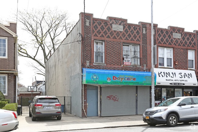
3012 Avenue M, Brooklyn, NY 11210


NEARBY LISTINGS FOR SALE OR LEASE
Property Detail
3012 Avenue M
07666-0046
DOCID-2018053000897001
Religious
Kings
X
New York
3604970352F
46
0
0.05 AC
2025
South Brooklyn
074600
Long Island (New York)
3,805 SF
New York-Jersey City-White Plains, NY-NJ
DEMOGRAPHICS near 3012 Avenue M
1 Mile
3 Mile
5 Mile
2024 Total Population
116,879
952,543
1,954,902
2029 Population
110,184
885,467
1,821,811
Pop Growth 2024-2029
(5.73%)
(7.04%)
(6.81%)
Average Age
40
40
40
2024 Total Households
40,021
327,173
708,550
HH Growth 2024-2029
(5.99%)
(7.40%)
(7.13%)
Median Household Inc
$73,724
$66,519
$66,066
Avg Household Size
2.80
2.80
2.60
2024 Avg HH Vehicles
1.00
1.00
1.00
Median Home Value
$754,186
$766,143
$809,717
Median Year Built
1947
1948
1948
Nearby Places
Map Layers
Map Styles
 Street
 Aerial
- Restaurants
- Banks
- Shops
- Fitness
- Groceries
PUBLIC TRANSPORTATION
TRANSIT/SUBWAY
Avenue M (Q - New York MTA Subway (The Subway))
DRIVE
WALK
Distance
Avenue M (Q - New York MTA Subway (The Subway))
3 min
15 min
0.8 mi
Brooklyn College-Flatbush Avenue (2 - New York MTA Subway (The Subway), 5 - New York MTA Subway (The Subway))
DRIVE
WALK
Distance
Brooklyn College-Flatbush Avenue (2 - New York MTA Subway (The Subway), 5 - New York MTA Subway (The Subway))
2 min
18 min
0.9 mi
COMMUTER RAIL
Nostrand Avenue Station (Far Rockaway Branch - Long Island Rail Road, Hempstead Branch - Long Island Rail Road, Long Beach Branch - Long Island Rail Road, West Hempstead Branch - Long Island Rail Road)
DRIVE
WALK
Distance
Nostrand Avenue Station (Far Rockaway Branch - Long Island Rail Road, Hempstead Branch - Long Island Rail Road, Long Beach Branch - Long Island Rail Road, West Hempstead Branch - Long Island Rail Road)
15 min
4.5 mi
DRIVE
WALK
Distance
14 min
5.1 mi
AIRPORT
John F Kennedy International
DRIVE
WALK
Distance
John F Kennedy International
21 min
12.3 mi
LaGuardia
DRIVE
WALK
Distance
LaGuardia
30 min
13.7 mi
Newark Liberty International
DRIVE
WALK
Distance
Newark Liberty International
38 min
22.1 mi
Freight Ports
NY - Red Hook Container Terminal
DRIVE
WALK
Distance
NY - Red Hook Container Terminal
14 min
7.5 mi
SALE & LEASE HISTORY
LISTING DATE
SALE/LEASE

Apr 26, 2018
For Sale
Nearby Properties
Address
Land Use
TOTAL SIZE
Lot Size
Zoning
Address
Land Use
TOTAL SIZE
Lot Size
Zoning
1,281,577 SF
20.78 AC
M3-1
Address
Land Use
TOTAL SIZE
Lot Size
Zoning
1,503,150 SF
20.47 AC
R5
Address
Land Use
TOTAL SIZE
Lot Size
Zoning
1,078,317 SF
10.45 AC
R4
Address
Land Use
TOTAL SIZE
Lot Size
Zoning
530.51 AC
R4-1
Address
Land Use
TOTAL SIZE
Lot Size
Zoning
12.39 AC
R6
Address
Land Use
TOTAL SIZE
Lot Size
Zoning
10,250 SF
773.50 AC
PARK
Address
Land Use
TOTAL SIZE
Lot Size
Zoning
965,600 SF
6.65 AC
R5
Address
Land Use
TOTAL SIZE
Lot Size
Zoning
1,061,228 SF
8.86 AC
R5
Address
Land Use
TOTAL SIZE
Lot Size
Zoning
1,073,920 SF
16.53 AC
R6
Address
Land Use
TOTAL SIZE
Lot Size
Zoning
561,945 SF
11.58 AC
R6
Address
Land Use
TOTAL SIZE
Lot Size
Zoning
61.60 AC
PARK
Address
Land Use
TOTAL SIZE
Lot Size
Zoning
785,450 SF
14.22 AC
R6
Address
Land Use
TOTAL SIZE
Lot Size
Zoning
353,600 SF
55.79 AC
R3-1
Address
Land Use
TOTAL SIZE
Lot Size
Zoning
1,800,000 SF
12.39 AC
R6
Address
Land Use
TOTAL SIZE
Lot Size
Zoning
6,000 SF
110.42 AC
PARK
Address
Land Use
TOTAL SIZE
Lot Size
Zoning
511,776 SF
2.33 AC
R6
Address
Land Use
TOTAL SIZE
Lot Size
Zoning
393,092 SF
1.07 AC
R8A
Address
Land Use
TOTAL SIZE
Lot Size
Zoning
229,456 SF
4.15 AC
M1-1
Address
Land Use
TOTAL SIZE
Lot Size
Zoning
1,259,938 SF
14.30 AC
R6
Address
Land Use
TOTAL SIZE
Lot Size
Zoning
635,994 SF
17.90 AC
R5
Address
Land Use
TOTAL SIZE
Lot Size
Zoning
241,735 SF
1.99 AC
C8-4
Address
Land Use
TOTAL SIZE
Lot Size
Zoning
308,757 SF
0.74 AC
R7-1
Address
Land Use
TOTAL SIZE
Lot Size
Zoning
689,000 SF
3.44 AC
R6
Address
Land Use
TOTAL SIZE
Lot Size
Zoning
689,000 SF
3.44 AC
R6
Address
Land Use
TOTAL SIZE
Lot Size
Zoning
689,000 SF
3.44 AC
R6
Address
Land Use
TOTAL SIZE
Lot Size
Zoning
689,000 SF
3.44 AC
R6
Address
Land Use
TOTAL SIZE
Lot Size
Zoning
689,000 SF
3.44 AC
R6
Address
Land Use
TOTAL SIZE
Lot Size
Zoning
689,000 SF
3.44 AC
R6
Address
Land Use
TOTAL SIZE
Lot Size
Zoning
689,000 SF
3.44 AC
R6
Address
Land Use
TOTAL SIZE
Lot Size
Zoning
689,000 SF
3.44 AC
R6
The World's #1 Commercial Real Estate Marketplace
Connect with us
© 2026 CoStar Group
The information above has been obtained from sources believed reliable. While we do not doubt its accuracy we have not verified it and make no guarantee, warranty or representation about it. It is your responsibility to independently confirm its accuracy and completeness. Any projections, opinions, assumptions, or estimates used are for example only and do not represent the current or future performance of the property. The value of this transaction to you depends on tax and other factors which should be evaluated by your tax, financial, and legal advisors. You and your advisors should conduct a careful, independent investigation of the property to determine to your satisfaction the suitability of the property for your needs.