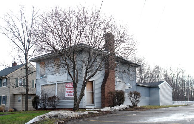
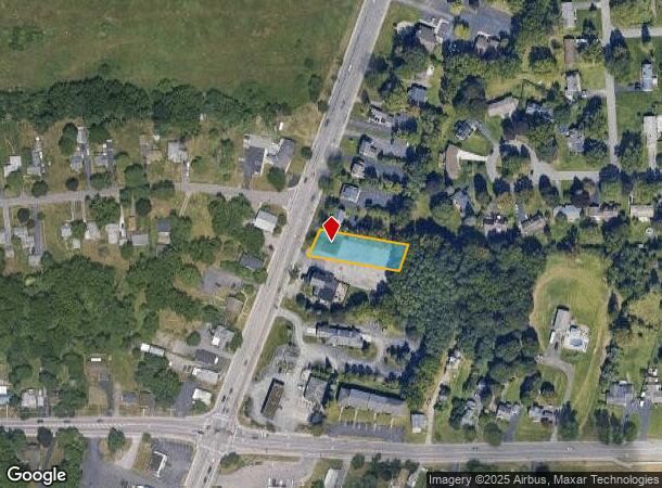
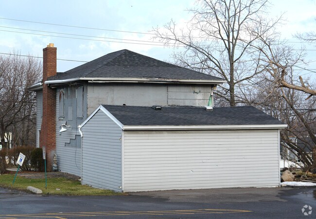
Property Record
3012 E Henrietta Rd, Henrietta, NY 14467
NEARBY LISTINGS FOR SALE OR LEASE
Property Detail
3012 E Henrietta Rd
Rochester, NY
T LOT 15 2ND R 1848 1860
263200-176-100-0001-074-000
Monroe
Commercialacreage
New York
X
74.000
36055C0361G
0.41 AC
2025
South Central
2024
Rochester
013203
DEMOGRAPHICS near 3012 E Henrietta Rd
1 Mile
3 Mile
5 Mile
2024 Total Population
7,505
33,990
90,696
2029 Population
7,571
33,613
89,717
Pop Growth 2024-2029
+ 0.88%
(1.11%)
(1.08%)
Average Age
42
41
40
2024 Total Households
3,226
13,926
35,324
HH Growth 2024-2029
+ 0.87%
(1.18%)
(1.18%)
Median Household Inc
$59,130
$69,544
$72,245
Avg Household Size
2.30
2.30
2.30
2024 Avg HH Vehicles
2.00
2.00
2.00
Median Home Value
$153,618
$171,428
$202,222
Median Year Built
1967
1969
1970
Nearby Places
- Restaurants
- Banks
- Shops
- Fitness
- Groceries
PUBLIC TRANSPORTATION
COMMUTER RAIL
DRIVE
WALK
Distance
18 min
7.6 mi
AIRPORT
Frederick Douglass/Greater Rochester International
DRIVE
WALK
Distance
Frederick Douglass/Greater Rochester International
13 min
6.9 mi
Nearby Properties
Address
Land Use
TOTAL SIZE
Lot Size
Zoning
Address
Land Use
TOTAL SIZE
Lot Size
Zoning
57,638 SF
227.96 AC
02 - SINGL
Address
Land Use
TOTAL SIZE
Lot Size
Zoning
446,748 SF
14.10 AC
06 - INDUS
Address
Land Use
TOTAL SIZE
Lot Size
Zoning
323,859 SF
19.12 AC
05 - COMME
Address
Land Use
TOTAL SIZE
Lot Size
Zoning
400,000 SF
43.50 AC
06 - INDUS
Address
Land Use
TOTAL SIZE
Lot Size
Zoning
37,632 SF
29.06 AC
06 - INDUS
Address
Land Use
TOTAL SIZE
Lot Size
Zoning
364,000 SF
66.25 AC
06 - INDUS
Address
Land Use
TOTAL SIZE
Lot Size
Zoning
94,000 SF
15.49 AC
02 - SINGL
Address
Land Use
TOTAL SIZE
Lot Size
Zoning
36,972 SF
2.79 AC
02 - SINGL
Address
Land Use
TOTAL SIZE
Lot Size
Zoning
65.37 AC
02 - SINGL
Address
Land Use
TOTAL SIZE
Lot Size
Zoning
3,960 SF
98.15 AC
02 - SINGL
Address
Land Use
TOTAL SIZE
Lot Size
Zoning
14,760 SF
64 AC
06 - INDUS
Address
Land Use
TOTAL SIZE
Lot Size
Zoning
160,692 SF
12.05 AC
06 - INDUS
Address
Land Use
TOTAL SIZE
Lot Size
Zoning
237,866 SF
34.97 AC
05 - COMME
Address
Land Use
TOTAL SIZE
Lot Size
Zoning
6,751 SF
18.52 AC
02 - SINGL
Address
Land Use
TOTAL SIZE
Lot Size
Zoning
600 SF
446.14 AC
07 - MIXED
Address
Land Use
TOTAL SIZE
Lot Size
Zoning
510,332 SF
48 AC
05 - COMME
Address
Land Use
TOTAL SIZE
Lot Size
Zoning
270,000 SF
54.90 AC
02 - SINGL
Address
Land Use
TOTAL SIZE
Lot Size
Zoning
181,876 SF
11.64 AC
07 - MIXED
Address
Land Use
TOTAL SIZE
Lot Size
Zoning
53,750 SF
16.61 AC
06 - INDUS
Address
Land Use
TOTAL SIZE
Lot Size
Zoning
183,054 SF
7.61 AC
06 - INDUS
Address
Land Use
TOTAL SIZE
Lot Size
Zoning
105,755 SF
8.43 AC
05 - COMME
Address
Land Use
TOTAL SIZE
Lot Size
Zoning
206,667 SF
36.77 AC
06 - INDUS
Address
Land Use
TOTAL SIZE
Lot Size
Zoning
170,256 SF
14.82 AC
06 - INDUS
Address
Land Use
TOTAL SIZE
Lot Size
Zoning
399,550 SF
61.76 AC
05 - COMME
Address
Land Use
TOTAL SIZE
Lot Size
Zoning
42,881 SF
17.46 AC
02 - SINGL
Address
Land Use
TOTAL SIZE
Lot Size
Zoning
140,533 SF
63.50 AC
02 - SINGL
Address
Land Use
TOTAL SIZE
Lot Size
Zoning
42,948 SF
16.24 AC
02 - SINGL
Address
Land Use
TOTAL SIZE
Lot Size
Zoning
51,248 SF
28.32 AC
06 - INDUS
Address
Land Use
TOTAL SIZE
Lot Size
Zoning
9,820 SF
48.50 AC
02 - SINGL
Address
Land Use
TOTAL SIZE
Lot Size
Zoning
170,387 SF
11.80 AC
02 - SINGL
The World's #1 Commercial Real Estate Marketplace
Connect with us
© 2025 CoStar Group
The information above has been obtained from sources believed reliable. While we do not doubt its accuracy we have not verified it and make no guarantee, warranty or representation about it. It is your responsibility to independently confirm its accuracy and completeness. Any projections, opinions, assumptions, or estimates used are for example only and do not represent the current or future performance of the property. The value of this transaction to you depends on tax and other factors which should be evaluated by your tax, financial, and legal advisors. You and your advisors should conduct a careful, independent investigation of the property to determine to your satisfaction the suitability of the property for your needs.