Property Record
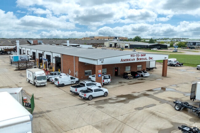
3012 E Interstate 30, Rockwall, TX 75087

Property Detail
3012 E Interstate 30
Dallas-Fort Worth-Arlington, TX
Brown Industrial Park
31001
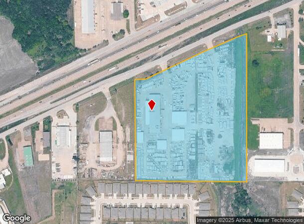
BROWN INDUSTRIAL PARK, BLOCK A, LOT 10, ACRES 13.7980
Commercialnec
Rockwall
AE
Texas
48113C0275K
10
2024
13.80 AC
2025
Rockwall
040408
Dallas/Ft Worth
23,750 SF
NEARBY LISTINGS FOR SALE OR LEASE
DEMOGRAPHICS near 3012 E Interstate 30
1 mile
3 mile
5 mile
2024 Total Population
3,621
33,511
86,758
2029 Population
5,061
46,042
118,810
Pop Growth 2024-2029
+ 39.77%
+ 37.39%
+ 36.94%
Average Age
34
35
37
2024 Total Households
1,111
10,851
28,766
HH Growth 2024-2029
+ 40.05%
+ 37.74%
+ 37.22%
Median Household Inc
$109,939
$109,946
$110,118
Avg Household Size
3.20
3.00
2.90
2024 Avg HH Vehicles
2.00
2.00
2.00
Median Home Value
$255,273
$278,638
$291,174
Median Year Built
2011
2010
2007
Nearby Places
Map Layers
Map Styles
 Street
 Aerial
Transit
 Traffic
 Biking
Places
Listings with unknown addresses are not visible on the map
- Restaurants
- Banks
- Shops
- Fitness
- Groceries
PUBLIC TRANSPORTATION
AIRPORT
Dallas Love Field
Drive
Walk
Distance
Dallas Love Field
48 min
32.9 mi
Nearby Properties
Address
Land Use
TOTAL SIZE
Lot Size
Zoning
Address
Land Use
TOTAL SIZE
Lot Size
Zoning
193,393 SF
80 AC
Address
Land Use
TOTAL SIZE
Lot Size
Zoning
408,932 SF
12.93 AC
Address
Land Use
TOTAL SIZE
Lot Size
Zoning
44,191 SF
32.66 AC
Address
Land Use
TOTAL SIZE
Lot Size
Zoning
326,842 SF
21.28 AC
Address
Land Use
TOTAL SIZE
Lot Size
Zoning
378,763 SF
12.92 AC
Address
Land Use
TOTAL SIZE
Lot Size
Zoning
311,294 SF
21.28 AC
Address
Land Use
TOTAL SIZE
Lot Size
Zoning
656,340 SF
34.23 AC
Address
Land Use
TOTAL SIZE
Lot Size
Zoning
250,627 SF
18.17 AC
Address
Land Use
TOTAL SIZE
Lot Size
Zoning
153,541 SF
27.44 AC
Address
Land Use
TOTAL SIZE
Lot Size
Zoning
391,599 SF
30.04 AC
Address
Land Use
TOTAL SIZE
Lot Size
Zoning
353,525 SF
42.99 AC
Address
Land Use
TOTAL SIZE
Lot Size
Zoning
288,266 SF
38.93 AC
Address
Land Use
TOTAL SIZE
Lot Size
Zoning
253,274 SF
18.76 AC
Address
Land Use
TOTAL SIZE
Lot Size
Zoning
83,268 SF
8.67 AC
Address
Land Use
TOTAL SIZE
Lot Size
Zoning
190,558 SF
49.75 AC
Address
Land Use
TOTAL SIZE
Lot Size
Zoning
227,610 SF
11.15 AC
Address
Land Use
TOTAL SIZE
Lot Size
Zoning
91,612 SF
14.20 AC
Address
Land Use
TOTAL SIZE
Lot Size
Zoning
211,211 SF
10.19 AC
L1
Address
Land Use
TOTAL SIZE
Lot Size
Zoning
91,039 SF
13.35 AC
Address
Land Use
TOTAL SIZE
Lot Size
Zoning
83,710 SF
6.38 AC
Address
Land Use
TOTAL SIZE
Lot Size
Zoning
93,932 SF
10 AC
Address
Land Use
TOTAL SIZE
Lot Size
Zoning
81,492 SF
11.34 AC
Address
Land Use
TOTAL SIZE
Lot Size
Zoning
74,900 SF
15.43 AC
Address
Land Use
TOTAL SIZE
Lot Size
Zoning
79,228 SF
14.75 AC
Address
Land Use
TOTAL SIZE
Lot Size
Zoning
66,333 SF
7.46 AC
Address
Land Use
TOTAL SIZE
Lot Size
Zoning
153,805 SF
13 AC
Address
Land Use
TOTAL SIZE
Lot Size
Zoning
52,582 SF
15.16 AC
Address
Land Use
TOTAL SIZE
Lot Size
Zoning
75,600 SF
5.13 AC
Address
Land Use
TOTAL SIZE
Lot Size
Zoning
49,920 SF
5.13 AC
The World's #1 Commercial Real Estate Marketplace
Connect with us
© 2026 CoStar Group
The information above has been obtained from sources believed reliable. While we do not doubt its accuracy we have not verified it and make no guarantee, warranty or representation about it. It is your responsibility to independently confirm its accuracy and completeness. Any projections, opinions, assumptions, or estimates used are for example only and do not represent the current or future performance of the property. The value of this transaction to you depends on tax and other factors which should be evaluated by your tax, financial, and legal advisors. You and your advisors should conduct a careful, independent investigation of the property to determine to your satisfaction the suitability of the property for your needs.