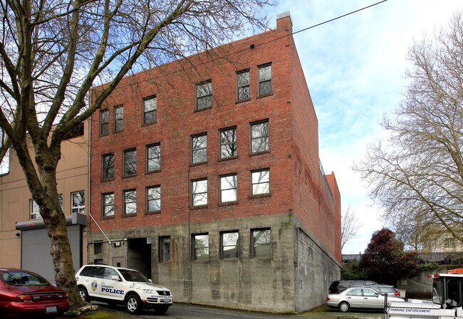
Property Record
3015 Colby Ave, Everett, WA 98201


NEARBY LISTINGS FOR SALE OR LEASE
Property Detail
3015 Colby Ave
Seattle-Tacoma-Bellevue, WA
Everett Plat Of
004391-717-008-00
EVERETT PLAT OF BLK 717 D-00 - LOTS 8 & 9
Commercialnec
Snohomish
X
Washington
53061C1030G
8,9
0
0.13 AC
2025
Everett CBD
040700
Seattle/Puget Sound
20,723 SF
DEMOGRAPHICS near 3015 Colby Ave
1 Mile
3 Mile
5 Mile
2024 Total Population
16,178
55,748
121,919
2029 Population
16,862
58,314
127,454
Pop Growth 2024-2029
+ 4.23%
+ 4.60%
+ 4.54%
Average Age
41
40
39
2024 Total Households
7,749
23,404
47,911
HH Growth 2024-2029
+ 4.56%
+ 4.72%
+ 4.65%
Median Household Inc
$62,728
$78,915
$82,233
Avg Household Size
1.90
2.20
2.40
2024 Avg HH Vehicles
1.00
2.00
2.00
Median Home Value
$472,533
$491,273
$515,972
Median Year Built
1965
1965
1980
Nearby Places
Map Layers
Map Styles
 Street
 Aerial
- Restaurants
- Banks
- Shops
- Fitness
- Groceries
PUBLIC TRANSPORTATION
COMMUTER RAIL
Everett Station (Sounder South Line - Central Puget Sound Regional Transit Authority Rail (Link Light Rail/Sounder))
DRIVE
WALK
Distance
Everett Station (Sounder South Line - Central Puget Sound Regional Transit Authority Rail (Link Light Rail/Sounder))
3 min
12 min
0.6 mi
AIRPORT
Seattle Paine Field International
DRIVE
WALK
Distance
Seattle Paine Field International
15 min
9.1 mi
SALE & LEASE HISTORY
LISTING DATE
SALE/LEASE

Mar 22, 2022
For Sale
Nearby Properties
Address
Land Use
TOTAL SIZE
Lot Size
Zoning
Address
Land Use
TOTAL SIZE
Lot Size
Zoning
61.99 AC
FE
Address
Land Use
TOTAL SIZE
Lot Size
Zoning
651,084 SF
1.10 AC
R-2
Address
Land Use
TOTAL SIZE
Lot Size
Zoning
372,084 SF
4.18 AC
R-2
Address
Land Use
TOTAL SIZE
Lot Size
Zoning
647,181 SF
3.53 AC
UR4
Address
Land Use
TOTAL SIZE
Lot Size
Zoning
523,186 SF
32.29 AC
UR3
Address
Land Use
TOTAL SIZE
Lot Size
Zoning
640,282 SF
2.75 AC
MU
Address
Land Use
TOTAL SIZE
Lot Size
Zoning
177,625 SF
22.70 AC
R-2
Address
Land Use
TOTAL SIZE
Lot Size
Zoning
339,059 SF
1.19 AC
MU
Address
Land Use
TOTAL SIZE
Lot Size
Zoning
53.95 AC
MU
Address
Land Use
TOTAL SIZE
Lot Size
Zoning
367,153 SF
0.14 AC
F6
Address
Land Use
TOTAL SIZE
Lot Size
Zoning
234,485 SF
16.71 AC
HI
Address
Land Use
TOTAL SIZE
Lot Size
Zoning
77.67 AC
P
Address
Land Use
TOTAL SIZE
Lot Size
Zoning
204,314 SF
9.68 AC
HI
Address
Land Use
TOTAL SIZE
Lot Size
Zoning
7,436 SF
5.06 AC
MU
Address
Land Use
TOTAL SIZE
Lot Size
Zoning
5,956 SF
0.86 AC
MU
Address
Land Use
TOTAL SIZE
Lot Size
Zoning
130,353 SF
28.73 AC
UR3
Address
Land Use
TOTAL SIZE
Lot Size
Zoning
186,258 SF
2.76 AC
MU
Address
Land Use
TOTAL SIZE
Lot Size
Zoning
249,940 SF
1.72 AC
R-2
Address
Land Use
TOTAL SIZE
Lot Size
Zoning
47.29 AC
FY
Address
Land Use
TOTAL SIZE
Lot Size
Zoning
285,572 SF
1.73 AC
UR3
Address
Land Use
TOTAL SIZE
Lot Size
Zoning
263,226 SF
4.22 AC
UR4
Address
Land Use
TOTAL SIZE
Lot Size
Zoning
176,914 SF
3.56 AC
MU
Address
Land Use
TOTAL SIZE
Lot Size
Zoning
151,385 SF
9.25 AC
UR4
Address
Land Use
TOTAL SIZE
Lot Size
Zoning
200,000 SF
13.01 AC
LI2
Address
Land Use
TOTAL SIZE
Lot Size
Zoning
141,051 SF
0.82 AC
UR4
Address
Land Use
TOTAL SIZE
Lot Size
Zoning
210,000 SF
12.40 AC
LI2
Address
Land Use
TOTAL SIZE
Lot Size
Zoning
78,467 SF
1.04 AC
MU
Address
Land Use
TOTAL SIZE
Lot Size
Zoning
98,584 SF
1.91 AC
MU
The World's #1 Commercial Real Estate Marketplace
Connect with us
© 2025 CoStar Group
The information above has been obtained from sources believed reliable. While we do not doubt its accuracy we have not verified it and make no guarantee, warranty or representation about it. It is your responsibility to independently confirm its accuracy and completeness. Any projections, opinions, assumptions, or estimates used are for example only and do not represent the current or future performance of the property. The value of this transaction to you depends on tax and other factors which should be evaluated by your tax, financial, and legal advisors. You and your advisors should conduct a careful, independent investigation of the property to determine to your satisfaction the suitability of the property for your needs.