Property Record
3013 W Spring Creek Pky, Plano, TX 75023
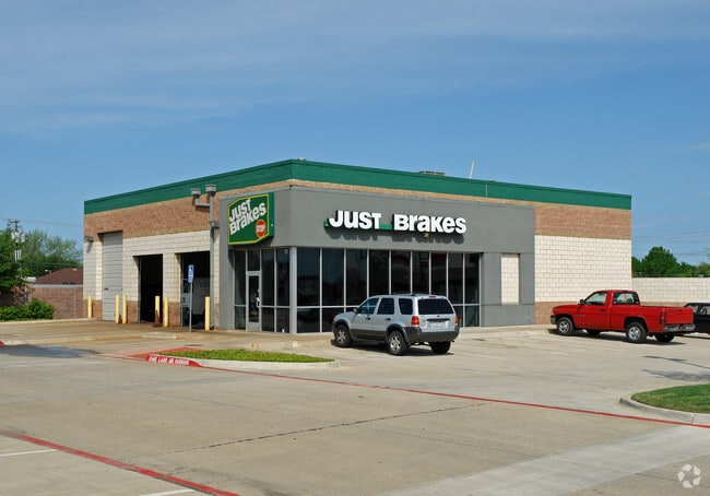


Property Detail
3013 W Spring Creek Pky
R-2346-002-001R-1
SPRING CREEK CROSSING, BLK 2, LOT 1R; * REPLAT *
Commercialnec
Collin
RT/0-M
Texas
B and X Area of moderate flood hazard, usually the area between the limits of the 100-year and 500-year floods.
1r
2025
1.81 AC
2025
West Plano
031636
Dallas/Ft Worth
16,745 SF
Dallas-Fort Worth-Arlington, TX
NEARBY LISTINGS FOR SALE OR LEASE
DEMOGRAPHICS near 3013 W Spring Creek Pky
1 mile
3 mile
5 mile
2025 Total Population
17,491
159,599
373,471
2030 Population
19,671
180,055
423,433
Pop Growth 2025-2030
+ 12.46%
+ 12.82%
+ 13.38%
Average Age
42
42
40
2025 Total Households
6,763
59,772
147,430
HH Growth 2025-2030
+ 12.66%
+ 13.05%
+ 13.75%
Median Household Inc
$126,089
$122,912
$113,101
Avg Household Size
2.50
2.60
2.50
2025 Avg HH Vehicles
2.00
2.00
2.00
Median Home Value
$477,668
$483,472
$524,756
Median Year Built
1986
1989
1994
Nearby Places
Map Layers
Map Styles
 Street
 Aerial
Transit
 Traffic
 Biking
Places
Listings with unknown addresses are not visible on the map
- Restaurants
- Banks
- Shops
- Fitness
- Groceries
PUBLIC TRANSPORTATION
AIRPORT
Dallas Love Field
Drive
Walk
Distance
Dallas Love Field
33 min
22.8 mi
Dallas-Fort Worth International
Drive
Walk
Distance
Dallas-Fort Worth International
36 min
26.7 mi
Freight Ports
Port of Shreveport
Drive
Walk
Distance
Port of Shreveport
232 min
211.6 mi
Nearby Properties
Address
Land Use
TOTAL SIZE
Lot Size
Zoning
Address
Land Use
TOTAL SIZE
Lot Size
Zoning
659,402 SF
24.39 AC
O-M
Address
Land Use
TOTAL SIZE
Lot Size
Zoning
606,071 SF
64.75 AC
SFR
Address
Land Use
TOTAL SIZE
Lot Size
Zoning
207,793 SF
12.48 AC
CE
Address
Land Use
TOTAL SIZE
Lot Size
Zoning
442,484 SF
APTS
Address
Land Use
TOTAL SIZE
Lot Size
Zoning
64.94 AC
Address
Land Use
TOTAL SIZE
Lot Size
Zoning
408,256 SF
27.66 AC
MF-M
Address
Land Use
TOTAL SIZE
Lot Size
Zoning
400,049 SF
34.67 AC
MF-L
Address
Land Use
TOTAL SIZE
Lot Size
Zoning
346,959 SF
12.68 AC
RT
Address
Land Use
TOTAL SIZE
Lot Size
Zoning
378,330 SF
16.32 AC
MF-H
Address
Land Use
TOTAL SIZE
Lot Size
Zoning
443,704 SF
18.87 AC
MFM
Address
Land Use
TOTAL SIZE
Lot Size
Zoning
300,347 SF
49.36 AC
SFR
Address
Land Use
TOTAL SIZE
Lot Size
Zoning
398,662 SF
21.42 AC
MF-M
Address
Land Use
TOTAL SIZE
Lot Size
Zoning
256,042 SF
28 AC
Address
Land Use
TOTAL SIZE
Lot Size
Zoning
291,184 SF
21.03 AC
MF-M
Address
Land Use
TOTAL SIZE
Lot Size
Zoning
361,316 SF
20.96 AC
MF-H
Address
Land Use
TOTAL SIZE
Lot Size
Zoning
299,442 SF
25.48 AC
PD-329 COM
Address
Land Use
TOTAL SIZE
Lot Size
Zoning
164,492 SF
20.47 AC
R/MF
Address
Land Use
TOTAL SIZE
Lot Size
Zoning
307,502 SF
39.62 AC
CE
Address
Land Use
TOTAL SIZE
Lot Size
Zoning
238,481 SF
17.23 AC
SFR
Address
Land Use
TOTAL SIZE
Lot Size
Zoning
258,988 SF
19.38 AC
MF-H
Address
Land Use
TOTAL SIZE
Lot Size
Zoning
326,534 SF
21.62 AC
MF-M
Address
Land Use
TOTAL SIZE
Lot Size
Zoning
303,820 SF
15.34 AC
MF-M
Address
Land Use
TOTAL SIZE
Lot Size
Zoning
290,129 SF
6.89 AC
OM
Address
Land Use
TOTAL SIZE
Lot Size
Zoning
332,500 SF
22.99 AC
MF-M
Address
Land Use
TOTAL SIZE
Lot Size
Zoning
271,907 SF
19.59 AC
MF-M
Address
Land Use
TOTAL SIZE
Lot Size
Zoning
260,679 SF
18.05 AC
MF-L
Address
Land Use
TOTAL SIZE
Lot Size
Zoning
246,610 SF
19.53 AC
MF-M
Address
Land Use
TOTAL SIZE
Lot Size
Zoning
446,544 SF
12 AC
MF-M
Address
Land Use
TOTAL SIZE
Lot Size
Zoning
213,680 SF
13.26 AC
MF-M
Address
Land Use
TOTAL SIZE
Lot Size
Zoning
249,571 SF
14.46 AC
MF-M
The World's #1 Commercial Real Estate Marketplace
Connect with us
© 2026 CoStar Group
The information above has been obtained from sources believed reliable. While we do not doubt its accuracy we have not verified it and make no guarantee, warranty or representation about it. It is your responsibility to independently confirm its accuracy and completeness. Any projections, opinions, assumptions, or estimates used are for example only and do not represent the current or future performance of the property. The value of this transaction to you depends on tax and other factors which should be evaluated by your tax, financial, and legal advisors. You and your advisors should conduct a careful, independent investigation of the property to determine to your satisfaction the suitability of the property for your needs.