Property Record
3014 E Queen Creek Rd, Gilbert, AZ 85297


Property Detail
3014 E Queen Creek Rd
304-59-976
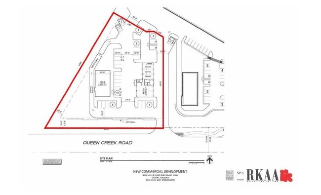
3014 E QUEEN CREEK ROAD MLD MCR 1813-09
Autorepair
Maricopa
C-C
Arizona
C and X Area of minimal flood hazard, usually depicted on FIRMs as above the 500-year flood level.
7a
2025
0.86 AC
2025
Gateway Airport/Loop 202
816002
Phoenix
6,594 SF
Phoenix-Mesa-Chandler, AZ
NEARBY LISTINGS FOR SALE OR LEASE
DEMOGRAPHICS near 3014 E Queen Creek Rd
1 mile
3 mile
5 mile
2025 Total Population
7,737
95,460
228,944
2030 Population
8,051
99,634
238,893
Pop Growth 2025-2030
+ 4.06%
+ 4.37%
+ 4.35%
Average Age
36
37
37
2025 Total Households
2,169
29,462
71,264
HH Growth 2025-2030
+ 4.06%
+ 4.30%
+ 4.38%
Median Household Inc
$177,678
$140,434
$134,825
Avg Household Size
3.50
3.20
3.10
2025 Avg HH Vehicles
3.00
2.00
2.00
Median Home Value
$733,174
$684,631
$670,378
Median Year Built
2009
2007
2007
Nearby Places
Map Layers
Map Styles
 Street
 Aerial
Transit
 Traffic
 Biking
Places
Listings with unknown addresses are not visible on the map
- Restaurants
- Banks
- Shops
- Fitness
- Groceries
PUBLIC TRANSPORTATION
AIRPORT
Phoenix-Mesa Gateway
Drive
Walk
Distance
Phoenix-Mesa Gateway
12 min
6.2 mi
Phoenix Sky Harbor International
Drive
Walk
Distance
Phoenix Sky Harbor International
40 min
28.5 mi
SALE & LEASE HISTORY
LISTING DATE
SALE/LEASE

Sep 24, 2016
For Sale
Nearby Properties
Address
Land Use
TOTAL SIZE
Lot Size
Zoning
Address
Land Use
TOTAL SIZE
Lot Size
Zoning
837,332 SF
55.22 AC
PF
Address
Land Use
TOTAL SIZE
Lot Size
Zoning
22.83 AC
PF
Address
Land Use
TOTAL SIZE
Lot Size
Zoning
2.91 AC
Address
Land Use
TOTAL SIZE
Lot Size
Zoning
298,703 SF
57.08 AC
PF
Address
Land Use
TOTAL SIZE
Lot Size
Zoning
430,700 SF
63.32 AC
PF
Address
Land Use
TOTAL SIZE
Lot Size
Zoning
254,314 SF
23.55 AC
R-43
Address
Land Use
TOTAL SIZE
Lot Size
Zoning
348,668 SF
8.97 AC
R3
Address
Land Use
TOTAL SIZE
Lot Size
Zoning
335,464 SF
13.41 AC
Address
Land Use
TOTAL SIZE
Lot Size
Zoning
139,348 SF
16.39 AC
R-12
Address
Land Use
TOTAL SIZE
Lot Size
Zoning
332,112 SF
15.44 AC
M-M
Address
Land Use
TOTAL SIZE
Lot Size
Zoning
275,813 SF
24.90 AC
R-CH
Address
Land Use
TOTAL SIZE
Lot Size
Zoning
316,979 SF
17.26 AC
MF/M
Address
Land Use
TOTAL SIZE
Lot Size
Zoning
1.55 AC
Address
Land Use
TOTAL SIZE
Lot Size
Zoning
439,353 SF
17.36 AC
M-M
Address
Land Use
TOTAL SIZE
Lot Size
Zoning
251,332 SF
8.62 AC
R3
Address
Land Use
TOTAL SIZE
Lot Size
Zoning
195,297 SF
8.90 AC
SC
Address
Land Use
TOTAL SIZE
Lot Size
Zoning
74,212 SF
65.05 AC
PF
Address
Land Use
TOTAL SIZE
Lot Size
Zoning
288,322 SF
11.98 AC
MFM
Address
Land Use
TOTAL SIZE
Lot Size
Zoning
112,957 SF
20 AC
PF/I
Address
Land Use
TOTAL SIZE
Lot Size
Zoning
114,479 SF
5.01 AC
PF
Address
Land Use
TOTAL SIZE
Lot Size
Zoning
97,347 SF
14.11 AC
PF
Address
Land Use
TOTAL SIZE
Lot Size
Zoning
110,923 SF
32.72 AC
PF
Address
Land Use
TOTAL SIZE
Lot Size
Zoning
105,152 SF
11.50 AC
C-C
Address
Land Use
TOTAL SIZE
Lot Size
Zoning
71,392 SF
8.87 AC
C-G
Address
Land Use
TOTAL SIZE
Lot Size
Zoning
326,708 SF
13.02 AC
M-M
Address
Land Use
TOTAL SIZE
Lot Size
Zoning
325,706 SF
16.32 AC
M-M
Address
Land Use
TOTAL SIZE
Lot Size
Zoning
95,040 SF
20.19 AC
PF/I
Address
Land Use
TOTAL SIZE
Lot Size
Zoning
110,880 SF
4.03 AC
R-C
Address
Land Use
TOTAL SIZE
Lot Size
Zoning
159,709 SF
17.77 AC
PF
The World's #1 Commercial Real Estate Marketplace
Connect with us
© 2026 CoStar Group
The information above has been obtained from sources believed reliable. While we do not doubt its accuracy we have not verified it and make no guarantee, warranty or representation about it. It is your responsibility to independently confirm its accuracy and completeness. Any projections, opinions, assumptions, or estimates used are for example only and do not represent the current or future performance of the property. The value of this transaction to you depends on tax and other factors which should be evaluated by your tax, financial, and legal advisors. You and your advisors should conduct a careful, independent investigation of the property to determine to your satisfaction the suitability of the property for your needs.