Property Record
3014 Edge Point Dr, Charlotte, NC 28262
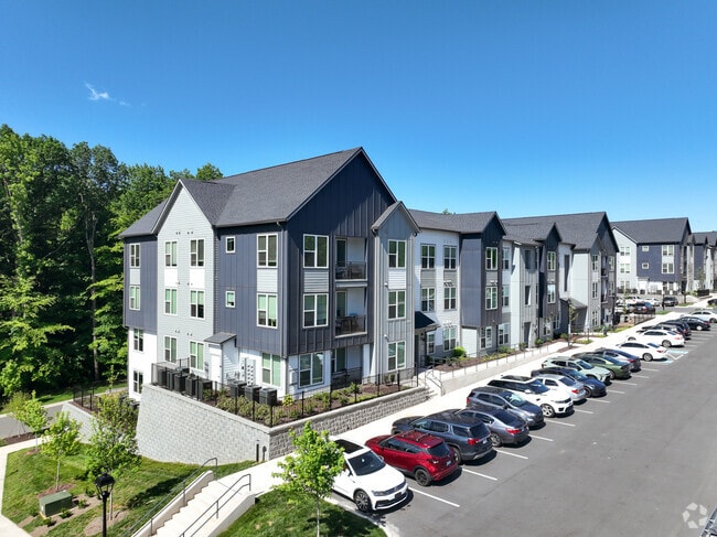


Property Detail
3014 Edge Point Dr
047-391-10
M74-593
Multifamilydwelling
MECKLENBURG
RE2
North Carolina
AE The base floodplain where base flood elevations are provided. AE Zones are now used on new format FIRMs instead of A1-A30 Zones.
1
2024
24.11 AC
2025
Mineral Springs
005536
Charlotte
333,683 SF
Charlotte-Concord-Gastonia, NC-SC
NEARBY LISTINGS FOR SALE OR LEASE
-
-
View all Charlotte listings for sale on LoopNet.com
DEMOGRAPHICS near 3014 Edge Point Dr
1 mile
3 mile
5 mile
2025 Total Population
8,511
86,708
236,520
2030 Population
9,344
94,804
258,025
Pop Growth 2025-2030
+ 9.79%
+ 9.34%
+ 9.09%
Average Age
35
35
36
2025 Total Households
3,344
34,135
93,377
HH Growth 2025-2030
+ 9.93%
+ 9.46%
+ 9.28%
Median Household Inc
$66,449
$59,525
$64,415
Avg Household Size
2.50
2.50
2.40
2025 Avg HH Vehicles
2.00
2.00
2.00
Median Home Value
$287,970
$303,302
$343,928
Median Year Built
2002
1996
1996
Nearby Places
Map Layers
Map Styles
 Street
 Aerial
Layers
 Traffic
 Biking
Places
Listings with unknown addresses are not visible on the map
- Restaurants
- Banks
- Shops
- Fitness
- Groceries
PUBLIC TRANSPORTATION
COMMUTER RAIL
Charlotte Amtrak Station (Carolinian - Amtrak, Crescent - Amtrak, Piedmont - Amtrak)
Drive
Walk
Distance
Charlotte Amtrak Station (Carolinian - Amtrak, Crescent - Amtrak, Piedmont - Amtrak)
10 min
5.9 mi
AIRPORT
Concord-Padgett Regional
Drive
Walk
Distance
Concord-Padgett Regional
15 min
9.2 mi
Charlotte/Douglas International
Drive
Walk
Distance
Charlotte/Douglas International
24 min
15.2 mi
Freight Ports
North Charleston Terminal
Drive
Walk
Distance
North Charleston Terminal
237 min
207.4 mi
Nearby Properties
Address
Land Use
TOTAL SIZE
Lot Size
Zoning
Address
Land Use
TOTAL SIZE
Lot Size
Zoning
2,534,387 SF
135.23 AC
RE2
Address
Land Use
TOTAL SIZE
Lot Size
Zoning
2,215,042 SF
68.45 AC
RE2
Address
Land Use
TOTAL SIZE
Lot Size
Zoning
1,474,585 SF
30.93 AC
Address
Land Use
TOTAL SIZE
Lot Size
Zoning
1,532,477 SF
92.30 AC
RE1
Address
Land Use
TOTAL SIZE
Lot Size
Zoning
628,300 SF
197.32 AC
INST
Address
Land Use
TOTAL SIZE
Lot Size
Zoning
497,730 SF
32.66 AC
B2CD
Address
Land Use
TOTAL SIZE
Lot Size
Zoning
727,169 SF
6.07 AC
INST
Address
Land Use
TOTAL SIZE
Lot Size
Zoning
419,364 SF
17.40 AC
Address
Land Use
TOTAL SIZE
Lot Size
Zoning
315,076 SF
21.16 AC
RE1
Address
Land Use
TOTAL SIZE
Lot Size
Zoning
401,069 SF
31.52 AC
R12MFCD
Address
Land Use
TOTAL SIZE
Lot Size
Zoning
164,809 SF
94.60 AC
Address
Land Use
TOTAL SIZE
Lot Size
Zoning
389,680 SF
28.83 AC
R17MFCD
Address
Land Use
TOTAL SIZE
Lot Size
Zoning
324,898 SF
22.31 AC
R17MFCD
Address
Land Use
TOTAL SIZE
Lot Size
Zoning
215,899 SF
4.86 AC
B-2(CD)
Address
Land Use
TOTAL SIZE
Lot Size
Zoning
335,688 SF
22.54 AC
Address
Land Use
TOTAL SIZE
Lot Size
Zoning
358,524 SF
23.80 AC
R17MFCD
Address
Land Use
TOTAL SIZE
Lot Size
Zoning
306,269 SF
9.44 AC
MUDD-O
Address
Land Use
TOTAL SIZE
Lot Size
Zoning
464,520 SF
3.43 AC
Address
Land Use
TOTAL SIZE
Lot Size
Zoning
325,799 SF
37.65 AC
R9MFCD
Address
Land Use
TOTAL SIZE
Lot Size
Zoning
306,583 SF
24.15 AC
Address
Land Use
TOTAL SIZE
Lot Size
Zoning
357,469 SF
49.75 AC
Address
Land Use
TOTAL SIZE
Lot Size
Zoning
19.62 AC
Address
Land Use
TOTAL SIZE
Lot Size
Zoning
352,085 SF
23.50 AC
NS
Address
Land Use
TOTAL SIZE
Lot Size
Zoning
276,596 SF
41.26 AC
Address
Land Use
TOTAL SIZE
Lot Size
Zoning
330,598 SF
20.29 AC
Address
Land Use
TOTAL SIZE
Lot Size
Zoning
311,358 SF
8.95 AC
B2
Address
Land Use
TOTAL SIZE
Lot Size
Zoning
68,352 SF
3.83 AC
TOD-M(O)
Address
Land Use
TOTAL SIZE
Lot Size
Zoning
400,421 SF
10.06 AC
MUDDO
Address
Land Use
TOTAL SIZE
Lot Size
Zoning
205,022 SF
15.68 AC
R9MFCD
The World's #1 Commercial Real Estate Marketplace
Connect with us
© 2026 CoStar Group
The information above has been obtained from sources believed reliable. While we do not doubt its accuracy we have not verified it and make no guarantee, warranty or representation about it. It is your responsibility to independently confirm its accuracy and completeness. Any projections, opinions, assumptions, or estimates used are for example only and do not represent the current or future performance of the property. The value of this transaction to you depends on tax and other factors which should be evaluated by your tax, financial, and legal advisors. You and your advisors should conduct a careful, independent investigation of the property to determine to your satisfaction the suitability of the property for your needs.