Property Record
3014 W William Cannon Dr, Austin, TX 78745


Save to a Folder
{{folder.Name}}
{{folder.ListingIds.length}} Properties
{{folder.ListingIds.length}} Property
Create a New Folder
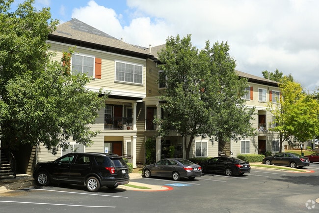
Property Detail
3014 W William Cannon Dr
Austin-Round Rock-San Marcos, TX
LOT 60-65 LESS S PART OF WESTERN HILLS ABS 3 SUR 18 BISSELL T ACR 49.0401 & VAC ROW TOTAL 59.7705 ACR
511982
Travis
Multifamilydwelling
Texas
AE The base floodplain where base flood elevations are provided. AE Zones are now used on new format FIRMs instead of A1-A30 Zones.
60-65
2025
59.77 AC
2025
Cherry Creek
032100
Austin
401,771 SF
NEARBY LISTINGS FOR SALE OR LEASE
DEMOGRAPHICS near 3014 W William Cannon Dr
1 mile
3 mile
5 mile
2025 Total Population
12,994
110,421
284,055
2030 Population
13,456
114,651
295,593
Pop Growth 2025-2030
+ 3.56%
+ 3.83%
+ 4.06%
Average Age
40
40
38
2025 Total Households
6,184
49,958
123,092
HH Growth 2025-2030
+ 4.24%
+ 4.52%
+ 4.82%
Median Household Inc
$99,078
$96,212
$99,346
Avg Household Size
2.10
2.10
2.20
2025 Avg HH Vehicles
2.00
2.00
2.00
Median Home Value
$545,511
$561,137
$615,563
Median Year Built
1986
1991
1996
Nearby Places
Map Layers
Map Styles
 Street
 Aerial
Layers
 Traffic
 Biking
Places
Listings with unknown addresses are not visible on the map
- Restaurants
- Banks
- Shops
- Fitness
- Groceries
PUBLIC TRANSPORTATION
COMMUTER RAIL
Austin (Texas Eagle - Amtrak)
Drive
Walk
Distance
Austin (Texas Eagle - Amtrak)
13 min
8.3 mi
AIRPORT
Austin-Bergstrom International
Drive
Walk
Distance
Austin-Bergstrom International
27 min
14.3 mi
Freight Ports
Calhoun Port
Drive
Walk
Distance
Calhoun Port
188 min
155.9 mi
Nearby Properties
Address
Land Use
TOTAL SIZE
Lot Size
Zoning
Address
Land Use
TOTAL SIZE
Lot Size
Zoning
Address
Land Use
TOTAL SIZE
Lot Size
Zoning
881,940 SF
80.11 AC
Address
Land Use
TOTAL SIZE
Lot Size
Zoning
368,349 SF
17.13 AC
Address
Land Use
TOTAL SIZE
Lot Size
Zoning
617,120 SF
53.40 AC
Address
Land Use
TOTAL SIZE
Lot Size
Zoning
474,907 SF
36.94 AC
Address
Land Use
TOTAL SIZE
Lot Size
Zoning
441,209 SF
64.41 AC
Address
Land Use
TOTAL SIZE
Lot Size
Zoning
413,880 SF
30.21 AC
Address
Land Use
TOTAL SIZE
Lot Size
Zoning
342,956 SF
6.15 AC
Address
Land Use
TOTAL SIZE
Lot Size
Zoning
539,533 SF
26.50 AC
Address
Land Use
TOTAL SIZE
Lot Size
Zoning
398,436 SF
30.81 AC
Address
Land Use
TOTAL SIZE
Lot Size
Zoning
432,404 SF
37.29 AC
Address
Land Use
TOTAL SIZE
Lot Size
Zoning
267,224 SF
56.90 AC
Address
Land Use
TOTAL SIZE
Lot Size
Zoning
450,836 SF
29.58 AC
Address
Land Use
TOTAL SIZE
Lot Size
Zoning
324,860 SF
8.36 AC
Address
Land Use
TOTAL SIZE
Lot Size
Zoning
400,301 SF
22.65 AC
Address
Land Use
TOTAL SIZE
Lot Size
Zoning
425,720 SF
28.49 AC
Address
Land Use
TOTAL SIZE
Lot Size
Zoning
404,812 SF
31.32 AC
Address
Land Use
TOTAL SIZE
Lot Size
Zoning
366,275 SF
39.95 AC
Address
Land Use
TOTAL SIZE
Lot Size
Zoning
239,000 SF
2.62 AC
Address
Land Use
TOTAL SIZE
Lot Size
Zoning
359,144 SF
Address
Land Use
TOTAL SIZE
Lot Size
Zoning
257,400 SF
10.70 AC
Address
Land Use
TOTAL SIZE
Lot Size
Zoning
399,828 SF
50.10 AC
Address
Land Use
TOTAL SIZE
Lot Size
Zoning
315,198 SF
8.88 AC
Address
Land Use
TOTAL SIZE
Lot Size
Zoning
233,943 SF
39.66 AC
Address
Land Use
TOTAL SIZE
Lot Size
Zoning
327,886 SF
23.91 AC
Address
Land Use
TOTAL SIZE
Lot Size
Zoning
316,572 SF
22.67 AC
Address
Land Use
TOTAL SIZE
Lot Size
Zoning
345,632 SF
25.21 AC
Address
Land Use
TOTAL SIZE
Lot Size
Zoning
255,144 SF
6.62 AC
Address
Land Use
TOTAL SIZE
Lot Size
Zoning
246,854 SF
19.40 AC
The World's #1 Commercial Real Estate Marketplace
Connect with us
© 2026 CoStar Group
The information above has been obtained from sources believed reliable. While we do not doubt its accuracy we have not verified it and make no guarantee, warranty or representation about it. It is your responsibility to independently confirm its accuracy and completeness. Any projections, opinions, assumptions, or estimates used are for example only and do not represent the current or future performance of the property. The value of this transaction to you depends on tax and other factors which should be evaluated by your tax, financial, and legal advisors. You and your advisors should conduct a careful, independent investigation of the property to determine to your satisfaction the suitability of the property for your needs.