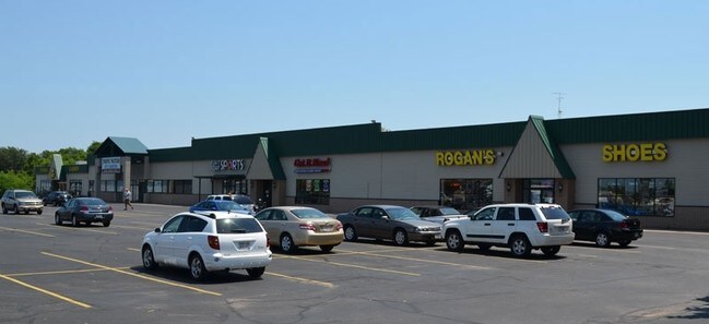
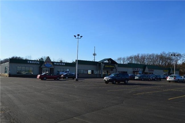
Property Record
3015 E Hamilton Ave, Eau Claire, WI 54701

NEARBY LISTINGS FOR SALE OR LEASE
Property Detail
3015 E Hamilton Ave
Eau Claire, WI
Second Assessors Plat
15-3473
N 1/2 OF LOT 7 BLK 2 & LOTS 1-2-3 BLK 3 EXC S 660.55 FT OF LOT 2 BLK 3 ALSO EXC THAT PT OF LOT 7 BLK 2 & OF LOTS 1-2 BLK 3 AS
Stripcommercialcenter
Eau Claire
X
Wisconsin
55017C0750E
1-3,7
2024
7.23 AC
2024
Eau Claire/Menomonie
000803
Other Market Areas
56,550 SF
DEMOGRAPHICS near 3015 E Hamilton Ave
1 Mile
3 Mile
5 Mile
2024 Total Population
7,565
53,873
85,221
2029 Population
7,906
56,172
88,708
Pop Growth 2024-2029
+ 4.51%
+ 4.27%
+ 4.09%
Average Age
41
38
38
2024 Total Households
3,401
22,334
35,278
HH Growth 2024-2029
+ 4.47%
+ 4.41%
+ 4.18%
Median Household Inc
$62,316
$60,341
$61,917
Avg Household Size
2.10
2.20
2.20
2024 Avg HH Vehicles
2.00
2.00
2.00
Median Home Value
$268,034
$239,620
$232,274
Median Year Built
1988
1978
1976
Nearby Places
Map Layers
Map Styles
 Street
 Aerial
- Restaurants
- Banks
- Shops
- Fitness
- Groceries
SALE & LEASE HISTORY
LISTING DATE
SALE/LEASE

Sep 23, 2016
For Sale
Nearby Properties
Address
Land Use
TOTAL SIZE
Lot Size
Zoning
Address
Land Use
TOTAL SIZE
Lot Size
Zoning
10.07 AC
FAIRFAX CO
Address
Land Use
TOTAL SIZE
Lot Size
Zoning
520,119 SF
42.39 AC
C3
Address
Land Use
TOTAL SIZE
Lot Size
Zoning
4.28 AC
Address
Land Use
TOTAL SIZE
Lot Size
Zoning
206,042 SF
5.59 AC
Address
Land Use
TOTAL SIZE
Lot Size
Zoning
4.94 AC
Address
Land Use
TOTAL SIZE
Lot Size
Zoning
21.41 AC
Address
Land Use
TOTAL SIZE
Lot Size
Zoning
2.70 AC
Address
Land Use
TOTAL SIZE
Lot Size
Zoning
1.36 AC
CBD
Address
Land Use
TOTAL SIZE
Lot Size
Zoning
Address
Land Use
TOTAL SIZE
Lot Size
Zoning
114,683 SF
5.47 AC
C3H
Address
Land Use
TOTAL SIZE
Lot Size
Zoning
207,978 SF
24.47 AC
C3P
Address
Land Use
TOTAL SIZE
Lot Size
Zoning
94,173 SF
9.36 AC
C3
Address
Land Use
TOTAL SIZE
Lot Size
Zoning
81,260 SF
2.32 AC
R4
Address
Land Use
TOTAL SIZE
Lot Size
Zoning
13.19 AC
C
Address
Land Use
TOTAL SIZE
Lot Size
Zoning
132,943 SF
11.26 AC
Address
Land Use
TOTAL SIZE
Lot Size
Zoning
1.05 AC
P
Address
Land Use
TOTAL SIZE
Lot Size
Zoning
105,434 SF
1.55 AC
CBD
Address
Land Use
TOTAL SIZE
Lot Size
Zoning
4.89 AC
FAIRFAX CO
Address
Land Use
TOTAL SIZE
Lot Size
Zoning
66,393 SF
12.95 AC
Address
Land Use
TOTAL SIZE
Lot Size
Zoning
200,880 SF
14.86 AC
C3P
Address
Land Use
TOTAL SIZE
Lot Size
Zoning
173,473 SF
14.38 AC
C3P
Address
Land Use
TOTAL SIZE
Lot Size
Zoning
114,100 SF
2.64 AC
Address
Land Use
TOTAL SIZE
Lot Size
Zoning
96,149 SF
5.92 AC
R3P
Address
Land Use
TOTAL SIZE
Lot Size
Zoning
169,740 SF
13.16 AC
C3P
Address
Land Use
TOTAL SIZE
Lot Size
Zoning
4.35 AC
Address
Land Use
TOTAL SIZE
Lot Size
Zoning
21,786 SF
4.14 AC
Address
Land Use
TOTAL SIZE
Lot Size
Zoning
13.26 AC
I
Address
Land Use
TOTAL SIZE
Lot Size
Zoning
88,350 SF
0.40 AC
Address
Land Use
TOTAL SIZE
Lot Size
Zoning
92,178 SF
3.81 AC
C3P
Address
Land Use
TOTAL SIZE
Lot Size
Zoning
97,194 SF
7.39 AC
C3H
The World's #1 Commercial Real Estate Marketplace
Connect with us
© 2026 CoStar Group
The information above has been obtained from sources believed reliable. While we do not doubt its accuracy we have not verified it and make no guarantee, warranty or representation about it. It is your responsibility to independently confirm its accuracy and completeness. Any projections, opinions, assumptions, or estimates used are for example only and do not represent the current or future performance of the property. The value of this transaction to you depends on tax and other factors which should be evaluated by your tax, financial, and legal advisors. You and your advisors should conduct a careful, independent investigation of the property to determine to your satisfaction the suitability of the property for your needs.