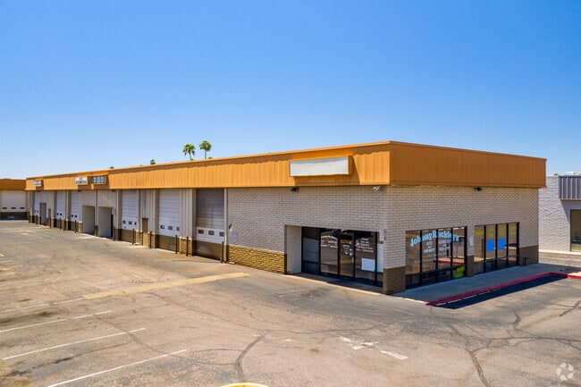
Property Record
3015 E Main St, Mesa, AZ 85213

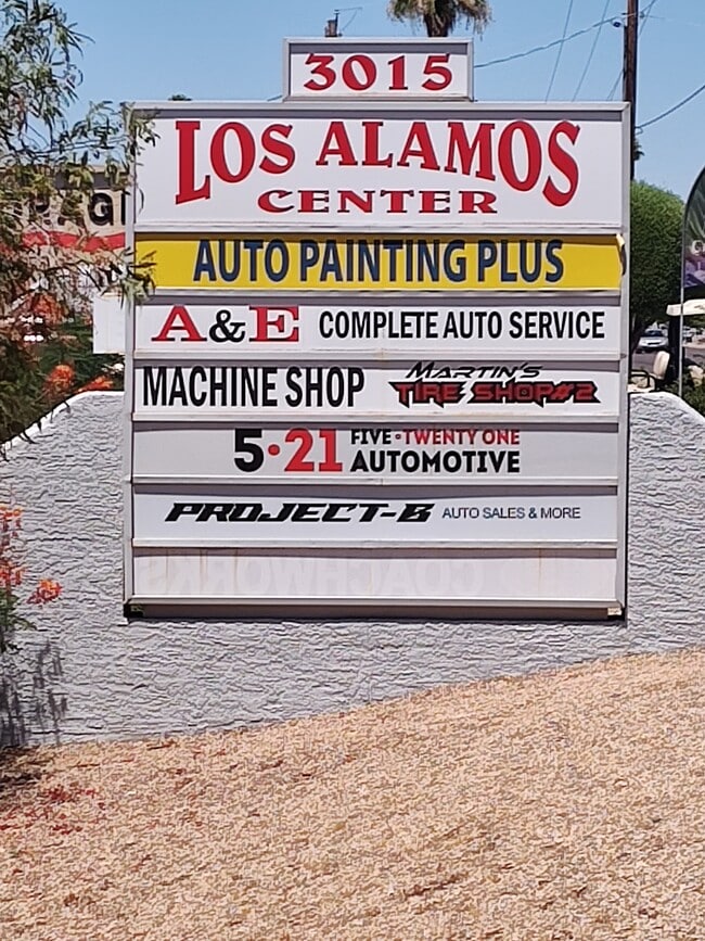

Current Lease Availabilities
Property Detail
3015 E Main St
140-27-003Z
BEG NW COR E2 SW4 SEC S 55F E 248.51F TPOB S 364.64F E 100F N 364.64F W 100F TPOB
Commercialnec
Maricopa
C-G
Arizona
C and X Area of minimal flood hazard, usually depicted on FIRMs as above the 500-year flood level.
0.84 AC
2025
Falcon Fld/Apache Jct
2025
Phoenix
420709
Phoenix-Mesa-Chandler, AZ
NEARBY LISTINGS FOR SALE OR LEASE
DEMOGRAPHICS near 3015 E Main St
1 mile
3 mile
5 mile
2024 Total Population
23,449
154,557
344,514
2029 Population
25,984
167,436
372,796
Pop Growth 2024-2029
+ 10.81%
+ 8.33%
+ 8.21%
Average Age
47
40
40
2024 Total Households
10,657
58,628
130,517
HH Growth 2024-2029
+ 11.59%
+ 8.88%
+ 8.59%
Median Household Inc
$52,910
$63,176
$65,510
Avg Household Size
2.20
2.50
2.50
2024 Avg HH Vehicles
2.00
2.00
2.00
Median Home Value
$93,904
$303,195
$334,626
Median Year Built
1985
1983
1985
Nearby Places
Map Layers
Map Styles
 Street
 Aerial
Transit
 Traffic
 Biking
Places
Listings with unknown addresses are not visible on the map
- Restaurants
- Banks
- Shops
- Fitness
- Groceries
PUBLIC TRANSPORTATION
AIRPORT
Phoenix-Mesa Gateway
Drive
Walk
Distance
Phoenix-Mesa Gateway
24 min
13.6 mi
Phoenix Sky Harbor International
Drive
Walk
Distance
Phoenix Sky Harbor International
28 min
17.3 mi
Nearby Properties
Address
Land Use
TOTAL SIZE
Lot Size
Zoning
Address
Land Use
TOTAL SIZE
Lot Size
Zoning
125,356 SF
21.63 AC
R-9
Address
Land Use
TOTAL SIZE
Lot Size
Zoning
400,798 SF
55.94 AC
PF
Address
Land Use
TOTAL SIZE
Lot Size
Zoning
441,928 SF
17.31 AC
RM3
Address
Land Use
TOTAL SIZE
Lot Size
Zoning
579,506 SF
17.78 AC
PF
Address
Land Use
TOTAL SIZE
Lot Size
Zoning
20.08 AC
Address
Land Use
TOTAL SIZE
Lot Size
Zoning
185,382 SF
23.37 AC
C-G
Address
Land Use
TOTAL SIZE
Lot Size
Zoning
427,210 SF
38.33 AC
PF
Address
Land Use
TOTAL SIZE
Lot Size
Zoning
1.46 AC
C-G
Address
Land Use
TOTAL SIZE
Lot Size
Zoning
160,296 SF
33.63 AC
PF
Address
Land Use
TOTAL SIZE
Lot Size
Zoning
367,012 SF
19.91 AC
M-H
Address
Land Use
TOTAL SIZE
Lot Size
Zoning
100,580 SF
22.70 AC
C-G
Address
Land Use
TOTAL SIZE
Lot Size
Zoning
233,188 SF
7.34 AC
RM4
Address
Land Use
TOTAL SIZE
Lot Size
Zoning
208,046 SF
23.54 AC
I-1
Address
Land Use
TOTAL SIZE
Lot Size
Zoning
147,408 SF
34.58 AC
PF
Address
Land Use
TOTAL SIZE
Lot Size
Zoning
309,059 SF
15.49 AC
M-M
Address
Land Use
TOTAL SIZE
Lot Size
Zoning
349,318 SF
18.47 AC
M-H
Address
Land Use
TOTAL SIZE
Lot Size
Zoning
212,942 SF
12.80 AC
M-H
Address
Land Use
TOTAL SIZE
Lot Size
Zoning
160,843 SF
22.07 AC
PF
Address
Land Use
TOTAL SIZE
Lot Size
Zoning
266,240 SF
9.75 AC
M-H
Address
Land Use
TOTAL SIZE
Lot Size
Zoning
291,925 SF
17.70 AC
M-H
Address
Land Use
TOTAL SIZE
Lot Size
Zoning
321,591 SF
15.68 AC
M-H
Address
Land Use
TOTAL SIZE
Lot Size
Zoning
11,460 SF
1.06 AC
C-G
Address
Land Use
TOTAL SIZE
Lot Size
Zoning
261,110 SF
14.71 AC
M-H
Address
Land Use
TOTAL SIZE
Lot Size
Zoning
3,545 SF
1.14 AC
C-G
Address
Land Use
TOTAL SIZE
Lot Size
Zoning
81,000 SF
15.70 AC
AG
Address
Land Use
TOTAL SIZE
Lot Size
Zoning
343,128 SF
13.01 AC
M-H
Address
Land Use
TOTAL SIZE
Lot Size
Zoning
258,649 SF
18.71 AC
LC
Address
Land Use
TOTAL SIZE
Lot Size
Zoning
202,266 SF
11.57 AC
M-H
Address
Land Use
TOTAL SIZE
Lot Size
Zoning
240,245 SF
8.82 AC
M-H
Address
Land Use
TOTAL SIZE
Lot Size
Zoning
149,700 SF
11.99 AC
C-G
The World's #1 Commercial Real Estate Marketplace
Connect with us
© 2026 CoStar Group
The information above has been obtained from sources believed reliable. While we do not doubt its accuracy we have not verified it and make no guarantee, warranty or representation about it. It is your responsibility to independently confirm its accuracy and completeness. Any projections, opinions, assumptions, or estimates used are for example only and do not represent the current or future performance of the property. The value of this transaction to you depends on tax and other factors which should be evaluated by your tax, financial, and legal advisors. You and your advisors should conduct a careful, independent investigation of the property to determine to your satisfaction the suitability of the property for your needs.