Property Record
3017 Cranberry Hwy, East Wareham, MA 02538
NEARBY LISTINGS FOR SALE OR LEASE
Property Detail
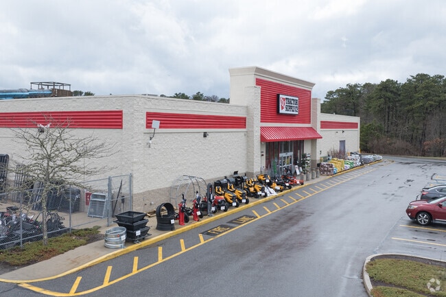
3017 Cranberry Hwy
WARE-000012-000000-A000001-A000000
Plymouth
Departmentstore
Massachusetts
AE
a1
25023C0493K
4.61 AC
2025
Route 3 South
2025
Boston
545200
Boston-Cambridge-Newton, MA-NH
19,611 SF
DEMOGRAPHICS near 3017 Cranberry Hwy
1 Mile
3 Mile
5 Mile
2024 Total Population
2,249
19,536
37,246
2029 Population
2,182
19,795
37,833
Pop Growth 2024-2029
(2.98%)
+ 1.33%
+ 1.58%
Average Age
46
45
45
2024 Total Households
1,041
8,145
15,668
HH Growth 2024-2029
(3.17%)
+ 1.12%
+ 1.42%
Median Household Inc
$69,072
$72,069
$76,956
Avg Household Size
2.10
2.20
2.20
2024 Avg HH Vehicles
2.00
2.00
2.00
Median Home Value
$316,406
$399,823
$410,100
Median Year Built
1954
1956
1966
Nearby Places
Map Layers
Map Styles
 Street
 Aerial
- Restaurants
- Banks
- Shops
- Fitness
- Groceries
PUBLIC TRANSPORTATION
COMMUTER RAIL
DRIVE
WALK
Distance
6 min
2.6 mi
DRIVE
WALK
Distance
7 min
3.2 mi
AIRPORT
Martha's Vineyard
DRIVE
WALK
Distance
Martha's Vineyard
99 min
36.0 mi
Nearby Properties
Address
Land Use
TOTAL SIZE
Lot Size
Zoning
Address
Land Use
TOTAL SIZE
Lot Size
Zoning
163,433 SF
7.47 AC
Address
Land Use
TOTAL SIZE
Lot Size
Zoning
1,758 SF
269.51 AC
R40
Address
Land Use
TOTAL SIZE
Lot Size
Zoning
167,599 SF
0.34 AC
Address
Land Use
TOTAL SIZE
Lot Size
Zoning
106,987 SF
3.95 AC
Address
Land Use
TOTAL SIZE
Lot Size
Zoning
19.77 AC
Address
Land Use
TOTAL SIZE
Lot Size
Zoning
15,716 SF
7.85 AC
R40
Address
Land Use
TOTAL SIZE
Lot Size
Zoning
11,930 SF
4.81 AC
Address
Land Use
TOTAL SIZE
Lot Size
Zoning
68.53 AC
R40
Address
Land Use
TOTAL SIZE
Lot Size
Zoning
12,812 SF
19.12 AC
Address
Land Use
TOTAL SIZE
Lot Size
Zoning
8.89 AC
Address
Land Use
TOTAL SIZE
Lot Size
Zoning
116,476 SF
13.22 AC
Address
Land Use
TOTAL SIZE
Lot Size
Zoning
60.89 AC
Address
Land Use
TOTAL SIZE
Lot Size
Zoning
27,958 SF
5.85 AC
R40
Address
Land Use
TOTAL SIZE
Lot Size
Zoning
117,814 SF
16.49 AC
Address
Land Use
TOTAL SIZE
Lot Size
Zoning
26,053 SF
1.26 AC
Address
Land Use
TOTAL SIZE
Lot Size
Zoning
17.47 AC
Address
Land Use
TOTAL SIZE
Lot Size
Zoning
4,959 SF
2.30 AC
Address
Land Use
TOTAL SIZE
Lot Size
Zoning
30,195 SF
0.82 AC
Address
Land Use
TOTAL SIZE
Lot Size
Zoning
41,185 SF
14.91 AC
Address
Land Use
TOTAL SIZE
Lot Size
Zoning
65,856 SF
6.70 AC
Address
Land Use
TOTAL SIZE
Lot Size
Zoning
6.30 AC
Address
Land Use
TOTAL SIZE
Lot Size
Zoning
4.20 AC
Address
Land Use
TOTAL SIZE
Lot Size
Zoning
2,024 SF
10.57 AC
R40
Address
Land Use
TOTAL SIZE
Lot Size
Zoning
32.24 AC
Address
Land Use
TOTAL SIZE
Lot Size
Zoning
2.44 AC
R40
Address
Land Use
TOTAL SIZE
Lot Size
Zoning
Address
Land Use
TOTAL SIZE
Lot Size
Zoning
22.30 AC
Address
Land Use
TOTAL SIZE
Lot Size
Zoning
21,240 SF
2.79 AC
Address
Land Use
TOTAL SIZE
Lot Size
Zoning
12.32 AC
Address
Land Use
TOTAL SIZE
Lot Size
Zoning
The World's #1 Commercial Real Estate Marketplace
Connect with us
© 2026 CoStar Group
The information above has been obtained from sources believed reliable. While we do not doubt its accuracy we have not verified it and make no guarantee, warranty or representation about it. It is your responsibility to independently confirm its accuracy and completeness. Any projections, opinions, assumptions, or estimates used are for example only and do not represent the current or future performance of the property. The value of this transaction to you depends on tax and other factors which should be evaluated by your tax, financial, and legal advisors. You and your advisors should conduct a careful, independent investigation of the property to determine to your satisfaction the suitability of the property for your needs.