Property Record
302 Route 59, Nyack, NY 10960


NEARBY LISTINGS FOR SALE OR LEASE
Property Detail
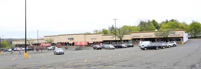
302 Route 59
392089-065-007-0003-049-000-0000
120-A-34
Regionalshoppingcenterormallwithanchorstore
Rockland
X
New York
36087C0177G
49.0
2023
6.70 AC
2024
Clarkstown
011102
Northern New Jersey
64,684 SF
New York-Jersey City-White Plains, NY-NJ
DEMOGRAPHICS near 302 Route 59
1 Mile
3 Mile
5 Mile
2024 Total Population
4,616
41,672
145,519
2029 Population
4,548
41,346
144,654
Pop Growth 2024-2029
(1.47%)
(0.78%)
(0.59%)
Average Age
42
43
42
2024 Total Households
1,892
15,407
51,199
HH Growth 2024-2029
(1.59%)
(0.88%)
(0.68%)
Median Household Inc
$87,664
$119,489
$116,325
Avg Household Size
2.30
2.60
2.70
2024 Avg HH Vehicles
2.00
2.00
2.00
Median Home Value
$419,690
$587,693
$563,770
Median Year Built
1967
1964
1966
Nearby Places
Map Layers
Map Styles
 Street
 Aerial
- Restaurants
- Banks
- Shops
- Fitness
- Groceries
PUBLIC TRANSPORTATION
COMMUTER RAIL
Nanuet (Pascack Valley Line - NJ Transit Commuter Rail (NJ Transit))
DRIVE
WALK
Distance
Nanuet (Pascack Valley Line - NJ Transit Commuter Rail (NJ Transit))
8 min
4.2 mi
Philipse Manor Station (Hudson Line - Metro-North Commuter Railroad Company (Metro-North))
DRIVE
WALK
Distance
Philipse Manor Station (Hudson Line - Metro-North Commuter Railroad Company (Metro-North))
15 min
9.0 mi
AIRPORT
Westchester County
DRIVE
WALK
Distance
Westchester County
27 min
19.3 mi
LaGuardia
DRIVE
WALK
Distance
LaGuardia
47 min
32.0 mi
New York Stewart International
DRIVE
WALK
Distance
New York Stewart International
56 min
38.3 mi
Freight Ports
NY - Red Hook Container Terminal
DRIVE
WALK
Distance
NY - Red Hook Container Terminal
59 min
40.2 mi
SALE & LEASE HISTORY
LISTING DATE
SALE/LEASE

Sep 20, 2017
For Lease
Mar 03, 2017
For Lease
Nearby Properties
Address
Land Use
TOTAL SIZE
Lot Size
Zoning
Address
Land Use
TOTAL SIZE
Lot Size
Zoning
415,374 SF
8.43 AC
H
Address
Land Use
TOTAL SIZE
Lot Size
Zoning
4,540,462 SF
30.89 AC
Address
Land Use
TOTAL SIZE
Lot Size
Zoning
237,408 SF
14.97 AC
R-40
Address
Land Use
TOTAL SIZE
Lot Size
Zoning
298,975 SF
63.32 AC
03 - MULTI
Address
Land Use
TOTAL SIZE
Lot Size
Zoning
316,644 SF
65.70 AC
Address
Land Use
TOTAL SIZE
Lot Size
Zoning
114,520 SF
6.71 AC
R4
Address
Land Use
TOTAL SIZE
Lot Size
Zoning
25.52 AC
Address
Land Use
TOTAL SIZE
Lot Size
Zoning
50,280 SF
24.37 AC
Address
Land Use
TOTAL SIZE
Lot Size
Zoning
108,264 SF
14.90 AC
R-18
Address
Land Use
TOTAL SIZE
Lot Size
Zoning
31.50 AC
R-15
Address
Land Use
TOTAL SIZE
Lot Size
Zoning
302.70 AC
R-40
Address
Land Use
TOTAL SIZE
Lot Size
Zoning
345,670 SF
49.40 AC
Address
Land Use
TOTAL SIZE
Lot Size
Zoning
247,496 SF
24.20 AC
Address
Land Use
TOTAL SIZE
Lot Size
Zoning
1.10 AC
R-3
Address
Land Use
TOTAL SIZE
Lot Size
Zoning
56,436 SF
7.06 AC
R-40
Address
Land Use
TOTAL SIZE
Lot Size
Zoning
984 SF
3.10 AC
LI
Address
Land Use
TOTAL SIZE
Lot Size
Zoning
1,887 SF
245.60 AC
02 - SINGL
Address
Land Use
TOTAL SIZE
Lot Size
Zoning
Address
Land Use
TOTAL SIZE
Lot Size
Zoning
441.47 AC
R-40
Address
Land Use
TOTAL SIZE
Lot Size
Zoning
68,910 SF
27 AC
Address
Land Use
TOTAL SIZE
Lot Size
Zoning
500,448 SF
29.92 AC
Address
Land Use
TOTAL SIZE
Lot Size
Zoning
142,608 SF
5.60 AC
HRA
Address
Land Use
TOTAL SIZE
Lot Size
Zoning
Address
Land Use
TOTAL SIZE
Lot Size
Zoning
129,957 SF
21.90 AC
Address
Land Use
TOTAL SIZE
Lot Size
Zoning
184.50 AC
R-40
Address
Land Use
TOTAL SIZE
Lot Size
Zoning
353,440 SF
24.54 AC
LI
Address
Land Use
TOTAL SIZE
Lot Size
Zoning
68,910 SF
6.90 AC
02 - SINGL
Address
Land Use
TOTAL SIZE
Lot Size
Zoning
215,345 SF
18.60 AC
LO
Address
Land Use
TOTAL SIZE
Lot Size
Zoning
34.45 AC
Address
Land Use
TOTAL SIZE
Lot Size
Zoning
8.80 AC
R-1
The World's #1 Commercial Real Estate Marketplace
Connect with us
© 2026 CoStar Group
The information above has been obtained from sources believed reliable. While we do not doubt its accuracy we have not verified it and make no guarantee, warranty or representation about it. It is your responsibility to independently confirm its accuracy and completeness. Any projections, opinions, assumptions, or estimates used are for example only and do not represent the current or future performance of the property. The value of this transaction to you depends on tax and other factors which should be evaluated by your tax, financial, and legal advisors. You and your advisors should conduct a careful, independent investigation of the property to determine to your satisfaction the suitability of the property for your needs.