Property Record
302 Samuel Dr, Madison, WI 53717


Save to a Folder
{{folder.Name}}
{{folder.ListingIds.length}} Properties
{{folder.ListingIds.length}} Property
Create a New Folder
Property Detail
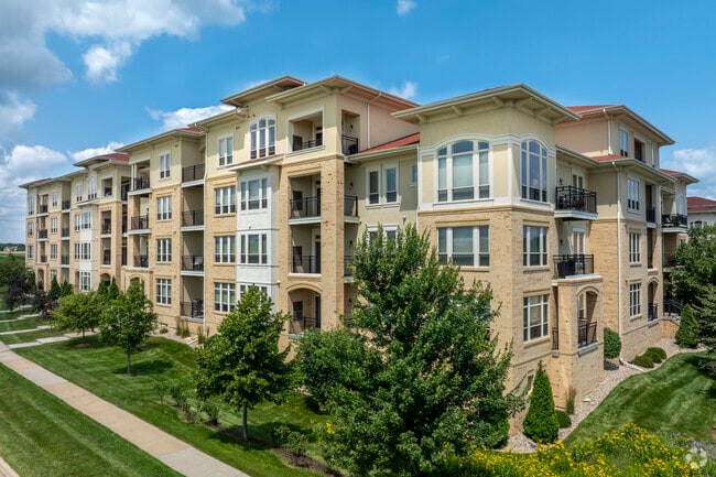
302 Samuel Dr
0708-222-1102-8
CERTIFIED SURVEY MAP NO 13159 AS RECORDED IN DANE COUNTY REGISTER OF DEEDS IN VO L 84 PAGE 251 OF CERTIFIED SURVEYS, LOT 2; EXCEPT THAT PART AS DESCRIBED IN DOC 4968943: BEG AT THE SWLY CORNER OF SD LOT 2, SD PT BEING THE PT OF CURVATURE ON ELY ROW L
Commercialnec
DANE
PD
Wisconsin
B and X Area of moderate flood hazard, usually the area between the limits of the 100-year and 500-year floods.
84
2025
4.23 AC
2025
Outer Middleton
010905
Milwaukee/Madison
204,228 SF
Madison, WI
NEARBY LISTINGS FOR SALE OR LEASE
DEMOGRAPHICS near 302 Samuel Dr
1 mile
3 mile
5 mile
2025 Total Population
7,725
56,585
133,501
2030 Population
8,118
59,281
139,037
Pop Growth 2025-2030
+ 5.09%
+ 4.76%
+ 4.15%
Average Age
38
40
40
2025 Total Households
3,665
26,072
59,831
HH Growth 2025-2030
+ 5.32%
+ 5.07%
+ 4.49%
Median Household Inc
$99,463
$96,779
$95,250
Avg Household Size
2.10
2.10
2.20
2025 Avg HH Vehicles
2.00
2.00
2.00
Median Home Value
$525,424
$486,827
$444,810
Median Year Built
2002
1995
1989
Nearby Places
Map Layers
Map Styles
 Street
 Aerial
Layers
 Traffic
 Biking
Places
Listings with unknown addresses are not visible on the map
- Restaurants
- Banks
- Shops
- Fitness
- Groceries
PUBLIC TRANSPORTATION
AIRPORT
Dane County Regional/Truax Field
Drive
Walk
Distance
Dane County Regional/Truax Field
27 min
16.3 mi
Freight Ports
Port Milwaukee
Drive
Walk
Distance
Port Milwaukee
111 min
92.0 mi
Nearby Properties
Address
Land Use
TOTAL SIZE
Lot Size
Zoning
Address
Land Use
TOTAL SIZE
Lot Size
Zoning
408,311 SF
9.26 AC
SE
Address
Land Use
TOTAL SIZE
Lot Size
Zoning
501,997 SF
26.90 AC
SE
Address
Land Use
TOTAL SIZE
Lot Size
Zoning
530,774 SF
37.40 AC
RMX
Address
Land Use
TOTAL SIZE
Lot Size
Zoning
526,685 SF
23.94 AC
SR-V2
Address
Land Use
TOTAL SIZE
Lot Size
Zoning
156,908 SF
23.87 AC
SE
Address
Land Use
TOTAL SIZE
Lot Size
Zoning
143,360 SF
10.27 AC
SEC
Address
Land Use
TOTAL SIZE
Lot Size
Zoning
235,052 SF
7.34 AC
WP-28
Address
Land Use
TOTAL SIZE
Lot Size
Zoning
217,544 SF
7.65 AC
TR-U2
Address
Land Use
TOTAL SIZE
Lot Size
Zoning
175,209 SF
12.60 AC
SEC
Address
Land Use
TOTAL SIZE
Lot Size
Zoning
169,563 SF
19.82 AC
SEC
Address
Land Use
TOTAL SIZE
Lot Size
Zoning
15.61 AC
Address
Land Use
TOTAL SIZE
Lot Size
Zoning
201,601 SF
10.08 AC
TR-U2
Address
Land Use
TOTAL SIZE
Lot Size
Zoning
5.95 AC
Address
Land Use
TOTAL SIZE
Lot Size
Zoning
222,210 SF
11.25 AC
PD
Address
Land Use
TOTAL SIZE
Lot Size
Zoning
169,975 SF
4.05 AC
CC-T
Address
Land Use
TOTAL SIZE
Lot Size
Zoning
167,555 SF
2.98 AC
TR-U2
Address
Land Use
TOTAL SIZE
Lot Size
Zoning
10.12 AC
Address
Land Use
TOTAL SIZE
Lot Size
Zoning
181,269 SF
4.58 AC
CC-T
Address
Land Use
TOTAL SIZE
Lot Size
Zoning
2.91 AC
CC-T
Address
Land Use
TOTAL SIZE
Lot Size
Zoning
237,562 SF
4.59 AC
PD
Address
Land Use
TOTAL SIZE
Lot Size
Zoning
248,319 SF
8.47 AC
PD
Address
Land Use
TOTAL SIZE
Lot Size
Zoning
243,290 SF
9.28 AC
SR-V2
Address
Land Use
TOTAL SIZE
Lot Size
Zoning
217,919 SF
11.97 AC
PD
Address
Land Use
TOTAL SIZE
Lot Size
Zoning
295,772 SF
7.35 AC
PD
Address
Land Use
TOTAL SIZE
Lot Size
Zoning
135,964 SF
6.57 AC
SR-V2
Address
Land Use
TOTAL SIZE
Lot Size
Zoning
Address
Land Use
TOTAL SIZE
Lot Size
Zoning
134,951 SF
7.39 AC
SEC
Address
Land Use
TOTAL SIZE
Lot Size
Zoning
11.09 AC
Address
Land Use
TOTAL SIZE
Lot Size
Zoning
37,909 SF
10.27 AC
SEC
The World's #1 Commercial Real Estate Marketplace
Connect with us
© 2026 CoStar Group
The information above has been obtained from sources believed reliable. While we do not doubt its accuracy we have not verified it and make no guarantee, warranty or representation about it. It is your responsibility to independently confirm its accuracy and completeness. Any projections, opinions, assumptions, or estimates used are for example only and do not represent the current or future performance of the property. The value of this transaction to you depends on tax and other factors which should be evaluated by your tax, financial, and legal advisors. You and your advisors should conduct a careful, independent investigation of the property to determine to your satisfaction the suitability of the property for your needs.