Property Record
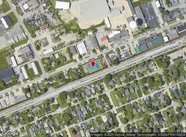
302 W Sophia St, Maumee, OH 43537

NEARBY LISTINGS FOR SALE OR LEASE
Property Detail
302 W Sophia St
Toledo, OH
Ewing & Rowans Addn
36-07505
EWING & ROWANS ADDN BLK 27 LOT 1 & LOT 1 BLK 27 HUNTS EXC ANTHONY
Officebuilding
Lucas
X
Ohio
39173C0010D
1
2024
0.28 AC
2024
South/Southwest
007102
Toledo
3,600 SF
DEMOGRAPHICS near 302 W Sophia St
1 Mile
3 Mile
5 Mile
2024 Total Population
3,722
51,335
115,153
2029 Population
3,608
50,821
114,260
Pop Growth 2024-2029
(3.06%)
(1.00%)
(0.78%)
Average Age
43
41
41
2024 Total Households
1,662
22,495
49,882
HH Growth 2024-2029
(3.19%)
(1.18%)
(0.88%)
Median Household Inc
$83,874
$73,772
$68,542
Avg Household Size
2.20
2.20
2.20
2024 Avg HH Vehicles
2.00
2.00
2.00
Median Home Value
$167,956
$202,296
$204,285
Median Year Built
1955
1975
1978
Nearby Places
Map Layers
Map Styles
 Street
 Aerial
- Restaurants
- Banks
- Shops
- Fitness
- Groceries
SALE & LEASE HISTORY
LISTING DATE
SALE/LEASE

May 08, 2020
For Lease
Mar 02, 2020
For Lease
Mar 02, 2020
For Sale
Jun 30, 2023
For Lease
Aug 14, 2017
For Lease
Nearby Properties
Address
Land Use
TOTAL SIZE
Lot Size
Zoning
Address
Land Use
TOTAL SIZE
Lot Size
Zoning
541,518 SF
21.30 AC
16-R1
Address
Land Use
TOTAL SIZE
Lot Size
Zoning
275,990 SF
49.65 AC
16-CM
Address
Land Use
TOTAL SIZE
Lot Size
Zoning
168,495 SF
12.36 AC
Address
Land Use
TOTAL SIZE
Lot Size
Zoning
56,660 SF
1.62 AC
16-M1
Address
Land Use
TOTAL SIZE
Lot Size
Zoning
67,264 SF
6.95 AC
16-CM
Address
Land Use
TOTAL SIZE
Lot Size
Zoning
131,721 SF
5.94 AC
Address
Land Use
TOTAL SIZE
Lot Size
Zoning
156,179 SF
15.67 AC
Address
Land Use
TOTAL SIZE
Lot Size
Zoning
35.94 AC
17-C3
Address
Land Use
TOTAL SIZE
Lot Size
Zoning
3.56 AC
Address
Land Use
TOTAL SIZE
Lot Size
Zoning
231,756 SF
31.37 AC
16-M1
Address
Land Use
TOTAL SIZE
Lot Size
Zoning
78,923 SF
10.12 AC
Address
Land Use
TOTAL SIZE
Lot Size
Zoning
173,528 SF
25.90 AC
Address
Land Use
TOTAL SIZE
Lot Size
Zoning
269,263 SF
55.93 AC
16-R2
Address
Land Use
TOTAL SIZE
Lot Size
Zoning
192,108 SF
33.10 AC
Address
Land Use
TOTAL SIZE
Lot Size
Zoning
231,670 SF
18.04 AC
Address
Land Use
TOTAL SIZE
Lot Size
Zoning
138,607 SF
21.30 AC
10-RS12
Address
Land Use
TOTAL SIZE
Lot Size
Zoning
606,883 SF
119.87 AC
16-M2
Address
Land Use
TOTAL SIZE
Lot Size
Zoning
352,382 SF
62.93 AC
16-M1
Address
Land Use
TOTAL SIZE
Lot Size
Zoning
8.57 AC
16-M1
Address
Land Use
TOTAL SIZE
Lot Size
Zoning
608,280 SF
48.86 AC
16-M2
Address
Land Use
TOTAL SIZE
Lot Size
Zoning
80,668 SF
9.67 AC
Address
Land Use
TOTAL SIZE
Lot Size
Zoning
212,672 SF
15.98 AC
17-R1
Address
Land Use
TOTAL SIZE
Lot Size
Zoning
148,107 SF
26.16 AC
Address
Land Use
TOTAL SIZE
Lot Size
Zoning
127,825 SF
10.99 AC
Address
Land Use
TOTAL SIZE
Lot Size
Zoning
214,986 SF
17.55 AC
19-R1
Address
Land Use
TOTAL SIZE
Lot Size
Zoning
119.87 AC
16-M2
Address
Land Use
TOTAL SIZE
Lot Size
Zoning
73,389 SF
1.78 AC
Address
Land Use
TOTAL SIZE
Lot Size
Zoning
77,030 SF
4.41 AC
16-M1
Address
Land Use
TOTAL SIZE
Lot Size
Zoning
78,166 SF
2.08 AC
16-CM
Address
Land Use
TOTAL SIZE
Lot Size
Zoning
342,566 SF
20.83 AC
17-M2
The World's #1 Commercial Real Estate Marketplace
Connect with us
© 2025 CoStar Group
The information above has been obtained from sources believed reliable. While we do not doubt its accuracy we have not verified it and make no guarantee, warranty or representation about it. It is your responsibility to independently confirm its accuracy and completeness. Any projections, opinions, assumptions, or estimates used are for example only and do not represent the current or future performance of the property. The value of this transaction to you depends on tax and other factors which should be evaluated by your tax, financial, and legal advisors. You and your advisors should conduct a careful, independent investigation of the property to determine to your satisfaction the suitability of the property for your needs.