Property Record
3020 Shawnee Dr, Winchester, VA 22601
NEARBY LISTINGS FOR SALE OR LEASE
-
-
View all Winchester listings for sale on LoopNet.com
Property Detail
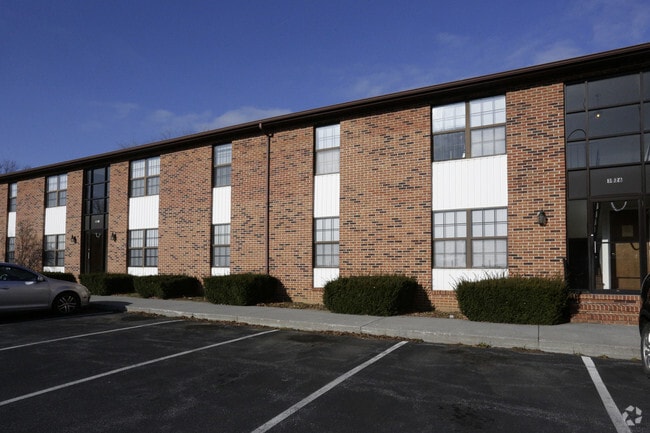
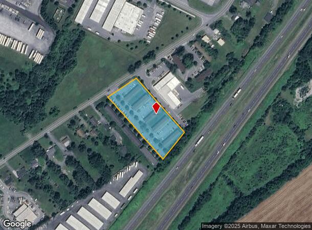
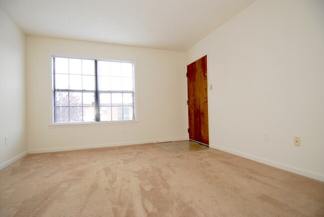
3020 Shawnee Dr
351-01-17C
E S 3020-3028 SHAWNEE DRIVE
Apartment
Winchester
X
Virginia
51069C0218E
1.69 AC
2025
Winchester County
2025
Washington, DC
000302
Winchester, VA-WV
6,900 SF
DEMOGRAPHICS near 3020 Shawnee Dr
1 mile
3 mile
5 mile
2024 Total Population
4,057
30,661
81,658
2029 Population
4,224
32,058
86,881
Pop Growth 2024-2029
+ 4.12%
+ 4.56%
+ 6.40%
Average Age
39
40
40
2024 Total Households
1,571
11,826
30,844
HH Growth 2024-2029
+ 4.01%
+ 4.26%
+ 6.11%
Median Household Inc
$61,437
$69,363
$74,857
Avg Household Size
2.50
2.40
2.50
2024 Avg HH Vehicles
2.00
2.00
2.00
Median Home Value
$286,792
$329,424
$307,103
Median Year Built
1977
1986
1986
Nearby Places
Map Layers
Map Styles
 Street
 Aerial
Transit
 Traffic
 Biking
Places
Listings with unknown addresses are not visible on the map
- Restaurants
- Banks
- Shops
- Fitness
- Groceries
Nearby Properties
Address
Land Use
TOTAL SIZE
Lot Size
Zoning
Address
Land Use
TOTAL SIZE
Lot Size
Zoning
64.27 AC
M1
Address
Land Use
TOTAL SIZE
Lot Size
Zoning
56,582 SF
35.39 AC
M1
Address
Land Use
TOTAL SIZE
Lot Size
Zoning
31,710 SF
47.28 AC
HE1
Address
Land Use
TOTAL SIZE
Lot Size
Zoning
375,081 SF
74.09 AC
M2
Address
Land Use
TOTAL SIZE
Lot Size
Zoning
156,379 SF
55.53 AC
RA
Address
Land Use
TOTAL SIZE
Lot Size
Zoning
1,440 SF
6.73 AC
RA
Address
Land Use
TOTAL SIZE
Lot Size
Zoning
30,054 SF
62.32 AC
M2
Address
Land Use
TOTAL SIZE
Lot Size
Zoning
411,597 SF
32.20 AC
M1
Address
Land Use
TOTAL SIZE
Lot Size
Zoning
15.24 AC
RP
Address
Land Use
TOTAL SIZE
Lot Size
Zoning
191,138 SF
35 AC
EIP
Address
Land Use
TOTAL SIZE
Lot Size
Zoning
11,979 SF
10.82 AC
HR
Address
Land Use
TOTAL SIZE
Lot Size
Zoning
254,560 SF
42.88 AC
M1
Address
Land Use
TOTAL SIZE
Lot Size
Zoning
462,500 SF
53.51 AC
B2
Address
Land Use
TOTAL SIZE
Lot Size
Zoning
351,500 SF
28.38 AC
M1
Address
Land Use
TOTAL SIZE
Lot Size
Zoning
422,658 SF
64.27 AC
M1
Address
Land Use
TOTAL SIZE
Lot Size
Zoning
27,464 SF
8.53 AC
B2
Address
Land Use
TOTAL SIZE
Lot Size
Zoning
231,756 SF
23.66 AC
CM1
Address
Land Use
TOTAL SIZE
Lot Size
Zoning
151,711 SF
16.25 AC
CM1
Address
Land Use
TOTAL SIZE
Lot Size
Zoning
181,832 SF
17.96 AC
CM1
Address
Land Use
TOTAL SIZE
Lot Size
Zoning
64,711 SF
18.10 AC
B2
Address
Land Use
TOTAL SIZE
Lot Size
Zoning
2,310 SF
17.28 AC
RP
Address
Land Use
TOTAL SIZE
Lot Size
Zoning
94,606 SF
4.92 AC
B2
Address
Land Use
TOTAL SIZE
Lot Size
Zoning
252,000 SF
24.87 AC
M1
Address
Land Use
TOTAL SIZE
Lot Size
Zoning
239,570 SF
17 AC
M1
Address
Land Use
TOTAL SIZE
Lot Size
Zoning
440,999 SF
55.46 AC
M1
Address
Land Use
TOTAL SIZE
Lot Size
Zoning
87,000 SF
16.30 AC
EIP
Address
Land Use
TOTAL SIZE
Lot Size
Zoning
83,786 SF
2.71 AC
HE1
Address
Land Use
TOTAL SIZE
Lot Size
Zoning
43,232 SF
169.19 AC
EIP
Address
Land Use
TOTAL SIZE
Lot Size
Zoning
12,000 SF
8.78 AC
CM1
Address
Land Use
TOTAL SIZE
Lot Size
Zoning
97,168 SF
16.78 AC
B2
The World's #1 Commercial Real Estate Marketplace
Connect with us
© 2026 CoStar Group
The information above has been obtained from sources believed reliable. While we do not doubt its accuracy we have not verified it and make no guarantee, warranty or representation about it. It is your responsibility to independently confirm its accuracy and completeness. Any projections, opinions, assumptions, or estimates used are for example only and do not represent the current or future performance of the property. The value of this transaction to you depends on tax and other factors which should be evaluated by your tax, financial, and legal advisors. You and your advisors should conduct a careful, independent investigation of the property to determine to your satisfaction the suitability of the property for your needs.