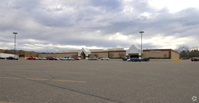
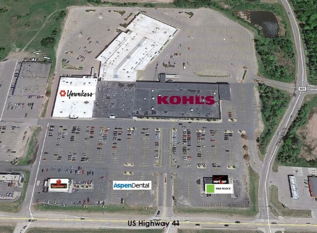
Property Record
3020 Us Highway 41 W, Marquette, MI 49855
NEARBY LISTINGS FOR SALE OR LEASE
Property Detail
3020 Us Highway 41 W
Marquette, MI
Fassbender Farm Assessors Plat
52-08-450-008-00
ASSESSOR'S PLAT OF FASSBENDER FARM LOT 10
Commercialnec
Marquette
X
Michigan
26103C0495E
10
2025
5.90 AC
2025
Upper Peninsula
002901
Other Market Areas
112,044 SF
DEMOGRAPHICS near 3020 Us Highway 41 W
1 Mile
3 Mile
5 Mile
2024 Total Population
2,539
21,031
26,050
2029 Population
2,571
21,271
26,353
Pop Growth 2024-2029
+ 1.26%
+ 1.14%
+ 1.16%
Average Age
42
39
39
2024 Total Households
1,177
8,686
10,695
HH Growth 2024-2029
+ 1.36%
+ 1.20%
+ 1.19%
Median Household Inc
$60,150
$47,886
$51,536
Avg Household Size
2.10
2.00
2.10
2024 Avg HH Vehicles
2.00
2.00
2.00
Median Home Value
$242,246
$223,114
$233,790
Median Year Built
1989
1972
1972
Nearby Places
Map Layers
Map Styles
 Street
 Aerial
- Restaurants
- Banks
- Shops
- Fitness
- Groceries
PUBLIC TRANSPORTATION
AIRPORT
Marquette/Sawyer Regional
DRIVE
WALK
Distance
Marquette/Sawyer Regional
28 min
17.5 mi
SALE & LEASE HISTORY
LISTING DATE
SALE/LEASE

Sep 25, 2016
For Lease
Nearby Properties
Address
Land Use
TOTAL SIZE
Lot Size
Zoning
Address
Land Use
TOTAL SIZE
Lot Size
Zoning
605,039 SF
39.11 AC
PUD
Address
Land Use
TOTAL SIZE
Lot Size
Zoning
254,287 SF
11.83 AC
M-U
Address
Land Use
TOTAL SIZE
Lot Size
Zoning
276,832 SF
21.36 AC
MFR
Address
Land Use
TOTAL SIZE
Lot Size
Zoning
104,333 SF
8.14 AC
RC
Address
Land Use
TOTAL SIZE
Lot Size
Zoning
106,380 SF
1.41 AC
PUD
Address
Land Use
TOTAL SIZE
Lot Size
Zoning
195,283 SF
10.25 AC
DD
Address
Land Use
TOTAL SIZE
Lot Size
Zoning
206,601 SF
21.83 AC
GB
Address
Land Use
TOTAL SIZE
Lot Size
Zoning
62,642 SF
47.89 AC
MFR
Address
Land Use
TOTAL SIZE
Lot Size
Zoning
184,024 SF
7.52 AC
MFR
Address
Land Use
TOTAL SIZE
Lot Size
Zoning
79,558 SF
17.85 AC
RC
Address
Land Use
TOTAL SIZE
Lot Size
Zoning
156,460 SF
14.25 AC
GB
Address
Land Use
TOTAL SIZE
Lot Size
Zoning
105,283 SF
6.40 AC
IM
Address
Land Use
TOTAL SIZE
Lot Size
Zoning
220,560 SF
22.20 AC
GB
Address
Land Use
TOTAL SIZE
Lot Size
Zoning
58,524 SF
4.02 AC
M-U
Address
Land Use
TOTAL SIZE
Lot Size
Zoning
23,286 SF
0.76 AC
PUD
Address
Land Use
TOTAL SIZE
Lot Size
Zoning
36,720 SF
I
Address
Land Use
TOTAL SIZE
Lot Size
Zoning
78,717 SF
19.14 AC
RC
Address
Land Use
TOTAL SIZE
Lot Size
Zoning
152.60 AC
RP
Address
Land Use
TOTAL SIZE
Lot Size
Zoning
49,463 SF
5.16 AC
PUD
Address
Land Use
TOTAL SIZE
Lot Size
Zoning
45,775 SF
1.49 AC
F 5
Address
Land Use
TOTAL SIZE
Lot Size
Zoning
48,579 SF
0.81 AC
PUD
Address
Land Use
TOTAL SIZE
Lot Size
Zoning
38,763 SF
I
Address
Land Use
TOTAL SIZE
Lot Size
Zoning
55,204 SF
1.13 AC
GC
Address
Land Use
TOTAL SIZE
Lot Size
Zoning
7.89 AC
DD
Address
Land Use
TOTAL SIZE
Lot Size
Zoning
126,697 SF
8.62 AC
GC
Address
Land Use
TOTAL SIZE
Lot Size
Zoning
125,381 SF
13.11 AC
GB
Address
Land Use
TOTAL SIZE
Lot Size
Zoning
42,108 SF
0.95 AC
CBD
Address
Land Use
TOTAL SIZE
Lot Size
Zoning
36,600 SF
6.06 AC
GB
Address
Land Use
TOTAL SIZE
Lot Size
Zoning
37,112 SF
3.05 AC
GC
Address
Land Use
TOTAL SIZE
Lot Size
Zoning
95,476 SF
7.29 AC
GB
The World's #1 Commercial Real Estate Marketplace
Connect with us
© 2026 CoStar Group
The information above has been obtained from sources believed reliable. While we do not doubt its accuracy we have not verified it and make no guarantee, warranty or representation about it. It is your responsibility to independently confirm its accuracy and completeness. Any projections, opinions, assumptions, or estimates used are for example only and do not represent the current or future performance of the property. The value of this transaction to you depends on tax and other factors which should be evaluated by your tax, financial, and legal advisors. You and your advisors should conduct a careful, independent investigation of the property to determine to your satisfaction the suitability of the property for your needs.