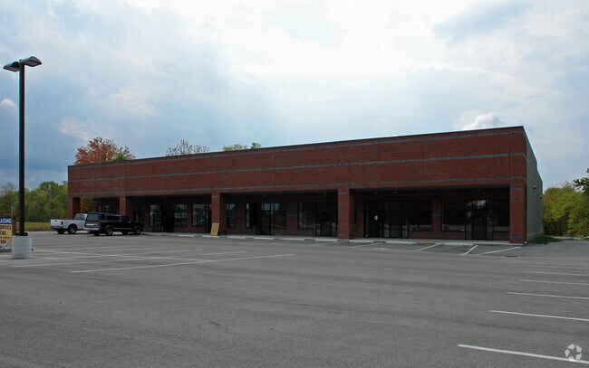
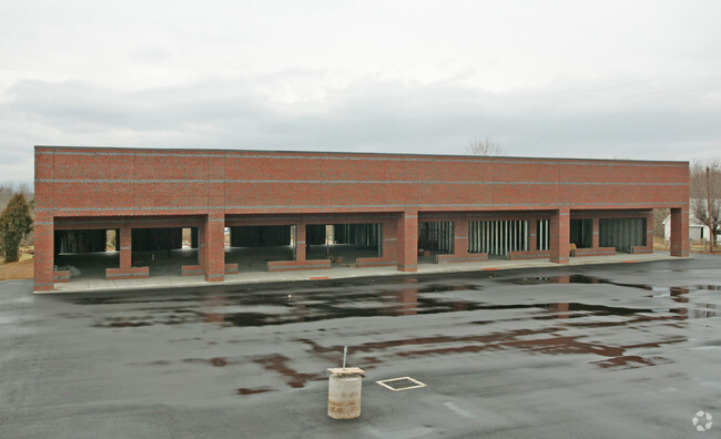
Property Record
3021 State Route 125, Bethel, OH 45106


NEARBY LISTINGS FOR SALE OR LEASE
-
-
View all Bethel listings for lease on LoopNet.com
Property Detail
3021 State Route 125
32-30-13C-103
Breckenridge Military Survey #2373
Stripcommercialcenter
Clermont
X
Ohio
39015C0225D
1.77 AC
2024
Outlying Cincinnati East
2024
Cincinnati/Dayton
041800
Cincinnati, OH-KY-IN
15,768 SF
DEMOGRAPHICS near 3021 State Route 125
1 Mile
3 Mile
5 Mile
2024 Total Population
1,300
7,090
13,901
2029 Population
1,327
7,231
14,206
Pop Growth 2024-2029
+ 2.08%
+ 1.99%
+ 2.19%
Average Age
41
42
42
2024 Total Households
516
2,782
5,327
HH Growth 2024-2029
+ 2.13%
+ 2.05%
+ 2.22%
Median Household Inc
$57,499
$60,277
$64,551
Avg Household Size
2.50
2.50
2.60
2024 Avg HH Vehicles
2.00
2.00
2.00
Median Home Value
$157,111
$168,672
$183,584
Median Year Built
1970
1967
1975
Nearby Places
Map Layers
Map Styles
 Street
 Aerial
- Restaurants
- Banks
- Shops
- Fitness
- Groceries
PUBLIC TRANSPORTATION
AIRPORT
Cincinnati/Northern Kentucky International
DRIVE
WALK
Distance
Cincinnati/Northern Kentucky International
47 min
35.9 mi
SALE & LEASE HISTORY
LISTING DATE
SALE/LEASE

Sep 24, 2016
For Lease
Sep 24, 2016
For Sale
Nearby Properties
Address
Land Use
TOTAL SIZE
Lot Size
Zoning
Address
Land Use
TOTAL SIZE
Lot Size
Zoning
40.43 AC
Address
Land Use
TOTAL SIZE
Lot Size
Zoning
43.24 AC
Address
Land Use
TOTAL SIZE
Lot Size
Zoning
21.25 AC
Address
Land Use
TOTAL SIZE
Lot Size
Zoning
23.18 AC
Address
Land Use
TOTAL SIZE
Lot Size
Zoning
14.48 AC
Address
Land Use
TOTAL SIZE
Lot Size
Zoning
5,184 SF
12.11 AC
Address
Land Use
TOTAL SIZE
Lot Size
Zoning
16,327 SF
0.25 AC
Address
Land Use
TOTAL SIZE
Lot Size
Zoning
36,780 SF
4.60 AC
Address
Land Use
TOTAL SIZE
Lot Size
Zoning
102.35 AC
Address
Land Use
TOTAL SIZE
Lot Size
Zoning
1,485 SF
9.33 AC
Address
Land Use
TOTAL SIZE
Lot Size
Zoning
6.64 AC
Address
Land Use
TOTAL SIZE
Lot Size
Zoning
5,822 SF
2.75 AC
Address
Land Use
TOTAL SIZE
Lot Size
Zoning
10,289 SF
0.36 AC
Address
Land Use
TOTAL SIZE
Lot Size
Zoning
4,262 SF
1.35 AC
Address
Land Use
TOTAL SIZE
Lot Size
Zoning
9,002 SF
1.60 AC
Address
Land Use
TOTAL SIZE
Lot Size
Zoning
23,904 SF
2.77 AC
Address
Land Use
TOTAL SIZE
Lot Size
Zoning
4,318 SF
15.29 AC
Address
Land Use
TOTAL SIZE
Lot Size
Zoning
9,090 SF
1.02 AC
Address
Land Use
TOTAL SIZE
Lot Size
Zoning
1,500 SF
192.06 AC
Address
Land Use
TOTAL SIZE
Lot Size
Zoning
9,192 SF
0.49 AC
Address
Land Use
TOTAL SIZE
Lot Size
Zoning
4,480 SF
5 AC
Address
Land Use
TOTAL SIZE
Lot Size
Zoning
2,128 SF
0.56 AC
Address
Land Use
TOTAL SIZE
Lot Size
Zoning
2,896 SF
0.80 AC
Address
Land Use
TOTAL SIZE
Lot Size
Zoning
1,504 SF
148.72 AC
Address
Land Use
TOTAL SIZE
Lot Size
Zoning
73.22 AC
Address
Land Use
TOTAL SIZE
Lot Size
Zoning
65.18 AC
Address
Land Use
TOTAL SIZE
Lot Size
Zoning
2,010 SF
123.31 AC
Address
Land Use
TOTAL SIZE
Lot Size
Zoning
14,527 SF
2 AC
Address
Land Use
TOTAL SIZE
Lot Size
Zoning
2,210 SF
1.38 AC
The World's #1 Commercial Real Estate Marketplace
Connect with us
© 2026 CoStar Group
The information above has been obtained from sources believed reliable. While we do not doubt its accuracy we have not verified it and make no guarantee, warranty or representation about it. It is your responsibility to independently confirm its accuracy and completeness. Any projections, opinions, assumptions, or estimates used are for example only and do not represent the current or future performance of the property. The value of this transaction to you depends on tax and other factors which should be evaluated by your tax, financial, and legal advisors. You and your advisors should conduct a careful, independent investigation of the property to determine to your satisfaction the suitability of the property for your needs.