Property Record
30216 Us Highway 60 89, Wickenburg, AZ 85390
NEARBY LISTINGS FOR SALE OR LEASE
Property Detail
30216 Us Highway 60 89
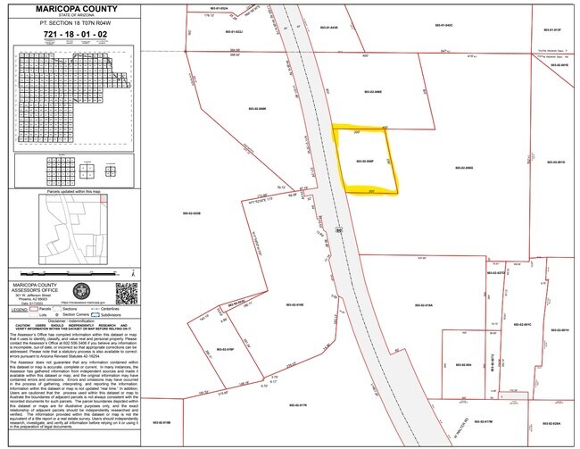
503-02-006E
Broadway Estates
Storebuilding
PT NE4 DAF BEG AT INTERSEC OF N LN OF NE4 WITH NE LY R/W LI OF PHOENIX-WICKENBURG H/W SD INTERSEC B EING LOCATED N 89D 58M E 488.8F FR NW COR NE4 TH SELY 300F TH N 89D 58M E 400F TO A PT TH N 14D 29 M W 300F TO A PT ON N LI SD NE4 TH S 89D 58M W 40 0
X
Maricopa
04013C0329M
Arizona
2025
2.76 AC
2025
W Outlying Maricopa
040539
Phoenix
430 SF
Phoenix-Mesa-Scottsdale, AZ
DEMOGRAPHICS near 30216 Us Highway 60 89
1 Mile
3 Mile
5 Mile
2024 Total Population
595
5,508
9,118
2029 Population
652
6,088
10,020
Pop Growth 2024-2029
+ 9.58%
+ 10.53%
+ 9.89%
Average Age
50
48
50
2024 Total Households
262
2,522
4,197
HH Growth 2024-2029
+ 9.92%
+ 10.63%
+ 9.98%
Median Household Inc
$54,722
$59,097
$59,536
Avg Household Size
2.30
2.10
2.10
2024 Avg HH Vehicles
3.00
2.00
2.00
Median Home Value
$577,981
$470,683
$472,706
Median Year Built
1991
1983
1986
Nearby Places
Map Layers
Map Styles
 Street
 Aerial
- Restaurants
- Banks
- Shops
- Fitness
- Groceries
Nearby Properties
Address
Land Use
TOTAL SIZE
Lot Size
Zoning
Address
Land Use
TOTAL SIZE
Lot Size
Zoning
65,984 SF
4.11 AC
D
Address
Land Use
TOTAL SIZE
Lot Size
Zoning
131,011 SF
5.14 AC
R112
Address
Land Use
TOTAL SIZE
Lot Size
Zoning
Address
Land Use
TOTAL SIZE
Lot Size
Zoning
45,912 SF
6.27 AC
R-12
Address
Land Use
TOTAL SIZE
Lot Size
Zoning
5,992 SF
11.78 AC
R-12
Address
Land Use
TOTAL SIZE
Lot Size
Zoning
17,872 SF
5.26 AC
D
Address
Land Use
TOTAL SIZE
Lot Size
Zoning
27,377 SF
3.85 AC
C-G
Address
Land Use
TOTAL SIZE
Lot Size
Zoning
23,619 SF
48.59 AC
Address
Land Use
TOTAL SIZE
Lot Size
Zoning
23,219 SF
0.81 AC
C2
Address
Land Use
TOTAL SIZE
Lot Size
Zoning
17,552 SF
1.66 AC
C-G
Address
Land Use
TOTAL SIZE
Lot Size
Zoning
22,908 SF
0.48 AC
C-C
Address
Land Use
TOTAL SIZE
Lot Size
Zoning
31,679 SF
1.29 AC
R-6
Address
Land Use
TOTAL SIZE
Lot Size
Zoning
8,672 SF
71.28 AC
R-35
Address
Land Use
TOTAL SIZE
Lot Size
Zoning
29,400 SF
2.38 AC
C-G
Address
Land Use
TOTAL SIZE
Lot Size
Zoning
45,157 SF
3.67 AC
D
Address
Land Use
TOTAL SIZE
Lot Size
Zoning
2,850 SF
279.90 AC
R-35
Address
Land Use
TOTAL SIZE
Lot Size
Zoning
8,212 SF
2.34 AC
C-3
Address
Land Use
TOTAL SIZE
Lot Size
Zoning
26,073 SF
4.54 AC
Address
Land Use
TOTAL SIZE
Lot Size
Zoning
41,518 SF
1.10 AC
C2
Address
Land Use
TOTAL SIZE
Lot Size
Zoning
23,287 SF
2.76 AC
D
Address
Land Use
TOTAL SIZE
Lot Size
Zoning
29,817 SF
2.32 AC
Address
Land Use
TOTAL SIZE
Lot Size
Zoning
8,917 SF
0.16 AC
C-C
Address
Land Use
TOTAL SIZE
Lot Size
Zoning
17,555 SF
2.75 AC
C-G
Address
Land Use
TOTAL SIZE
Lot Size
Zoning
24,786 SF
1.14 AC
C-G
Address
Land Use
TOTAL SIZE
Lot Size
Zoning
22,386 SF
1.43 AC
RM1
Address
Land Use
TOTAL SIZE
Lot Size
Zoning
17,780 SF
0.90 AC
C-G
Address
Land Use
TOTAL SIZE
Lot Size
Zoning
9,684 SF
7.05 AC
RU43
Address
Land Use
TOTAL SIZE
Lot Size
Zoning
5,461 SF
1.41 AC
C-G
Address
Land Use
TOTAL SIZE
Lot Size
Zoning
8,193 SF
65.34 AC
RU43
The World's #1 Commercial Real Estate Marketplace
Connect with us
© 2025 CoStar Group
The information above has been obtained from sources believed reliable. While we do not doubt its accuracy we have not verified it and make no guarantee, warranty or representation about it. It is your responsibility to independently confirm its accuracy and completeness. Any projections, opinions, assumptions, or estimates used are for example only and do not represent the current or future performance of the property. The value of this transaction to you depends on tax and other factors which should be evaluated by your tax, financial, and legal advisors. You and your advisors should conduct a careful, independent investigation of the property to determine to your satisfaction the suitability of the property for your needs.