Property Record
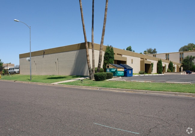
3007 W Indian School Rd, Phoenix, AZ 85017


NEARBY LISTINGS FOR SALE OR LEASE
Property Detail
3007 W Indian School Rd
Phoenix-Mesa-Scottsdale, AZ
Thunderbird Business Park Lot 2 Condomin
108-01-184
THUNDERBIRD BUSINESS PARK LOT 2 CONDOMINIUM MCR 722-37
Publicschool
Maricopa
X
Arizona
04013C2205L
2
0
0.45 AC
2025
W Phx N of Thomas Rd
107201
Phoenix
33,790 SF
DEMOGRAPHICS near 3007 W Indian School Rd
1 Mile
3 Mile
5 Mile
2024 Total Population
22,310
196,508
500,383
2029 Population
24,019
211,224
540,356
Pop Growth 2024-2029
+ 7.66%
+ 7.49%
+ 7.99%
Average Age
32
34
35
2024 Total Households
6,863
64,097
177,210
HH Growth 2024-2029
+ 7.68%
+ 7.95%
+ 8.49%
Median Household Inc
$45,143
$50,666
$51,247
Avg Household Size
3.10
2.80
2.60
2024 Avg HH Vehicles
2.00
2.00
2.00
Median Home Value
$220,370
$258,909
$285,958
Median Year Built
1971
1967
1971
Nearby Places
Map Layers
Map Styles
 Street
 Aerial
- Restaurants
- Banks
- Shops
- Fitness
- Groceries
PUBLIC TRANSPORTATION
AIRPORT
Phoenix Sky Harbor International
DRIVE
WALK
Distance
Phoenix Sky Harbor International
19 min
11.2 mi
Phoenix-Mesa Gateway
DRIVE
WALK
Distance
Phoenix-Mesa Gateway
52 min
38.4 mi
SALE & LEASE HISTORY
LISTING DATE
SALE/LEASE

Aug 10, 2022
For Sale
Nearby Properties
Address
Land Use
TOTAL SIZE
Lot Size
Zoning
Address
Land Use
TOTAL SIZE
Lot Size
Zoning
1.85 AC
Address
Land Use
TOTAL SIZE
Lot Size
Zoning
2,334,671 SF
32.63 AC
C-2
Address
Land Use
TOTAL SIZE
Lot Size
Zoning
96,183 SF
11.04 AC
R-6
Address
Land Use
TOTAL SIZE
Lot Size
Zoning
686,094 SF
5.09 AC
C-C
Address
Land Use
TOTAL SIZE
Lot Size
Zoning
69,542 SF
4.92 AC
I-P
Address
Land Use
TOTAL SIZE
Lot Size
Zoning
377,037 SF
35.46 AC
R1-6
Address
Land Use
TOTAL SIZE
Lot Size
Zoning
956,022 SF
14.86 AC
Address
Land Use
TOTAL SIZE
Lot Size
Zoning
547,141 SF
18.52 AC
R-6
Address
Land Use
TOTAL SIZE
Lot Size
Zoning
184,363 SF
1.24 AC
WU
Address
Land Use
TOTAL SIZE
Lot Size
Zoning
496,222 SF
29.53 AC
C-R
Address
Land Use
TOTAL SIZE
Lot Size
Zoning
42,631 SF
2.90 AC
A-2
Address
Land Use
TOTAL SIZE
Lot Size
Zoning
329,830 SF
12.18 AC
Address
Land Use
TOTAL SIZE
Lot Size
Zoning
281,038 SF
7.71 AC
Address
Land Use
TOTAL SIZE
Lot Size
Zoning
32,600 SF
2.38 AC
R-5
Address
Land Use
TOTAL SIZE
Lot Size
Zoning
337,487 SF
39 AC
R-6
Address
Land Use
TOTAL SIZE
Lot Size
Zoning
423,681 SF
8.29 AC
Address
Land Use
TOTAL SIZE
Lot Size
Zoning
474,952 SF
13.68 AC
C-C
Address
Land Use
TOTAL SIZE
Lot Size
Zoning
378,071 SF
1.52 AC
C-C
Address
Land Use
TOTAL SIZE
Lot Size
Zoning
449,802 SF
27.08 AC
A-1
Address
Land Use
TOTAL SIZE
Lot Size
Zoning
5.67 AC
Address
Land Use
TOTAL SIZE
Lot Size
Zoning
464,812 SF
35.43 AC
R16
Address
Land Use
TOTAL SIZE
Lot Size
Zoning
299,513 SF
43.10 AC
M-H
Address
Land Use
TOTAL SIZE
Lot Size
Zoning
335,757 SF
6.20 AC
Address
Land Use
TOTAL SIZE
Lot Size
Zoning
25.91 AC
A1
Address
Land Use
TOTAL SIZE
Lot Size
Zoning
350,874 SF
28.66 AC
C-C
Address
Land Use
TOTAL SIZE
Lot Size
Zoning
401,203 SF
7.25 AC
C2
Address
Land Use
TOTAL SIZE
Lot Size
Zoning
298,021 SF
1.63 AC
Address
Land Use
TOTAL SIZE
Lot Size
Zoning
211,015 SF
9.59 AC
R-6
Address
Land Use
TOTAL SIZE
Lot Size
Zoning
364,236 SF
2.99 AC
WU
Address
Land Use
TOTAL SIZE
Lot Size
Zoning
100,000 SF
77.44 AC
R1-6
The World's #1 Commercial Real Estate Marketplace
Connect with us
© 2025 CoStar Group
The information above has been obtained from sources believed reliable. While we do not doubt its accuracy we have not verified it and make no guarantee, warranty or representation about it. It is your responsibility to independently confirm its accuracy and completeness. Any projections, opinions, assumptions, or estimates used are for example only and do not represent the current or future performance of the property. The value of this transaction to you depends on tax and other factors which should be evaluated by your tax, financial, and legal advisors. You and your advisors should conduct a careful, independent investigation of the property to determine to your satisfaction the suitability of the property for your needs.