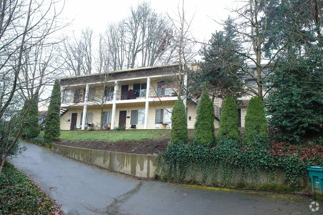
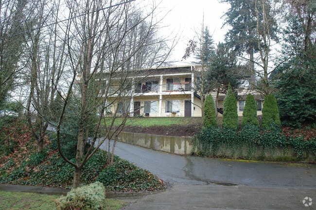
Property Record
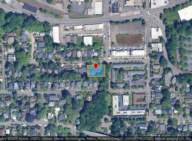
3024 Nw Wilson St, Portland, OR 97210

NEARBY LISTINGS FOR SALE OR LEASE
Property Detail
3024 Nw Wilson St
Portland-Vancouver-Hillsboro, OR-WA
Willamette Hts Add
R307760
WILLAMETTE HTS ADD, BLOCK 16, LOT 1&2&6
Multifamilydwelling
Multnomah
ARE
Oregon
41067C0400E
1,2
2025
0.34 AC
2025
Uptown Portland
004500
Portland
5,688 SF
DEMOGRAPHICS near 3024 Nw Wilson St
1 Mile
3 Mile
5 Mile
2024 Total Population
10,280
134,585
374,948
2029 Population
10,227
134,615
371,411
Pop Growth 2024-2029
(0.52%)
+ 0.02%
(0.94%)
Average Age
41
40
40
2024 Total Households
5,599
70,545
175,776
HH Growth 2024-2029
(0.59%)
0.00%
(0.97%)
Median Household Inc
$102,433
$80,426
$90,847
Avg Household Size
1.80
1.80
2.00
2024 Avg HH Vehicles
1.00
1.00
1.00
Median Home Value
$845,785
$714,824
$681,489
Median Year Built
1977
1983
1969
Nearby Places
Map Layers
Map Styles
 Street
 Aerial
- Restaurants
- Banks
- Shops
- Fitness
- Groceries
PUBLIC TRANSPORTATION
COMMUTER RAIL
DRIVE
WALK
Distance
8 min
2.4 mi
AIRPORT
Portland International
DRIVE
WALK
Distance
Portland International
24 min
12.0 mi
Freight Ports
Port of Portland
DRIVE
WALK
Distance
Port of Portland
4 min
1.5 mi
Nearby Properties
Address
Land Use
TOTAL SIZE
Lot Size
Zoning
Address
Land Use
TOTAL SIZE
Lot Size
Zoning
395,815 SF
2.66 AC
IRD
Address
Land Use
TOTAL SIZE
Lot Size
Zoning
27.58 AC
EX
Address
Land Use
TOTAL SIZE
Lot Size
Zoning
627,500 SF
16.60 AC
CX
Address
Land Use
TOTAL SIZE
Lot Size
Zoning
882,480 SF
80.73 AC
CI1
Address
Land Use
TOTAL SIZE
Lot Size
Zoning
57,314 SF
60.69 AC
OS
Address
Land Use
TOTAL SIZE
Lot Size
Zoning
560,000 SF
0.15 AC
CX
Address
Land Use
TOTAL SIZE
Lot Size
Zoning
20.71 AC
OS
Address
Land Use
TOTAL SIZE
Lot Size
Zoning
409,260 SF
7.41 AC
EX
Address
Land Use
TOTAL SIZE
Lot Size
Zoning
326,547 SF
2.42 AC
RH
Address
Land Use
TOTAL SIZE
Lot Size
Zoning
304,836 SF
10.85 AC
CX
Address
Land Use
TOTAL SIZE
Lot Size
Zoning
417,324 SF
0.68 AC
CX
Address
Land Use
TOTAL SIZE
Lot Size
Zoning
598,328 SF
12.32 AC
CX
Address
Land Use
TOTAL SIZE
Lot Size
Zoning
257,700 SF
2.89 AC
EX
Address
Land Use
TOTAL SIZE
Lot Size
Zoning
128,500 SF
6.95 AC
OS
Address
Land Use
TOTAL SIZE
Lot Size
Zoning
460,000 SF
0.92 AC
CX
Address
Land Use
TOTAL SIZE
Lot Size
Zoning
689,840 SF
0.92 AC
CX
Address
Land Use
TOTAL SIZE
Lot Size
Zoning
125,217 SF
0.23 AC
CX
Address
Land Use
TOTAL SIZE
Lot Size
Zoning
97,465 SF
107.18 AC
OS
Address
Land Use
TOTAL SIZE
Lot Size
Zoning
Address
Land Use
TOTAL SIZE
Lot Size
Zoning
426,742 SF
0.53 AC
RXD
Address
Land Use
TOTAL SIZE
Lot Size
Zoning
243,371 SF
0.67 AC
CI2
Address
Land Use
TOTAL SIZE
Lot Size
Zoning
584,483 SF
0.90 AC
CX
Address
Land Use
TOTAL SIZE
Lot Size
Zoning
645,294 SF
5.64 AC
CO2D
Address
Land Use
TOTAL SIZE
Lot Size
Zoning
247,520 SF
7.74 AC
CX
Address
Land Use
TOTAL SIZE
Lot Size
Zoning
306,000 SF
1.21 AC
NULL
Address
Land Use
TOTAL SIZE
Lot Size
Zoning
596,161 SF
0.92 AC
CX
Address
Land Use
TOTAL SIZE
Lot Size
Zoning
456,760 SF
0.53 AC
EX
Address
Land Use
TOTAL SIZE
Lot Size
Zoning
193,898 SF
2.50 AC
IRD
Address
Land Use
TOTAL SIZE
Lot Size
Zoning
134,398 SF
3.17 AC
CG
Address
Land Use
TOTAL SIZE
Lot Size
Zoning
387,000 SF
0.88 AC
CXD
The World's #1 Commercial Real Estate Marketplace
Connect with us
© 2026 CoStar Group
The information above has been obtained from sources believed reliable. While we do not doubt its accuracy we have not verified it and make no guarantee, warranty or representation about it. It is your responsibility to independently confirm its accuracy and completeness. Any projections, opinions, assumptions, or estimates used are for example only and do not represent the current or future performance of the property. The value of this transaction to you depends on tax and other factors which should be evaluated by your tax, financial, and legal advisors. You and your advisors should conduct a careful, independent investigation of the property to determine to your satisfaction the suitability of the property for your needs.