Property Record
3024 Tower Rd, Rapid City, SD 57701
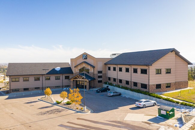


Property Detail
3024 Tower Rd
Rapid City, SD
SKYLINE PINES EAST SUBD, LOT 7
0062990
Pennington
Medicalbuilding
South Dakota
B and X Area of moderate flood hazard, usually the area between the limits of the 100-year and 500-year floods.
7
2025
2.20 AC
2025
Rapid City
010905
Other Market Areas
13,152 SF
NEARBY LISTINGS FOR SALE OR LEASE
DEMOGRAPHICS near 3024 Tower Rd
1 mile
3 mile
5 mile
2025 Total Population
5,111
50,939
82,474
2030 Population
5,331
52,959
85,975
Pop Growth 2025-2030
+ 4.30%
+ 3.97%
+ 4.24%
Average Age
45
42
41
2025 Total Households
2,171
21,830
34,588
HH Growth 2025-2030
+ 4.61%
+ 4.28%
+ 4.50%
Median Household Inc
$75,037
$68,875
$73,096
Avg Household Size
2.20
2.10
2.20
2025 Avg HH Vehicles
2.00
2.00
2.00
Median Home Value
$312,188
$305,642
$312,260
Median Year Built
1974
1978
1981
Nearby Places
Map Layers
Map Styles
 Street
 Aerial
Transit
 Traffic
 Biking
Places
Listings with unknown addresses are not visible on the map
- Restaurants
- Banks
- Shops
- Fitness
- Groceries
PUBLIC TRANSPORTATION
AIRPORT
Rapid City Regional
Drive
Walk
Distance
Rapid City Regional
22 min
11.4 mi
Freight Ports
Tulsa Port Of Catoosa
Drive
Walk
Distance
Tulsa Port Of Catoosa
974 min
892.7 mi
SALE & LEASE HISTORY
LISTING DATE
SALE/LEASE

Oct 21, 2019
For Sale
Jan 31, 2020
For Lease
Nearby Properties
Address
Land Use
TOTAL SIZE
Lot Size
Zoning
Address
Land Use
TOTAL SIZE
Lot Size
Zoning
3,312 SF
27.57 AC
Address
Land Use
TOTAL SIZE
Lot Size
Zoning
19,728 SF
7.67 AC
Address
Land Use
TOTAL SIZE
Lot Size
Zoning
23,278 SF
9.23 AC
Address
Land Use
TOTAL SIZE
Lot Size
Zoning
56,132 SF
7.14 AC
Address
Land Use
TOTAL SIZE
Lot Size
Zoning
4,759 SF
7.78 AC
Address
Land Use
TOTAL SIZE
Lot Size
Zoning
3,703 SF
8.46 AC
Address
Land Use
TOTAL SIZE
Lot Size
Zoning
12,258 SF
7.62 AC
Address
Land Use
TOTAL SIZE
Lot Size
Zoning
48,204 SF
15.19 AC
Address
Land Use
TOTAL SIZE
Lot Size
Zoning
6,820 SF
10.60 AC
Address
Land Use
TOTAL SIZE
Lot Size
Zoning
12,464 SF
4.94 AC
Address
Land Use
TOTAL SIZE
Lot Size
Zoning
8,764 SF
6 AC
Address
Land Use
TOTAL SIZE
Lot Size
Zoning
2,058 SF
6.70 AC
Address
Land Use
TOTAL SIZE
Lot Size
Zoning
48,108 SF
38.14 AC
Address
Land Use
TOTAL SIZE
Lot Size
Zoning
26,807 SF
0.58 AC
Address
Land Use
TOTAL SIZE
Lot Size
Zoning
24,360 SF
4.24 AC
Address
Land Use
TOTAL SIZE
Lot Size
Zoning
48,263 SF
7.28 AC
Address
Land Use
TOTAL SIZE
Lot Size
Zoning
29,226 SF
1.38 AC
Address
Land Use
TOTAL SIZE
Lot Size
Zoning
14,360 SF
2.07 AC
Address
Land Use
TOTAL SIZE
Lot Size
Zoning
25,762 SF
5.74 AC
Address
Land Use
TOTAL SIZE
Lot Size
Zoning
48,084 SF
5.74 AC
Address
Land Use
TOTAL SIZE
Lot Size
Zoning
26,845 SF
3.49 AC
Address
Land Use
TOTAL SIZE
Lot Size
Zoning
17,392 SF
7.85 AC
Address
Land Use
TOTAL SIZE
Lot Size
Zoning
10,128 SF
2 AC
Address
Land Use
TOTAL SIZE
Lot Size
Zoning
164,294 SF
19 AC
Address
Land Use
TOTAL SIZE
Lot Size
Zoning
27,300 SF
70.55 AC
Address
Land Use
TOTAL SIZE
Lot Size
Zoning
35,999 SF
3.01 AC
Address
Land Use
TOTAL SIZE
Lot Size
Zoning
5,448 SF
7.92 AC
Address
Land Use
TOTAL SIZE
Lot Size
Zoning
3,008 SF
4.66 AC
Address
Land Use
TOTAL SIZE
Lot Size
Zoning
30,740 SF
3.22 AC
Address
Land Use
TOTAL SIZE
Lot Size
Zoning
37,888 SF
6.21 AC
The World's #1 Commercial Real Estate Marketplace
Connect with us
© 2026 CoStar Group
The information above has been obtained from sources believed reliable. While we do not doubt its accuracy we have not verified it and make no guarantee, warranty or representation about it. It is your responsibility to independently confirm its accuracy and completeness. Any projections, opinions, assumptions, or estimates used are for example only and do not represent the current or future performance of the property. The value of this transaction to you depends on tax and other factors which should be evaluated by your tax, financial, and legal advisors. You and your advisors should conduct a careful, independent investigation of the property to determine to your satisfaction the suitability of the property for your needs.