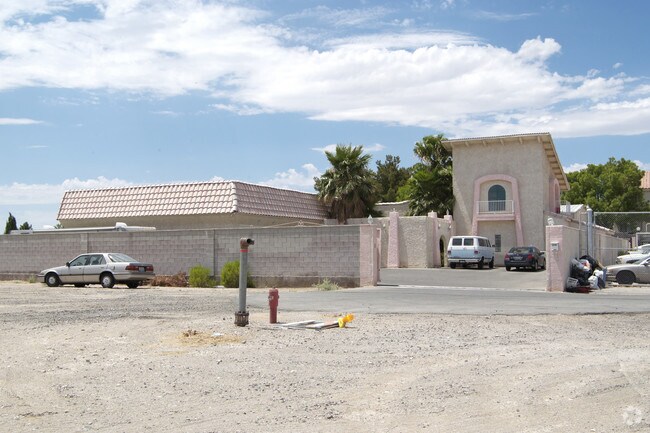
Property Record
3025 E Sunset Rd, Las Vegas, NV 89120


NEARBY LISTINGS FOR SALE OR LEASE
Property Detail
3025 E Sunset Rd
Las Vegas-Henderson-Paradise, NV
Parcel Map File 121 Page 063
177-01-501-017
Clark
Residentialnec
Nevada
X
2.74 AC
32003C2580F
South Las Vegas
4,183 SF
Las Vegas
DEMOGRAPHICS near 3025 E Sunset Rd
1 Mile
3 Mile
5 Mile
2024 Total Population
3,624
136,727
409,803
2029 Population
3,788
146,371
438,626
Pop Growth 2024-2029
+ 4.53%
+ 7.05%
+ 7.03%
Average Age
43
41
40
2024 Total Households
1,575
55,715
168,065
HH Growth 2024-2029
+ 4.32%
+ 7.05%
+ 7.03%
Median Household Inc
$52,158
$60,668
$58,647
Avg Household Size
2.20
2.40
2.40
2024 Avg HH Vehicles
1.00
2.00
2.00
Median Home Value
$464,799
$373,690
$355,828
Median Year Built
1993
1989
1992
Nearby Places
Map Layers
Map Styles
 Street
 Aerial
- Restaurants
- Banks
- Shops
- Fitness
- Groceries
PUBLIC TRANSPORTATION
AIRPORT
Harry Reid International
DRIVE
WALK
Distance
Harry Reid International
10 min
4.0 mi
Boulder City Municipal
DRIVE
WALK
Distance
Boulder City Municipal
29 min
19.4 mi
SALE & LEASE HISTORY
LISTING DATE
SALE/LEASE

Jun 24, 2025
For Lease
Nearby Properties
Address
Land Use
TOTAL SIZE
Lot Size
Zoning
Address
Land Use
TOTAL SIZE
Lot Size
Zoning
79.03 AC
PF
Address
Land Use
TOTAL SIZE
Lot Size
Zoning
76.93 AC
PF
Address
Land Use
TOTAL SIZE
Lot Size
Zoning
56.95 AC
PF
Address
Land Use
TOTAL SIZE
Lot Size
Zoning
459,983 SF
12.65 AC
M1
Address
Land Use
TOTAL SIZE
Lot Size
Zoning
44.69 AC
PF
Address
Land Use
TOTAL SIZE
Lot Size
Zoning
50,000 SF
72.01 AC
PF
Address
Land Use
TOTAL SIZE
Lot Size
Zoning
399,206 SF
22.06 AC
MD
Address
Land Use
TOTAL SIZE
Lot Size
Zoning
402,610 SF
15.51 AC
R3
Address
Land Use
TOTAL SIZE
Lot Size
Zoning
95,928 SF
3.71 AC
C:U-V
Address
Land Use
TOTAL SIZE
Lot Size
Zoning
9,164 SF
22.81 AC
R3
Address
Land Use
TOTAL SIZE
Lot Size
Zoning
148.64 AC
PF
Address
Land Use
TOTAL SIZE
Lot Size
Zoning
513,085 SF
53.27 AC
C2
Address
Land Use
TOTAL SIZE
Lot Size
Zoning
100.25 AC
RS1
Address
Land Use
TOTAL SIZE
Lot Size
Zoning
8,891 SF
11.59 AC
Address
Land Use
TOTAL SIZE
Lot Size
Zoning
198.15 AC
PF
Address
Land Use
TOTAL SIZE
Lot Size
Zoning
18.75 AC
PF
Address
Land Use
TOTAL SIZE
Lot Size
Zoning
4,460 SF
27.52 AC
Address
Land Use
TOTAL SIZE
Lot Size
Zoning
125,393 SF
12.33 AC
Address
Land Use
TOTAL SIZE
Lot Size
Zoning
160 AC
PF
Address
Land Use
TOTAL SIZE
Lot Size
Zoning
13,128 SF
47.47 AC
PF
Address
Land Use
TOTAL SIZE
Lot Size
Zoning
152.76 AC
PF
Address
Land Use
TOTAL SIZE
Lot Size
Zoning
181,573 SF
7.68 AC
Address
Land Use
TOTAL SIZE
Lot Size
Zoning
100.43 AC
PF
Address
Land Use
TOTAL SIZE
Lot Size
Zoning
303,540 SF
4.99 AC
Address
Land Use
TOTAL SIZE
Lot Size
Zoning
213,048 SF
13.60 AC
Address
Land Use
TOTAL SIZE
Lot Size
Zoning
13,589 SF
56.80 AC
PF
Address
Land Use
TOTAL SIZE
Lot Size
Zoning
334,698 SF
18.44 AC
MD
Address
Land Use
TOTAL SIZE
Lot Size
Zoning
3,040 SF
16.76 AC
R4
Address
Land Use
TOTAL SIZE
Lot Size
Zoning
116,548 SF
1.53 AC
M1
Address
Land Use
TOTAL SIZE
Lot Size
Zoning
6,548 SF
15.75 AC
RH24
The World's #1 Commercial Real Estate Marketplace
Connect with us
© 2025 CoStar Group
The information above has been obtained from sources believed reliable. While we do not doubt its accuracy we have not verified it and make no guarantee, warranty or representation about it. It is your responsibility to independently confirm its accuracy and completeness. Any projections, opinions, assumptions, or estimates used are for example only and do not represent the current or future performance of the property. The value of this transaction to you depends on tax and other factors which should be evaluated by your tax, financial, and legal advisors. You and your advisors should conduct a careful, independent investigation of the property to determine to your satisfaction the suitability of the property for your needs.