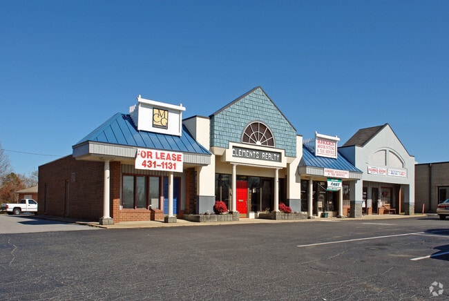
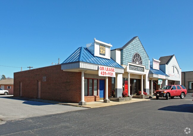
Property Record
3029 S Main St, High Point, NC 27263

Property Detail
3029 S Main St
0200529
PT 3031 S MAIN ST
Officebuilding
Guilford
AG
North Carolina
B and X Area of moderate flood hazard, usually the area between the limits of the 100-year and 500-year floods.
3031
2024
0.90 AC
2025
High Point/SW Guilford Cty
014502
Greensboro/Winston-Salem
10,724 SF
Greensboro-High Point, NC
NEARBY LISTINGS FOR SALE OR LEASE
DEMOGRAPHICS near 3029 S Main St
1 mile
3 mile
5 mile
2024 Total Population
6,860
31,839
87,133
2029 Population
6,969
32,886
90,307
Pop Growth 2024-2029
+ 1.59%
+ 3.29%
+ 3.64%
Average Age
39
39
39
2024 Total Households
2,866
12,753
33,000
HH Growth 2024-2029
+ 1.57%
+ 3.38%
+ 3.88%
Median Household Inc
$52,041
$46,887
$49,955
Avg Household Size
2.40
2.40
2.40
2024 Avg HH Vehicles
2.00
2.00
2.00
Median Home Value
$155,864
$172,089
$184,750
Median Year Built
1975
1973
1973
Nearby Places
Map Layers
Map Styles
 Street
 Aerial
Transit
 Traffic
 Biking
Places
Listings with unknown addresses are not visible on the map
- Restaurants
- Banks
- Shops
- Fitness
- Groceries
PUBLIC TRANSPORTATION
COMMUTER RAIL
High Point Station (Piedmont - North Carolina by Train (NC Train))
Drive
Walk
Distance
High Point Station (Piedmont - North Carolina by Train (NC Train))
6 min
3.5 mi
AIRPORT
Piedmont Triad International
Drive
Walk
Distance
Piedmont Triad International
30 min
15.4 mi
Freight Ports
Port of Wilmington
Drive
Walk
Distance
Port of Wilmington
247 min
207.5 mi
The World's #1 Commercial Real Estate Marketplace
Connect with us
© 2026 CoStar Group
The information above has been obtained from sources believed reliable. While we do not doubt its accuracy we have not verified it and make no guarantee, warranty or representation about it. It is your responsibility to independently confirm its accuracy and completeness. Any projections, opinions, assumptions, or estimates used are for example only and do not represent the current or future performance of the property. The value of this transaction to you depends on tax and other factors which should be evaluated by your tax, financial, and legal advisors. You and your advisors should conduct a careful, independent investigation of the property to determine to your satisfaction the suitability of the property for your needs.