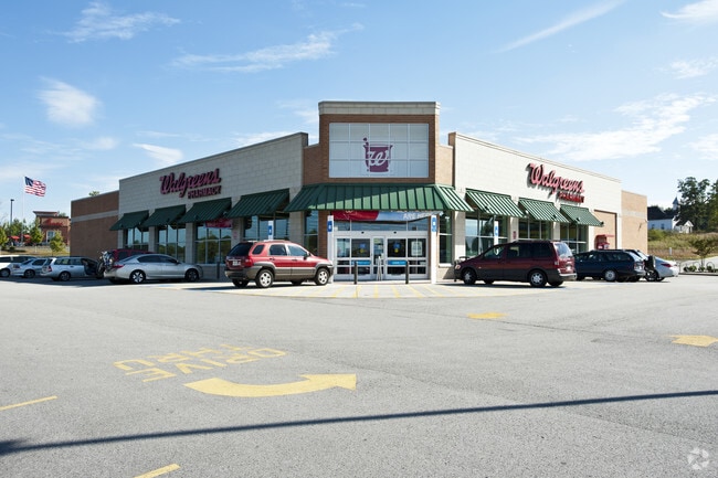
Property Record
303 Charlie Watts Dr, Dallas, GA 30157

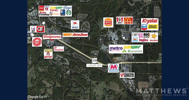

NEARBY LISTINGS FOR SALE OR LEASE
Property Detail
303 Charlie Watts Dr
Atlanta-Sandy Springs-Roswell, GA
Macland Mill
138.3.4.037.0000
REAL PROPERTY
Storebuilding
Paulding
X
Georgia
13223C0137C
415
2024
2.37 AC
2024
Paulding Cnty/Dallas
120307
Atlanta
14,742 SF
DEMOGRAPHICS near 303 Charlie Watts Dr
1 Mile
3 Mile
5 Mile
2024 Total Population
6,033
29,505
72,155
2029 Population
6,863
33,763
82,796
Pop Growth 2024-2029
+ 13.76%
+ 14.43%
+ 14.75%
Average Age
37
37
38
2024 Total Households
2,270
10,821
25,199
HH Growth 2024-2029
+ 13.79%
+ 14.48%
+ 14.80%
Median Household Inc
$68,643
$72,318
$85,104
Avg Household Size
2.70
2.70
2.80
2024 Avg HH Vehicles
2.00
2.00
2.00
Median Home Value
$221,494
$194,366
$220,092
Median Year Built
2001
1998
1999
Nearby Places
Map Layers
Map Styles
 Street
 Aerial
- Restaurants
- Banks
- Shops
- Fitness
- Groceries
PUBLIC TRANSPORTATION
AIRPORT
Hartsfield - Jackson Atlanta International
DRIVE
WALK
Distance
Hartsfield - Jackson Atlanta International
57 min
38.8 mi
Freight Ports
Georgia Ports - Savannah
DRIVE
WALK
Distance
Georgia Ports - Savannah
320 min
278.1 mi
SALE & LEASE HISTORY
LISTING DATE
SALE/LEASE

Sep 20, 2019
For Sale
May 02, 2022
For Sale
Jan 26, 2023
For Sale
Jan 21, 2018
For Sale
Aug 25, 2022
For Sale
Nearby Properties
Address
Land Use
TOTAL SIZE
Lot Size
Zoning
Address
Land Use
TOTAL SIZE
Lot Size
Zoning
83.40 AC
Address
Land Use
TOTAL SIZE
Lot Size
Zoning
62,628 SF
32.23 AC
B2
Address
Land Use
TOTAL SIZE
Lot Size
Zoning
62.35 AC
Address
Land Use
TOTAL SIZE
Lot Size
Zoning
126,638 SF
20.26 AC
R4
Address
Land Use
TOTAL SIZE
Lot Size
Zoning
133,468 SF
12.37 AC
Address
Land Use
TOTAL SIZE
Lot Size
Zoning
187,435 SF
31.39 AC
R55
Address
Land Use
TOTAL SIZE
Lot Size
Zoning
Address
Land Use
TOTAL SIZE
Lot Size
Zoning
179,316 SF
13.43 AC
R3
Address
Land Use
TOTAL SIZE
Lot Size
Zoning
25.11 AC
Address
Land Use
TOTAL SIZE
Lot Size
Zoning
19,718 SF
0.52 AC
B1
Address
Land Use
TOTAL SIZE
Lot Size
Zoning
20.91 AC
Address
Land Use
TOTAL SIZE
Lot Size
Zoning
35,442 SF
0.66 AC
B1
Address
Land Use
TOTAL SIZE
Lot Size
Zoning
0.44 AC
Address
Land Use
TOTAL SIZE
Lot Size
Zoning
71,122 SF
30.70 AC
C2
Address
Land Use
TOTAL SIZE
Lot Size
Zoning
149,128 SF
108.92 AC
I1
Address
Land Use
TOTAL SIZE
Lot Size
Zoning
136,556 SF
7.24 AC
B2
Address
Land Use
TOTAL SIZE
Lot Size
Zoning
39,290 SF
10.56 AC
R4
Address
Land Use
TOTAL SIZE
Lot Size
Zoning
26,770 SF
3.45 AC
Address
Land Use
TOTAL SIZE
Lot Size
Zoning
70,456 SF
8.58 AC
B2
Address
Land Use
TOTAL SIZE
Lot Size
Zoning
128.92 AC
Address
Land Use
TOTAL SIZE
Lot Size
Zoning
7.69 AC
Address
Land Use
TOTAL SIZE
Lot Size
Zoning
8.59 AC
Address
Land Use
TOTAL SIZE
Lot Size
Zoning
0.56 AC
Address
Land Use
TOTAL SIZE
Lot Size
Zoning
42,774 SF
7.61 AC
Address
Land Use
TOTAL SIZE
Lot Size
Zoning
104,552 SF
11.19 AC
I1
Address
Land Use
TOTAL SIZE
Lot Size
Zoning
45,560 SF
4.06 AC
DC2
Address
Land Use
TOTAL SIZE
Lot Size
Zoning
57,800 SF
10.48 AC
Address
Land Use
TOTAL SIZE
Lot Size
Zoning
33,024 SF
5.41 AC
R3
Address
Land Use
TOTAL SIZE
Lot Size
Zoning
7.37 AC
Address
Land Use
TOTAL SIZE
Lot Size
Zoning
26,359 SF
18.38 AC
B2
The World's #1 Commercial Real Estate Marketplace
Connect with us
© 2026 CoStar Group
The information above has been obtained from sources believed reliable. While we do not doubt its accuracy we have not verified it and make no guarantee, warranty or representation about it. It is your responsibility to independently confirm its accuracy and completeness. Any projections, opinions, assumptions, or estimates used are for example only and do not represent the current or future performance of the property. The value of this transaction to you depends on tax and other factors which should be evaluated by your tax, financial, and legal advisors. You and your advisors should conduct a careful, independent investigation of the property to determine to your satisfaction the suitability of the property for your needs.