Property Record
303 E Highway 67, Duncanville, TX 75137

NEARBY LISTINGS FOR SALE OR LEASE
Property Detail
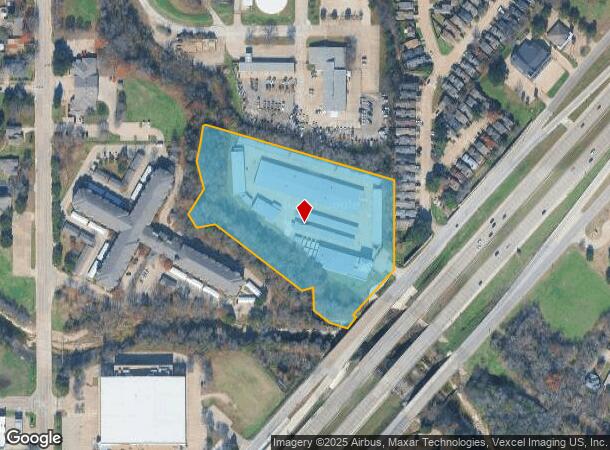
303 E Highway 67
Dallas-Fort Worth-Arlington, TX
Assured Highway 67
22001570010010000
ASSURED HIGHWAY 67 BLK 1 LT 1 ACS 6.139 INT201800243734 DD08282018 CO-DC 0015700100100 5CV00157001
Publicstorage
Dallas
AE
Texas
48113C0470K
1
2024
6.13 AC
2025
Southwest Dallas
016517
Dallas/Ft Worth
73,265 SF
DEMOGRAPHICS near 303 E Highway 67
1 Mile
3 Mile
5 Mile
2024 Total Population
10,132
93,521
196,883
2029 Population
9,937
92,027
194,310
Pop Growth 2024-2029
(1.92%)
(1.60%)
(1.31%)
Average Age
39
38
37
2024 Total Households
3,518
33,147
67,814
HH Growth 2024-2029
(2.16%)
(1.75%)
(1.49%)
Median Household Inc
$74,430
$57,808
$59,810
Avg Household Size
2.80
2.80
2.80
2024 Avg HH Vehicles
2.00
2.00
2.00
Median Home Value
$217,270
$229,230
$222,053
Median Year Built
1978
1984
1985
Nearby Places
Map Layers
Map Styles
 Street
 Aerial
- Restaurants
- Banks
- Shops
- Fitness
- Groceries
PUBLIC TRANSPORTATION
AIRPORT
Dallas Love Field
DRIVE
WALK
Distance
Dallas Love Field
28 min
18.5 mi
Dallas-Fort Worth International
DRIVE
WALK
Distance
Dallas-Fort Worth International
38 min
26.9 mi
Nearby Properties
Address
Land Use
TOTAL SIZE
Lot Size
Zoning
Address
Land Use
TOTAL SIZE
Lot Size
Zoning
726,662 SF
44.94 AC
Z239
Address
Land Use
TOTAL SIZE
Lot Size
Zoning
1,126,320 SF
63.41 AC
Z111
Address
Land Use
TOTAL SIZE
Lot Size
Zoning
494,366 SF
43.30 AC
Z137
Address
Land Use
TOTAL SIZE
Lot Size
Zoning
662,230 SF
38.49 AC
Z248
Address
Land Use
TOTAL SIZE
Lot Size
Zoning
399,458 SF
24.51 AC
MF2
Address
Land Use
TOTAL SIZE
Lot Size
Zoning
381,633 SF
21.25 AC
Z239
Address
Land Use
TOTAL SIZE
Lot Size
Zoning
217,510 SF
67.57 AC
Z268
Address
Land Use
TOTAL SIZE
Lot Size
Zoning
172,840 SF
49.65 AC
Z164
Address
Land Use
TOTAL SIZE
Lot Size
Zoning
489,310 SF
33.91 AC
Z111
Address
Land Use
TOTAL SIZE
Lot Size
Zoning
374,400 SF
6.15 AC
Z150
Address
Land Use
TOTAL SIZE
Lot Size
Zoning
531,254 SF
33.40 AC
Z06
Address
Land Use
TOTAL SIZE
Lot Size
Zoning
421,890 SF
23.95 AC
Z111
Address
Land Use
TOTAL SIZE
Lot Size
Zoning
305,724 SF
7.02 AC
Z357
Address
Land Use
TOTAL SIZE
Lot Size
Zoning
400,000 SF
24.69 AC
Z116
Address
Land Use
TOTAL SIZE
Lot Size
Zoning
344,952 SF
14.39 AC
Z239
Address
Land Use
TOTAL SIZE
Lot Size
Zoning
219,128 SF
11.62 AC
Z160
Address
Land Use
TOTAL SIZE
Lot Size
Zoning
188,600 SF
13.52 AC
Z160
Address
Land Use
TOTAL SIZE
Lot Size
Zoning
223,899 SF
10 AC
Z160
Address
Land Use
TOTAL SIZE
Lot Size
Zoning
350,000 SF
19.77 AC
Z109
Address
Land Use
TOTAL SIZE
Lot Size
Zoning
305,727 SF
25.02 AC
Z06
Address
Land Use
TOTAL SIZE
Lot Size
Zoning
373,028 SF
19.78 AC
Z116
Address
Land Use
TOTAL SIZE
Lot Size
Zoning
179,100 SF
9.91 AC
Z163
Address
Land Use
TOTAL SIZE
Lot Size
Zoning
180,659 SF
8.19 AC
Z137
Address
Land Use
TOTAL SIZE
Lot Size
Zoning
220,975 SF
10.52 AC
Z151
Address
Land Use
TOTAL SIZE
Lot Size
Zoning
168,476 SF
8.15 AC
Z137
Address
Land Use
TOTAL SIZE
Lot Size
Zoning
235,897 SF
7.97 AC
Z150
Address
Land Use
TOTAL SIZE
Lot Size
Zoning
297,000 SF
19.63 AC
Z248
Address
Land Use
TOTAL SIZE
Lot Size
Zoning
312,180 SF
22.71 AC
Z163
Address
Land Use
TOTAL SIZE
Lot Size
Zoning
176,010 SF
16.72 AC
Z137
Address
Land Use
TOTAL SIZE
Lot Size
Zoning
160,113 SF
9.45 AC
Z187
The World's #1 Commercial Real Estate Marketplace
Connect with us
© 2026 CoStar Group
The information above has been obtained from sources believed reliable. While we do not doubt its accuracy we have not verified it and make no guarantee, warranty or representation about it. It is your responsibility to independently confirm its accuracy and completeness. Any projections, opinions, assumptions, or estimates used are for example only and do not represent the current or future performance of the property. The value of this transaction to you depends on tax and other factors which should be evaluated by your tax, financial, and legal advisors. You and your advisors should conduct a careful, independent investigation of the property to determine to your satisfaction the suitability of the property for your needs.