Property Record
303 Miller Rd, Mauldin, SC 29662
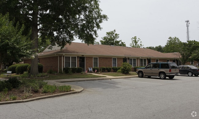

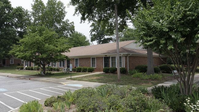
Property Detail
303 Miller Rd
Greenville-Anderson-Greer, SC
MAP M002.01; B
M002.01-02-001.02
Greenville
Apartment
South Carolina
RM
001.02
AE The base floodplain where base flood elevations are provided. AE Zones are now used on new format FIRMs instead of A1-A30 Zones.
8.40 AC
2025
Outer Greenville/Mauldin
2025
Greenville/Spartanburg
002903
NEARBY LISTINGS FOR SALE OR LEASE
-
-
View all Mauldin listings for sale on LoopNet.com
DEMOGRAPHICS near 303 Miller Rd
1 mile
3 mile
5 mile
2025 Total Population
6,096
49,412
138,257
2030 Population
6,611
53,607
149,399
Pop Growth 2025-2030
+ 8.45%
+ 8.49%
+ 8.06%
Average Age
40
40
40
2025 Total Households
2,824
21,030
57,819
HH Growth 2025-2030
+ 8.64%
+ 8.72%
+ 8.31%
Median Household Inc
$76,105
$84,555
$85,880
Avg Household Size
2.10
2.30
2.40
2025 Avg HH Vehicles
2.00
2.00
2.00
Median Home Value
$252,638
$287,108
$338,931
Median Year Built
1989
1999
1995
Nearby Places
Map Layers
Map Styles
 Street
 Aerial
Layers
 Traffic
 Biking
Places
Listings with unknown addresses are not visible on the map
- Restaurants
- Banks
- Shops
- Fitness
- Groceries
PUBLIC TRANSPORTATION
AIRPORT
Greenville Spartanburg International
Drive
Walk
Distance
Greenville Spartanburg International
20 min
11.2 mi
Freight Ports
North Charleston Terminal
Drive
Walk
Distance
North Charleston Terminal
219 min
195.0 mi
Nearby Properties
Address
Land Use
TOTAL SIZE
Lot Size
Zoning
Address
Land Use
TOTAL SIZE
Lot Size
Zoning
17.56 AC
C3
Address
Land Use
TOTAL SIZE
Lot Size
Zoning
23.23 AC
Address
Land Use
TOTAL SIZE
Lot Size
Zoning
22.50 AC
S1
Address
Land Use
TOTAL SIZE
Lot Size
Zoning
15.82 AC
RM
Address
Land Use
TOTAL SIZE
Lot Size
Zoning
10.20 AC
R12
Address
Land Use
TOTAL SIZE
Lot Size
Zoning
10.07 AC
S1
Address
Land Use
TOTAL SIZE
Lot Size
Zoning
Address
Land Use
TOTAL SIZE
Lot Size
Zoning
10.29 AC
S1
Address
Land Use
TOTAL SIZE
Lot Size
Zoning
12.95 AC
RM3
Address
Land Use
TOTAL SIZE
Lot Size
Zoning
3.38 AC
S1
Address
Land Use
TOTAL SIZE
Lot Size
Zoning
9.10 AC
RM,C2
Address
Land Use
TOTAL SIZE
Lot Size
Zoning
20.30 AC
I1
Address
Land Use
TOTAL SIZE
Lot Size
Zoning
5.83 AC
S1
Address
Land Use
TOTAL SIZE
Lot Size
Zoning
31.81 AC
R6
Address
Land Use
TOTAL SIZE
Lot Size
Zoning
11.05 AC
S1
Address
Land Use
TOTAL SIZE
Lot Size
Zoning
12.31 AC
Address
Land Use
TOTAL SIZE
Lot Size
Zoning
17.59 AC
Address
Land Use
TOTAL SIZE
Lot Size
Zoning
6.27 AC
UVD
Address
Land Use
TOTAL SIZE
Lot Size
Zoning
10.36 AC
R12
Address
Land Use
TOTAL SIZE
Lot Size
Zoning
3.24 AC
S1
Address
Land Use
TOTAL SIZE
Lot Size
Zoning
12.03 AC
RM2
Address
Land Use
TOTAL SIZE
Lot Size
Zoning
15.14 AC
I1
Address
Land Use
TOTAL SIZE
Lot Size
Zoning
39.85 AC
C3
Address
Land Use
TOTAL SIZE
Lot Size
Zoning
26.75 AC
S1
Address
Land Use
TOTAL SIZE
Lot Size
Zoning
11.91 AC
RM20
Address
Land Use
TOTAL SIZE
Lot Size
Zoning
Address
Land Use
TOTAL SIZE
Lot Size
Zoning
7.53 AC
S1
Address
Land Use
TOTAL SIZE
Lot Size
Zoning
108.12 AC
I1
Address
Land Use
TOTAL SIZE
Lot Size
Zoning
19.33 AC
S1
Address
Land Use
TOTAL SIZE
Lot Size
Zoning
40.92 AC
S1
The World's #1 Commercial Real Estate Marketplace
Connect with us
© 2026 CoStar Group
The information above has been obtained from sources believed reliable. While we do not doubt its accuracy we have not verified it and make no guarantee, warranty or representation about it. It is your responsibility to independently confirm its accuracy and completeness. Any projections, opinions, assumptions, or estimates used are for example only and do not represent the current or future performance of the property. The value of this transaction to you depends on tax and other factors which should be evaluated by your tax, financial, and legal advisors. You and your advisors should conduct a careful, independent investigation of the property to determine to your satisfaction the suitability of the property for your needs.