Property Record
303 N Main St, Rockford, IL 61101


NEARBY LISTINGS FOR SALE OR LEASE
Property Detail
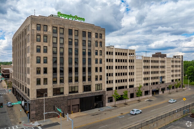
303 N Main St
Rockford, IL
West Rockford
11-23-309-005
WEST ROCKFORD S 28 FT LOT 4 + ALL LOT005 BLOCK 010
Officebuilding
Winnebago
X
Illinois
17201C0264E
4,005
2024
0.34 AC
2024
I-39 Corr/Winnebago Cnty
002900
Chicago
108,233 SF
DEMOGRAPHICS near 303 N Main St
1 Mile
3 Mile
5 Mile
2024 Total Population
14,449
91,597
158,072
2029 Population
14,688
91,085
156,541
Pop Growth 2024-2029
+ 1.65%
(0.56%)
(0.97%)
Average Age
37
37
39
2024 Total Households
6,258
36,671
63,703
HH Growth 2024-2029
+ 1.31%
(0.66%)
(1.04%)
Median Household Inc
$23,614
$38,612
$44,668
Avg Household Size
2.10
2.40
2.40
2024 Avg HH Vehicles
1.00
1.00
2.00
Median Home Value
$74,810
$77,467
$100,858
Median Year Built
1948
1952
1959
Nearby Places
Map Layers
Map Styles
 Street
 Aerial
- Restaurants
- Banks
- Shops
- Fitness
- Groceries
PUBLIC TRANSPORTATION
AIRPORT
Chicago/Rockford International
DRIVE
WALK
Distance
Chicago/Rockford International
17 min
8.5 mi
Freight Ports
Port Milwaukee
DRIVE
WALK
Distance
Port Milwaukee
114 min
93.9 mi
SALE & LEASE HISTORY
LISTING DATE
SALE/LEASE

May 17, 2017
For Lease
Nearby Properties
Address
Land Use
TOTAL SIZE
Lot Size
Zoning
Address
Land Use
TOTAL SIZE
Lot Size
Zoning
216,540 SF
22 AC
C3
Address
Land Use
TOTAL SIZE
Lot Size
Zoning
201,507 SF
C4
Address
Land Use
TOTAL SIZE
Lot Size
Zoning
106,145 SF
8.54 AC
R3
Address
Land Use
TOTAL SIZE
Lot Size
Zoning
13,308 SF
19.30 AC
I2
Address
Land Use
TOTAL SIZE
Lot Size
Zoning
115,095 SF
0.25 AC
C4
Address
Land Use
TOTAL SIZE
Lot Size
Zoning
117,360 SF
1.52 AC
R4
Address
Land Use
TOTAL SIZE
Lot Size
Zoning
111,491 SF
0.32 AC
C4
Address
Land Use
TOTAL SIZE
Lot Size
Zoning
373,791 SF
25.40 AC
IL
Address
Land Use
TOTAL SIZE
Lot Size
Zoning
79,318 SF
1.55 AC
C4
Address
Land Use
TOTAL SIZE
Lot Size
Zoning
58,526 SF
134.42 AC
RE
Address
Land Use
TOTAL SIZE
Lot Size
Zoning
192,575 SF
46.19 AC
I1
Address
Land Use
TOTAL SIZE
Lot Size
Zoning
238,884 SF
15.96 AC
R3
Address
Land Use
TOTAL SIZE
Lot Size
Zoning
645,384 SF
25.22 AC
I1
Address
Land Use
TOTAL SIZE
Lot Size
Zoning
79,700 SF
7.15 AC
C2
Address
Land Use
TOTAL SIZE
Lot Size
Zoning
243,057 SF
21.38 AC
C2
Address
Land Use
TOTAL SIZE
Lot Size
Zoning
60,479 SF
117 AC
R1
Address
Land Use
TOTAL SIZE
Lot Size
Zoning
113,175 SF
5 AC
R3
Address
Land Use
TOTAL SIZE
Lot Size
Zoning
2,975 SF
5.42 AC
I2
Address
Land Use
TOTAL SIZE
Lot Size
Zoning
150,426 SF
9.25 AC
C3
Address
Land Use
TOTAL SIZE
Lot Size
Zoning
158,754 SF
0.91 AC
C4
Address
Land Use
TOTAL SIZE
Lot Size
Zoning
39,184 SF
3.10 AC
C2
Address
Land Use
TOTAL SIZE
Lot Size
Zoning
77,936 SF
1.71 AC
C4
Address
Land Use
TOTAL SIZE
Lot Size
Zoning
83,110 SF
5.30 AC
R3
Address
Land Use
TOTAL SIZE
Lot Size
Zoning
239,792 SF
0.25 AC
C4
Address
Land Use
TOTAL SIZE
Lot Size
Zoning
85,575 SF
10.29 AC
C2
Address
Land Use
TOTAL SIZE
Lot Size
Zoning
299,238 SF
18.84 AC
I2
Address
Land Use
TOTAL SIZE
Lot Size
Zoning
137,546 SF
0.71 AC
C4
Address
Land Use
TOTAL SIZE
Lot Size
Zoning
103,365 SF
3 AC
C2
Address
Land Use
TOTAL SIZE
Lot Size
Zoning
83,247 SF
3.36 AC
C2
The World's #1 Commercial Real Estate Marketplace
Connect with us
© 2025 CoStar Group
The information above has been obtained from sources believed reliable. While we do not doubt its accuracy we have not verified it and make no guarantee, warranty or representation about it. It is your responsibility to independently confirm its accuracy and completeness. Any projections, opinions, assumptions, or estimates used are for example only and do not represent the current or future performance of the property. The value of this transaction to you depends on tax and other factors which should be evaluated by your tax, financial, and legal advisors. You and your advisors should conduct a careful, independent investigation of the property to determine to your satisfaction the suitability of the property for your needs.