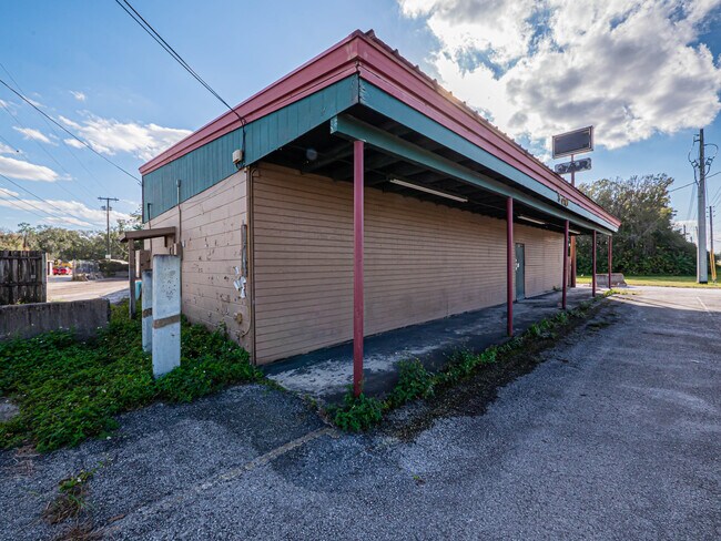
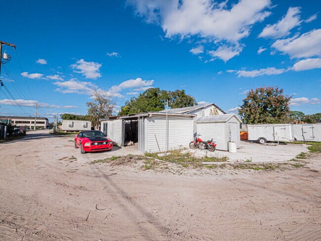
Property Record
3070 New Tampa Hwy, Lakeland, FL 33815
Current Lease Availabilities
NEARBY LISTINGS FOR SALE OR LEASE
Property Detail
3070 New Tampa Hwy
Lakeland-Winter Haven, FL
Edwards Subdivision
23-28-22-095000-002042
EDWARDS SUB PB 26 PG 10 BLK 2 LOT 4 BEG NW COR RUN S 190 FT E 112 FT N 195 FT W 100 FT TO BEG
Bartavern
Polk
X
Florida
12105C0292G
4
2024
0.46 AC
2025
Polk County
012002
Tampa/St Petersburg
5,664 SF
DEMOGRAPHICS near 3070 New Tampa Hwy
1 Mile
3 Mile
5 Mile
2024 Total Population
5,534
44,447
118,944
2029 Population
6,798
53,540
141,576
Pop Growth 2024-2029
+ 22.84%
+ 20.46%
+ 19.03%
Average Age
44
41
40
2024 Total Households
2,395
18,346
46,907
HH Growth 2024-2029
+ 23.01%
+ 20.43%
+ 19.34%
Median Household Inc
$40,961
$42,431
$52,834
Avg Household Size
2.20
2.30
2.40
2024 Avg HH Vehicles
1.00
1.00
2.00
Median Home Value
$85,126
$120,664
$188,846
Median Year Built
1976
1979
1980
Nearby Places
Map Layers
Map Styles
 Street
 Aerial
- Restaurants
- Banks
- Shops
- Fitness
- Groceries
PUBLIC TRANSPORTATION
COMMUTER RAIL
Lakeland (Silver Star - Amtrak)
DRIVE
WALK
Distance
Lakeland (Silver Star - Amtrak)
6 min
3.4 mi
Freight Ports
Port of Tampa Bay
DRIVE
WALK
Distance
Port of Tampa Bay
42 min
31.5 mi
Nearby Properties
Address
Land Use
TOTAL SIZE
Lot Size
Zoning
Address
Land Use
TOTAL SIZE
Lot Size
Zoning
2,095,234 SF
102.45 AC
PUD
Address
Land Use
TOTAL SIZE
Lot Size
Zoning
1,210,880 SF
405.82 AC
PUD
Address
Land Use
TOTAL SIZE
Lot Size
Zoning
518,028 SF
195.69 AC
Address
Land Use
TOTAL SIZE
Lot Size
Zoning
705,615 SF
33.05 AC
Address
Land Use
TOTAL SIZE
Lot Size
Zoning
315,901 SF
20.55 AC
Address
Land Use
TOTAL SIZE
Lot Size
Zoning
333,455 SF
11.90 AC
Address
Land Use
TOTAL SIZE
Lot Size
Zoning
655,123 SF
45.28 AC
Address
Land Use
TOTAL SIZE
Lot Size
Zoning
263,185 SF
32.20 AC
C6
Address
Land Use
TOTAL SIZE
Lot Size
Zoning
1,004,426 SF
93.42 AC
C4
Address
Land Use
TOTAL SIZE
Lot Size
Zoning
520,806 SF
25.62 AC
Address
Land Use
TOTAL SIZE
Lot Size
Zoning
492,960 SF
22.09 AC
Address
Land Use
TOTAL SIZE
Lot Size
Zoning
602,125 SF
43.97 AC
Address
Land Use
TOTAL SIZE
Lot Size
Zoning
599,280 SF
35.27 AC
GI
Address
Land Use
TOTAL SIZE
Lot Size
Zoning
566,274 SF
33.79 AC
GI
Address
Land Use
TOTAL SIZE
Lot Size
Zoning
568,801 SF
37.13 AC
C4
Address
Land Use
TOTAL SIZE
Lot Size
Zoning
277,272 SF
19.35 AC
RA4
Address
Land Use
TOTAL SIZE
Lot Size
Zoning
172,176 SF
8.93 AC
RE2
Address
Land Use
TOTAL SIZE
Lot Size
Zoning
349,920 SF
22.21 AC
Address
Land Use
TOTAL SIZE
Lot Size
Zoning
297,600 SF
27.53 AC
XX
Address
Land Use
TOTAL SIZE
Lot Size
Zoning
441,480 SF
24.28 AC
Address
Land Use
TOTAL SIZE
Lot Size
Zoning
309,334 SF
41.64 AC
Address
Land Use
TOTAL SIZE
Lot Size
Zoning
84,824 SF
163.73 AC
I2
Address
Land Use
TOTAL SIZE
Lot Size
Zoning
333,560 SF
44.88 AC
IND
Address
Land Use
TOTAL SIZE
Lot Size
Zoning
79,697 SF
6.37 AC
C2
Address
Land Use
TOTAL SIZE
Lot Size
Zoning
165,743 SF
17.11 AC
PUD
Address
Land Use
TOTAL SIZE
Lot Size
Zoning
451,505 SF
30.12 AC
GI
Address
Land Use
TOTAL SIZE
Lot Size
Zoning
682,828 SF
36.01 AC
Address
Land Use
TOTAL SIZE
Lot Size
Zoning
342,987 SF
16.81 AC
Address
Land Use
TOTAL SIZE
Lot Size
Zoning
77,358 SF
8.34 AC
PUD
Address
Land Use
TOTAL SIZE
Lot Size
Zoning
76,250 SF
5.25 AC
The World's #1 Commercial Real Estate Marketplace
Connect with us
© 2025 CoStar Group
The information above has been obtained from sources believed reliable. While we do not doubt its accuracy we have not verified it and make no guarantee, warranty or representation about it. It is your responsibility to independently confirm its accuracy and completeness. Any projections, opinions, assumptions, or estimates used are for example only and do not represent the current or future performance of the property. The value of this transaction to you depends on tax and other factors which should be evaluated by your tax, financial, and legal advisors. You and your advisors should conduct a careful, independent investigation of the property to determine to your satisfaction the suitability of the property for your needs.