Property Record
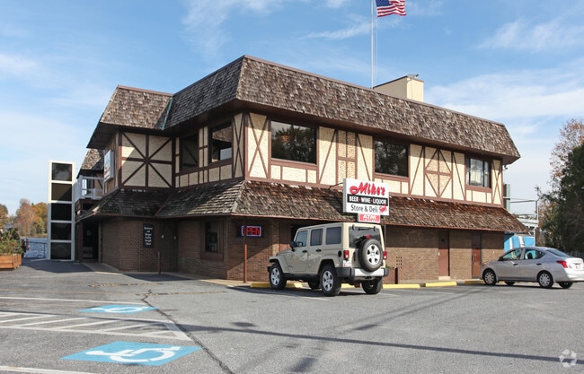
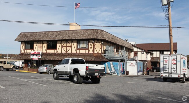
3030 Riva Rd, Riva, MD 21140

Property Detail
3030 Riva Rd
02-000-09339900
PT OF ROADBED & .42 TAYLORSVILLE
Restaurantbuilding
Anne Arundel
MA2
Maryland
AE The base floodplain where base flood elevations are provided. AE Zones are now used on new format FIRMs instead of A1-A30 Zones.
0.46 AC
2024
Southern Anne Arundel
2025
Baltimore
702300
Baltimore-Columbia-Towson, MD
19,786 SF
NEARBY LISTINGS FOR SALE OR LEASE
DEMOGRAPHICS near 3030 Riva Rd
1 mile
3 mile
5 mile
2025 Total Population
5,648
37,919
97,397
2030 Population
5,744
38,421
99,042
Pop Growth 2025-2030
+ 1.70%
+ 1.32%
+ 1.69%
Average Age
48
45
43
2025 Total Households
2,375
15,551
39,413
HH Growth 2025-2030
+ 1.77%
+ 1.36%
+ 1.70%
Median Household Inc
$148,669
$121,308
$118,693
Avg Household Size
2.30
2.30
2.40
2025 Avg HH Vehicles
2.00
2.00
2.00
Median Home Value
$664,197
$567,317
$598,678
Median Year Built
1982
1986
1982
Nearby Places
Map Layers
Map Styles
 Street
 Aerial
Transit
 Traffic
 Biking
Places
Listings with unknown addresses are not visible on the map
- Restaurants
- Banks
- Shops
- Fitness
- Groceries
PUBLIC TRANSPORTATION
AIRPORT
Baltimore/Washington International Thurgood Marshall
Drive
Walk
Distance
Baltimore/Washington International Thurgood Marshall
34 min
23.6 mi
Ronald Reagan Washington Ntl
Drive
Walk
Distance
Ronald Reagan Washington Ntl
48 min
32.3 mi
Freight Ports
Port of Baltimore
Drive
Walk
Distance
Port of Baltimore
41 min
29.2 mi
Nearby Properties
Address
Land Use
TOTAL SIZE
Lot Size
Zoning
Address
Land Use
TOTAL SIZE
Lot Size
Zoning
2,568,175 SF
55.32 AC
TC
Address
Land Use
TOTAL SIZE
Lot Size
Zoning
296,790 SF
27.74 AC
TC
Address
Land Use
TOTAL SIZE
Lot Size
Zoning
313,440 SF
23.43 AC
TC
Address
Land Use
TOTAL SIZE
Lot Size
Zoning
441,482 SF
3.85 AC
W1
Address
Land Use
TOTAL SIZE
Lot Size
Zoning
419,712 SF
9.48 AC
R2
Address
Land Use
TOTAL SIZE
Lot Size
Zoning
389,081 SF
4.79 AC
TC
Address
Land Use
TOTAL SIZE
Lot Size
Zoning
271,003 SF
1 AC
TC
Address
Land Use
TOTAL SIZE
Lot Size
Zoning
365,268 SF
4.85 AC
W1
Address
Land Use
TOTAL SIZE
Lot Size
Zoning
97,888 SF
59.42 AC
C2
Address
Land Use
TOTAL SIZE
Lot Size
Zoning
589,210 SF
111.38 AC
RA
Address
Land Use
TOTAL SIZE
Lot Size
Zoning
341,468 SF
1.82 AC
TC
Address
Land Use
TOTAL SIZE
Lot Size
Zoning
315,260 SF
22.82 AC
C2
Address
Land Use
TOTAL SIZE
Lot Size
Zoning
285,174 SF
24 AC
R2
Address
Land Use
TOTAL SIZE
Lot Size
Zoning
254,969 SF
13.73 AC
W1A
Address
Land Use
TOTAL SIZE
Lot Size
Zoning
73.33 AC
R2
Address
Land Use
TOTAL SIZE
Lot Size
Zoning
104,950 SF
2.93 AC
TC
Address
Land Use
TOTAL SIZE
Lot Size
Zoning
25,990 SF
32.06 AC
C2
Address
Land Use
TOTAL SIZE
Lot Size
Zoning
74,527 SF
16.62 AC
TC
Address
Land Use
TOTAL SIZE
Lot Size
Zoning
376,688 SF
4.02 AC
TC
Address
Land Use
TOTAL SIZE
Lot Size
Zoning
91.22 AC
C2
Address
Land Use
TOTAL SIZE
Lot Size
Zoning
138,592 SF
8.47 AC
W1
Address
Land Use
TOTAL SIZE
Lot Size
Zoning
2.43 AC
TC
Address
Land Use
TOTAL SIZE
Lot Size
Zoning
15 AC
C2
Address
Land Use
TOTAL SIZE
Lot Size
Zoning
134,693 SF
6 AC
R2
Address
Land Use
TOTAL SIZE
Lot Size
Zoning
124,626 SF
4.73 AC
C2
Address
Land Use
TOTAL SIZE
Lot Size
Zoning
9.15 AC
C2
Address
Land Use
TOTAL SIZE
Lot Size
Zoning
117,008 SF
1.40 AC
C4
Address
Land Use
TOTAL SIZE
Lot Size
Zoning
150,240 SF
16.02 AC
TC
Address
Land Use
TOTAL SIZE
Lot Size
Zoning
52,228 SF
4.94 AC
C2
Address
Land Use
TOTAL SIZE
Lot Size
Zoning
137,270 SF
19.06 AC
C3
The World's #1 Commercial Real Estate Marketplace
Connect with us
© 2026 CoStar Group
The information above has been obtained from sources believed reliable. While we do not doubt its accuracy we have not verified it and make no guarantee, warranty or representation about it. It is your responsibility to independently confirm its accuracy and completeness. Any projections, opinions, assumptions, or estimates used are for example only and do not represent the current or future performance of the property. The value of this transaction to you depends on tax and other factors which should be evaluated by your tax, financial, and legal advisors. You and your advisors should conduct a careful, independent investigation of the property to determine to your satisfaction the suitability of the property for your needs.