Property Record
3030 Zingara Rd Ne, Conyers, GA 30012
NEARBY LISTINGS FOR SALE OR LEASE
Property Detail
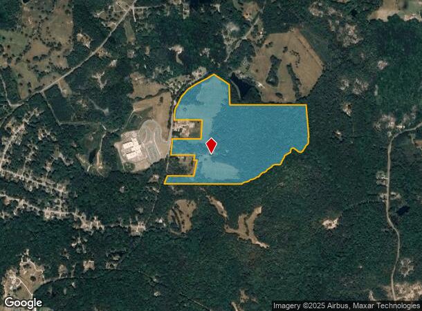
3030 Zingara Rd Ne
Atlanta-Sandy Springs-Roswell, GA
Rural
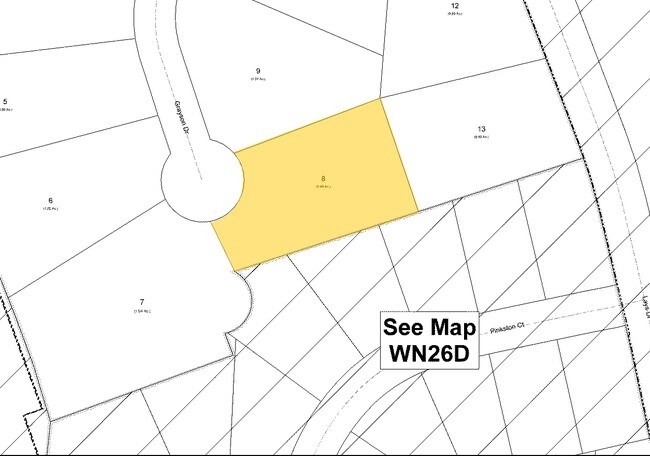
054-0-01-0017
&LL 308 312 313 332 BOTH SIDES
Privatepreserveopenspacevacantlandforestlandconservation
Rockdale
X
Georgia
13247C0105D
312
2024
79.22 AC
2024
I-20 East/Conyers
060101
Atlanta
3,370 SF
DEMOGRAPHICS near 3030 Zingara Rd Ne
1 Mile
3 Mile
5 Mile
2024 Total Population
1,036
14,211
60,304
2029 Population
1,084
14,689
62,730
Pop Growth 2024-2029
+ 4.63%
+ 3.36%
+ 4.02%
Average Age
41
38
38
2024 Total Households
372
4,790
20,386
HH Growth 2024-2029
+ 4.57%
+ 3.40%
+ 4.08%
Median Household Inc
$70,639
$66,336
$64,802
Avg Household Size
2.60
2.90
2.90
2024 Avg HH Vehicles
2.00
2.00
2.00
Median Home Value
$157,562
$194,487
$220,587
Median Year Built
1982
1985
1991
Nearby Places
- Restaurants
- Banks
- Shops
- Fitness
- Groceries
PUBLIC TRANSPORTATION
AIRPORT
Hartsfield - Jackson Atlanta International
DRIVE
WALK
Distance
Hartsfield - Jackson Atlanta International
49 min
31.7 mi
Freight Ports
Georgia Ports - Savannah
DRIVE
WALK
Distance
Georgia Ports - Savannah
288 min
244.3 mi
Nearby Properties
Address
Land Use
TOTAL SIZE
Lot Size
Zoning
Address
Land Use
TOTAL SIZE
Lot Size
Zoning
17,800 SF
11.36 AC
RM/C
Address
Land Use
TOTAL SIZE
Lot Size
Zoning
159,014 SF
3.88 AC
RM
Address
Land Use
TOTAL SIZE
Lot Size
Zoning
28,012 SF
4.04 AC
OI
Address
Land Use
TOTAL SIZE
Lot Size
Zoning
14,575 SF
14.55 AC
OI
Address
Land Use
TOTAL SIZE
Lot Size
Zoning
145,159 SF
1.13 AC
BN
Address
Land Use
TOTAL SIZE
Lot Size
Zoning
29.96 AC
R1
Address
Land Use
TOTAL SIZE
Lot Size
Zoning
57,417 SF
11.25 AC
BN
Address
Land Use
TOTAL SIZE
Lot Size
Zoning
66,181 SF
25.46 AC
R1A
Address
Land Use
TOTAL SIZE
Lot Size
Zoning
34,370 SF
5.04 AC
OI
Address
Land Use
TOTAL SIZE
Lot Size
Zoning
16,100 SF
5.10 AC
BG
Address
Land Use
TOTAL SIZE
Lot Size
Zoning
69,088 SF
9.37 AC
BG
Address
Land Use
TOTAL SIZE
Lot Size
Zoning
7,980 SF
1.20 AC
BN
Address
Land Use
TOTAL SIZE
Lot Size
Zoning
46,452 SF
20 AC
AR
Address
Land Use
TOTAL SIZE
Lot Size
Zoning
3,057 SF
27.27 AC
RM
Address
Land Use
TOTAL SIZE
Lot Size
Zoning
6,000 SF
2 AC
C1
Address
Land Use
TOTAL SIZE
Lot Size
Zoning
14,505 SF
2.86 AC
BN
Address
Land Use
TOTAL SIZE
Lot Size
Zoning
3,183 SF
1.22 AC
BN
Address
Land Use
TOTAL SIZE
Lot Size
Zoning
8,986 SF
25.72 AC
RS10/CU
Address
Land Use
TOTAL SIZE
Lot Size
Zoning
9,869 SF
3.20 AC
C1/C
Address
Land Use
TOTAL SIZE
Lot Size
Zoning
14,620 SF
2.60 AC
R1
Address
Land Use
TOTAL SIZE
Lot Size
Zoning
3,174 SF
1.22 AC
BN
Address
Land Use
TOTAL SIZE
Lot Size
Zoning
5,500 SF
2.11 AC
C1
Address
Land Use
TOTAL SIZE
Lot Size
Zoning
5.86 AC
OI
Address
Land Use
TOTAL SIZE
Lot Size
Zoning
38.50 AC
R3C2C1OI(C
Address
Land Use
TOTAL SIZE
Lot Size
Zoning
8,433 SF
2.18 AC
C1/C
Address
Land Use
TOTAL SIZE
Lot Size
Zoning
2,660 SF
0.74 AC
BN
Address
Land Use
TOTAL SIZE
Lot Size
Zoning
3,302 SF
1.04 AC
BN
Address
Land Use
TOTAL SIZE
Lot Size
Zoning
3,000 SF
0.77 AC
BN
Address
Land Use
TOTAL SIZE
Lot Size
Zoning
13,500 SF
1.18 AC
R1
Address
Land Use
TOTAL SIZE
Lot Size
Zoning
9,842 SF
1.21 AC
BN
The World's #1 Commercial Real Estate Marketplace
Connect with us
© 2025 CoStar Group
The information above has been obtained from sources believed reliable. While we do not doubt its accuracy we have not verified it and make no guarantee, warranty or representation about it. It is your responsibility to independently confirm its accuracy and completeness. Any projections, opinions, assumptions, or estimates used are for example only and do not represent the current or future performance of the property. The value of this transaction to you depends on tax and other factors which should be evaluated by your tax, financial, and legal advisors. You and your advisors should conduct a careful, independent investigation of the property to determine to your satisfaction the suitability of the property for your needs.