Property Record
3032 N Ridge Rd E, Ashtabula, OH 44004
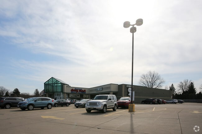

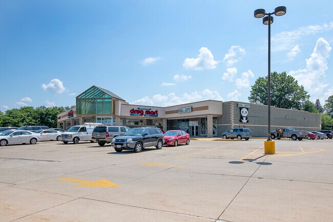
Property Detail
3032 N Ridge Rd E
Cleveland-Elyria, OH
T 13 SEC 2--10 M ERIE TR
030130002000
Ashtabula
Departmentstore
Ohio
B and X Area of moderate flood hazard, usually the area between the limits of the 100-year and 500-year floods.
2
2024
2.72 AC
2024
Ashtabula County
000300
Cleveland
30,530 SF
NEARBY LISTINGS FOR SALE OR LEASE
DEMOGRAPHICS near 3032 N Ridge Rd E
1 mile
3 mile
5 mile
2025 Total Population
2,800
20,571
30,203
2030 Population
2,782
20,513
30,057
Pop Growth 2025-2030
(0.64%)
(0.28%)
(0.48%)
Average Age
43
41
42
2025 Total Households
1,229
8,737
12,793
HH Growth 2025-2030
(0.65%)
(0.43%)
(0.60%)
Median Household Inc
$63,872
$50,463
$53,798
Avg Household Size
2.20
2.20
2.20
2025 Avg HH Vehicles
2.00
2.00
2.00
Median Home Value
$123,913
$111,787
$136,441
Median Year Built
1953
1953
1955
Nearby Places
Map Layers
Map Styles
 Street
 Aerial
Layers
 Traffic
 Biking
Places
Listings with unknown addresses are not visible on the map
- Restaurants
- Banks
- Shops
- Fitness
- Groceries
SALE & LEASE HISTORY
LISTING DATE
SALE/LEASE

Sep 01, 2021
For Sale
Mar 25, 2019
For Sale
Jan 16, 2026
For Sale
Jan 10, 2020
For Sale
Feb 21, 2019
For Sale
Nearby Properties
Address
Land Use
TOTAL SIZE
Lot Size
Zoning
Address
Land Use
TOTAL SIZE
Lot Size
Zoning
297,379 SF
2.03 AC
Address
Land Use
TOTAL SIZE
Lot Size
Zoning
421,253 SF
260.15 AC
Address
Land Use
TOTAL SIZE
Lot Size
Zoning
0.36 AC
Address
Land Use
TOTAL SIZE
Lot Size
Zoning
219,369 SF
21.87 AC
Address
Land Use
TOTAL SIZE
Lot Size
Zoning
417,667 SF
91.53 AC
Address
Land Use
TOTAL SIZE
Lot Size
Zoning
148,372 SF
18 AC
Address
Land Use
TOTAL SIZE
Lot Size
Zoning
302,473 SF
31.70 AC
Address
Land Use
TOTAL SIZE
Lot Size
Zoning
124,358 SF
49.11 AC
Address
Land Use
TOTAL SIZE
Lot Size
Zoning
116,000 SF
44.51 AC
Address
Land Use
TOTAL SIZE
Lot Size
Zoning
192,830 SF
9.09 AC
Address
Land Use
TOTAL SIZE
Lot Size
Zoning
7,882 SF
13.53 AC
Address
Land Use
TOTAL SIZE
Lot Size
Zoning
21,988 SF
4.49 AC
Address
Land Use
TOTAL SIZE
Lot Size
Zoning
683,606 SF
61.73 AC
Address
Land Use
TOTAL SIZE
Lot Size
Zoning
59,222 SF
6.76 AC
Address
Land Use
TOTAL SIZE
Lot Size
Zoning
252,612 SF
20.47 AC
Address
Land Use
TOTAL SIZE
Lot Size
Zoning
21,912 SF
1.47 AC
Address
Land Use
TOTAL SIZE
Lot Size
Zoning
25,607 SF
1.56 AC
Address
Land Use
TOTAL SIZE
Lot Size
Zoning
30,642 SF
0.12 AC
Address
Land Use
TOTAL SIZE
Lot Size
Zoning
119,090 SF
8.49 AC
Address
Land Use
TOTAL SIZE
Lot Size
Zoning
116,093 SF
28.16 AC
Address
Land Use
TOTAL SIZE
Lot Size
Zoning
26,026 SF
2.08 AC
Address
Land Use
TOTAL SIZE
Lot Size
Zoning
60,687 SF
3.91 AC
Address
Land Use
TOTAL SIZE
Lot Size
Zoning
40,222 SF
3.03 AC
Address
Land Use
TOTAL SIZE
Lot Size
Zoning
50,596 SF
42.10 AC
Address
Land Use
TOTAL SIZE
Lot Size
Zoning
Address
Land Use
TOTAL SIZE
Lot Size
Zoning
59,936 SF
0.31 AC
Address
Land Use
TOTAL SIZE
Lot Size
Zoning
146,940 SF
28.52 AC
Address
Land Use
TOTAL SIZE
Lot Size
Zoning
31,912 SF
1.45 AC
Address
Land Use
TOTAL SIZE
Lot Size
Zoning
31,454 SF
0.84 AC
The World's #1 Commercial Real Estate Marketplace
Connect with us
© 2026 CoStar Group
The information above has been obtained from sources believed reliable. While we do not doubt its accuracy we have not verified it and make no guarantee, warranty or representation about it. It is your responsibility to independently confirm its accuracy and completeness. Any projections, opinions, assumptions, or estimates used are for example only and do not represent the current or future performance of the property. The value of this transaction to you depends on tax and other factors which should be evaluated by your tax, financial, and legal advisors. You and your advisors should conduct a careful, independent investigation of the property to determine to your satisfaction the suitability of the property for your needs.