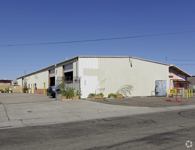
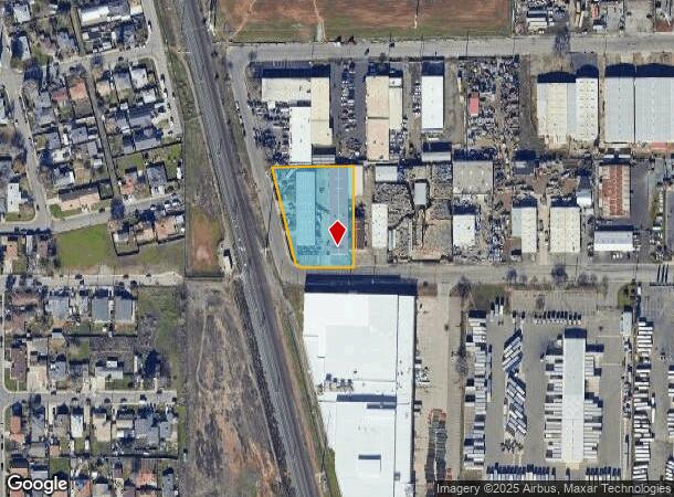
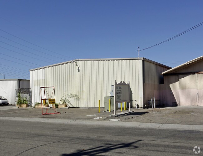
Property Record
3039 52Nd Ave, Sacramento, CA 95823
NEARBY LISTINGS FOR SALE OR LEASE
Property Detail
3039 52Nd Ave
036-0210-021
POR NE 1/4 SEC 31 T8N R5E MDB&M BEG AT A PT LOC N.89%57E 455.04FT FM SW COR SD NE 1/4 OF SD SEC 31; TH N.313.95 FT; TH
Warehouse
Sacramento
X
California
06067C0190H
1.23 AC
2024
South Sacramento
2025
Sacramento
004502
Sacramento--Roseville--Arden-Arcade, CA
22,000 SF
DEMOGRAPHICS near 3039 52Nd Ave
1 Mile
3 Mile
5 Mile
2024 Total Population
19,405
188,442
382,387
2029 Population
19,557
189,658
385,297
Pop Growth 2024-2029
+ 0.78%
+ 0.65%
+ 0.76%
Average Age
36
37
38
2024 Total Households
5,893
61,449
137,080
HH Growth 2024-2029
+ 0.80%
+ 0.62%
+ 0.84%
Median Household Inc
$48,479
$60,680
$70,464
Avg Household Size
3.10
2.90
2.60
2024 Avg HH Vehicles
2.00
2.00
2.00
Median Home Value
$305,225
$372,462
$442,185
Median Year Built
1970
1968
1971
Nearby Places
Map Layers
Map Styles
 Street
 Aerial
- Restaurants
- Banks
- Shops
- Fitness
- Groceries
PUBLIC TRANSPORTATION
COMMUTER RAIL
Sacramento (Capitol Corridor - Capitol Corridor Joint Powers Authority)
DRIVE
WALK
Distance
Sacramento (Capitol Corridor - Capitol Corridor Joint Powers Authority)
14 min
8.2 mi
AIRPORT
Sacramento International
DRIVE
WALK
Distance
Sacramento International
29 min
18.9 mi
Freight Ports
Port of Stockton
DRIVE
WALK
Distance
Port of Stockton
53 min
43.4 mi
Nearby Properties
Address
Land Use
TOTAL SIZE
Lot Size
Zoning
Address
Land Use
TOTAL SIZE
Lot Size
Zoning
12.70 AC
SC-PUD
Address
Land Use
TOTAL SIZE
Lot Size
Zoning
253,984 SF
11.58 AC
R-2B-PUD
Address
Land Use
TOTAL SIZE
Lot Size
Zoning
53,386 SF
7.75 AC
C-2-SPD
Address
Land Use
TOTAL SIZE
Lot Size
Zoning
173,323 SF
10.39 AC
C-2-PUD
Address
Land Use
TOTAL SIZE
Lot Size
Zoning
13.87 AC
C-2-PUD
Address
Land Use
TOTAL SIZE
Lot Size
Zoning
249,868 SF
15.23 AC
R-2B-R
Address
Land Use
TOTAL SIZE
Lot Size
Zoning
166,941 SF
7.46 AC
R-2B-PUD
Address
Land Use
TOTAL SIZE
Lot Size
Zoning
64,082 SF
2.38 AC
R-1
Address
Land Use
TOTAL SIZE
Lot Size
Zoning
213,445 SF
18.25 AC
SC
Address
Land Use
TOTAL SIZE
Lot Size
Zoning
186.36 AC
R-1-PUD R-
Address
Land Use
TOTAL SIZE
Lot Size
Zoning
267,580 SF
16.12 AC
R-1A
Address
Land Use
TOTAL SIZE
Lot Size
Zoning
Address
Land Use
TOTAL SIZE
Lot Size
Zoning
102,930 SF
4.87 AC
R-3
Address
Land Use
TOTAL SIZE
Lot Size
Zoning
181,766 SF
4.79 AC
R-4-PUD R-
Address
Land Use
TOTAL SIZE
Lot Size
Zoning
95,548 SF
24.25 AC
R-1
Address
Land Use
TOTAL SIZE
Lot Size
Zoning
227,396 SF
15.76 AC
R-2A-R-EA-
Address
Land Use
TOTAL SIZE
Lot Size
Zoning
91,586 SF
6.03 AC
R-3-R
Address
Land Use
TOTAL SIZE
Lot Size
Zoning
95,427 SF
7.07 AC
LC
Address
Land Use
TOTAL SIZE
Lot Size
Zoning
100,704 SF
5.63 AC
RD-20
Address
Land Use
TOTAL SIZE
Lot Size
Zoning
84,087 SF
4.11 AC
R-3-R
Address
Land Use
TOTAL SIZE
Lot Size
Zoning
162,259 SF
12.73 AC
R-3
Address
Land Use
TOTAL SIZE
Lot Size
Zoning
165,523 SF
15.76 AC
A-PUD OB-P
Address
Land Use
TOTAL SIZE
Lot Size
Zoning
100,787 SF
8.78 AC
SPA
Address
Land Use
TOTAL SIZE
Lot Size
Zoning
6.90 AC
RD-20
Address
Land Use
TOTAL SIZE
Lot Size
Zoning
53,967 SF
8.77 AC
SC-PUD
Address
Land Use
TOTAL SIZE
Lot Size
Zoning
129,305 SF
9.37 AC
C-2-SPD
Address
Land Use
TOTAL SIZE
Lot Size
Zoning
55,537 SF
3.67 AC
SC-PUD
Address
Land Use
TOTAL SIZE
Lot Size
Zoning
90,716 SF
7.52 AC
C-2-R
Address
Land Use
TOTAL SIZE
Lot Size
Zoning
29.28 AC
C-2-PUD
Address
Land Use
TOTAL SIZE
Lot Size
Zoning
111,196 SF
5.40 AC
C-2-R
The World's #1 Commercial Real Estate Marketplace
Connect with us
© 2025 CoStar Group
The information above has been obtained from sources believed reliable. While we do not doubt its accuracy we have not verified it and make no guarantee, warranty or representation about it. It is your responsibility to independently confirm its accuracy and completeness. Any projections, opinions, assumptions, or estimates used are for example only and do not represent the current or future performance of the property. The value of this transaction to you depends on tax and other factors which should be evaluated by your tax, financial, and legal advisors. You and your advisors should conduct a careful, independent investigation of the property to determine to your satisfaction the suitability of the property for your needs.