Property Record
30330/30599 Jeffries Rd, Richland, MO 65556

NEARBY LISTINGS FOR SALE OR LEASE
-
-
View all Richland listings for sale on LoopNet.com
Property Detail
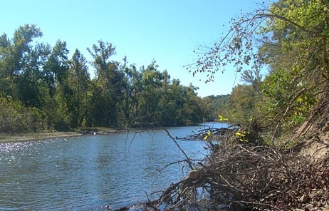
30330/30599 Jeffries Rd
08-2.0-04-000-000-007.001
4-35-14 27.02 ACRES PT E1/2 SW1/4
Agriculturalland
Laclede
X
Missouri
29029C0500C
27.02 AC
2024
Missouri South Central Area
2025
Other Market Areas
470501
Lebanon, MO
1,346 SF
DEMOGRAPHICS near 30330/30599 Jeffries Rd
1 Mile
3 Mile
5 Mile
2024 Total Population
76
711
1,671
2029 Population
77
720
1,686
Pop Growth 2024-2029
+ 1.32%
+ 1.27%
+ 0.90%
Average Age
41
42
42
2024 Total Households
28
267
632
HH Growth 2024-2029
+ 3.57%
+ 1.12%
+ 0.63%
Median Household Inc
$42,500
$42,826
$44,577
Avg Household Size
2.60
2.50
2.50
2024 Avg HH Vehicles
3.00
2.00
2.00
Median Home Value
$74,999
$92,276
$117,816
Median Year Built
1994
1992
1991
Nearby Places
Map Layers
Map Styles
 Street
 Aerial
- Restaurants
- Banks
- Shops
- Fitness
- Groceries
Nearby Properties
Address
Land Use
TOTAL SIZE
Lot Size
Zoning
Address
Land Use
TOTAL SIZE
Lot Size
Zoning
2,850 SF
12 AC
Address
Land Use
TOTAL SIZE
Lot Size
Zoning
3,000 SF
1.29 AC
Address
Land Use
TOTAL SIZE
Lot Size
Zoning
Address
Land Use
TOTAL SIZE
Lot Size
Zoning
1,386 SF
2.60 AC
Address
Land Use
TOTAL SIZE
Lot Size
Zoning
177.42 AC
Address
Land Use
TOTAL SIZE
Lot Size
Zoning
1,100 SF
0.77 AC
Address
Land Use
TOTAL SIZE
Lot Size
Zoning
2,100 SF
2.64 AC
Address
Land Use
TOTAL SIZE
Lot Size
Zoning
2,580 SF
0.27 AC
Address
Land Use
TOTAL SIZE
Lot Size
Zoning
2,536 SF
0.15 AC
Address
Land Use
TOTAL SIZE
Lot Size
Zoning
290 AC
Address
Land Use
TOTAL SIZE
Lot Size
Zoning
498.66 AC
Address
Land Use
TOTAL SIZE
Lot Size
Zoning
0.24 AC
Address
Land Use
TOTAL SIZE
Lot Size
Zoning
1,148 SF
183.49 AC
Address
Land Use
TOTAL SIZE
Lot Size
Zoning
2,493 SF
0.07 AC
Address
Land Use
TOTAL SIZE
Lot Size
Zoning
60.16 AC
Address
Land Use
TOTAL SIZE
Lot Size
Zoning
Address
Land Use
TOTAL SIZE
Lot Size
Zoning
590 SF
0.42 AC
Address
Land Use
TOTAL SIZE
Lot Size
Zoning
2,811 SF
0.07 AC
Address
Land Use
TOTAL SIZE
Lot Size
Zoning
2,820 SF
0.08 AC
Address
Land Use
TOTAL SIZE
Lot Size
Zoning
33.30 AC
Address
Land Use
TOTAL SIZE
Lot Size
Zoning
9.26 AC
Address
Land Use
TOTAL SIZE
Lot Size
Zoning
69.53 AC
Address
Land Use
TOTAL SIZE
Lot Size
Zoning
188.16 AC
Address
Land Use
TOTAL SIZE
Lot Size
Zoning
Address
Land Use
TOTAL SIZE
Lot Size
Zoning
10.02 AC
Address
Land Use
TOTAL SIZE
Lot Size
Zoning
95.82 AC
Address
Land Use
TOTAL SIZE
Lot Size
Zoning
84 AC
Address
Land Use
TOTAL SIZE
Lot Size
Zoning
784 SF
3.14 AC
Address
Land Use
TOTAL SIZE
Lot Size
Zoning
1,913 SF
78.32 AC
Address
Land Use
TOTAL SIZE
Lot Size
Zoning
142.30 AC
The World's #1 Commercial Real Estate Marketplace
Connect with us
© 2026 CoStar Group
The information above has been obtained from sources believed reliable. While we do not doubt its accuracy we have not verified it and make no guarantee, warranty or representation about it. It is your responsibility to independently confirm its accuracy and completeness. Any projections, opinions, assumptions, or estimates used are for example only and do not represent the current or future performance of the property. The value of this transaction to you depends on tax and other factors which should be evaluated by your tax, financial, and legal advisors. You and your advisors should conduct a careful, independent investigation of the property to determine to your satisfaction the suitability of the property for your needs.